Historic District in St. Augustine in St. Johns County, Florida — The American South (South Atlantic)
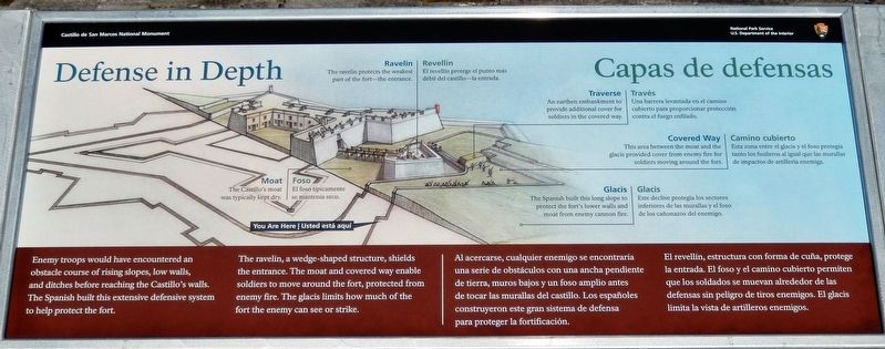
Defense in Depth / Capas de defensas
Castillo de San Marcos National Monument
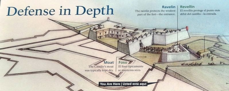
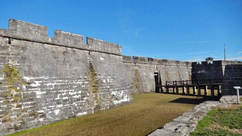
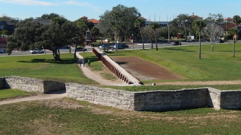
The ravelin, a wedge-shaped structure, shields the entrance. The moat and covered way enable soldiers to move around the fort, protected from enemy fire. The glacis limits how much of the fort the enemy can see or strike.
• Moat The Castillo’s moat was typically kept dry.
• Ravelin The ravelin protects the weakest part of the fort – the entrance.
• Traverse An earthen embankment to provide additional cover for soldiers in the covered way.
• Covered Way This area between the moat and the glacis provided cover from enemy fire for soldiers moving around the fort.
• Glacis The Spanish built this long slope to protect the fort’s lower walls and moat from enemy cannon fire.
El revellín, estructura con forma de cuña, protege la entrada. El foso y el camino cubierto permiten que los soldados se muevan alrededor de las defensas sin peligro de tiros enemigos. El glacis limita la vista de artilleros enemigos.
• Foso El foso típicamente se mantenía seco.
• Revellín El revellín protégé el punto más debil del Castillo – la entrada.
• Través Una barrera levantada en el camino cubierto para proporcionar proteccion contra el fuego enfilado.
• Camino cubierto Esta zona entre el glacis y el foso protegía tanto los fusileros al igual que las murallas de impactos de artillería enemiga.
• Glacis Este declive protegía los sectores inferiores de las murallas y el foso de los cañonazos del enemigo.
Erected 2018 by National Park Service, U.S. Department of the Interior.
Topics. This historical marker is listed in these topic lists: Architecture • Colonial Era • Forts and Castles • Hispanic Americans.
Location. 29° 53.833′ N, 81° 18.709′ W. Marker is in St. Augustine, Florida, in St. Johns County. It is in the Historic District. Marker can be reached from the intersection of South Castillo Drive (Business U.S. 1) and Cuna Street, on the right when traveling north. Marker is located on the Castillo de San Marcos National Monument grounds, along the sidewalk on the south side of the fort, near the main entrance, overlooking the San Pedro Bastion. Touch for map. Marker is at or near this postal address: 1 South Castillo Drive, Saint Augustine FL 32084, United States of America. Touch for directions.
Other nearby markers. At least 8 other markers are within walking distance of this marker. Under Continuous Attack / Bajo ataques continuos (here, next to this marker); Engulfed in Flames / Devorada por las llamas (within shouting distance of this marker); St. Peter's Bastion (within shouting distance of this marker); Crumbling Coquina / Piedra frágil (within shouting distance of this marker); Covered Way (within shouting distance of this marker); Well (within shouting distance of this marker); Firing Steps (within shouting distance of this marker); Ramp (within shouting distance of this marker). Touch for a list and map of all markers in St. Augustine.
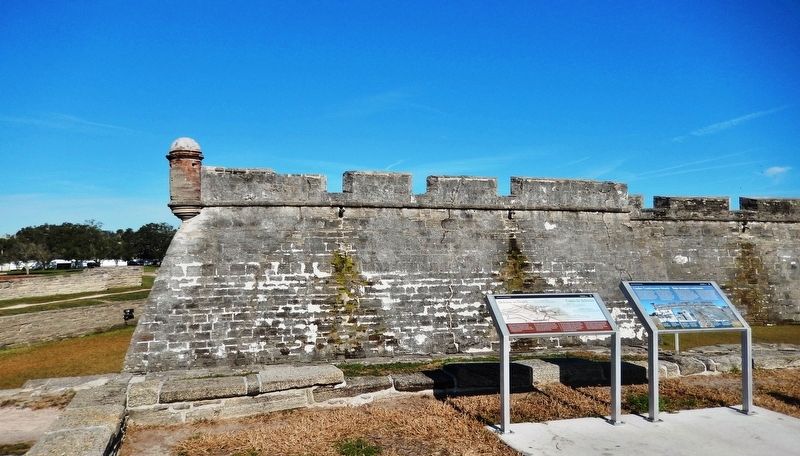
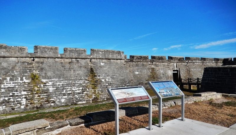
More about this marker. Marker is a large rectangular composite plaque, mounted horizontally on waist-high metal posts.
Related markers. Click here for a list of markers that are related to this marker. Castillo de San Marcos National Monument
Also see . . . Castillo de San Marcos National Monument. A monument not only of stone and mortar but of human determination and endurance,
the Castillo de San Marcos symbolizes the clash between cultures which ultimately resulted in our nation. Still resonant with the struggles of an earlier time, these original walls provide tangible evidence of America’s remarkable history. (Submitted on December 13, 2018, by Cosmos Mariner of Cape Canaveral, Florida.)
Credits. This page was last revised on August 20, 2020. It was originally submitted on December 10, 2018, by Cosmos Mariner of Cape Canaveral, Florida. This page has been viewed 201 times since then and 14 times this year. Photos: 1. submitted on December 12, 2018, by Cosmos Mariner of Cape Canaveral, Florida. 2. submitted on December 13, 2018, by Cosmos Mariner of Cape Canaveral, Florida. 3, 4. submitted on December 12, 2018, by Cosmos Mariner of Cape Canaveral, Florida. 5, 6. submitted on December 19, 2018, by Cosmos Mariner of Cape Canaveral, Florida. • Bill Pfingsten was the editor who published this page.
