Irapuato, Guanajuato, Mexico — The Central Highlands (North America)
Irapuato Cathedral
Photographed by J. Makali Bruton, December 8, 2018
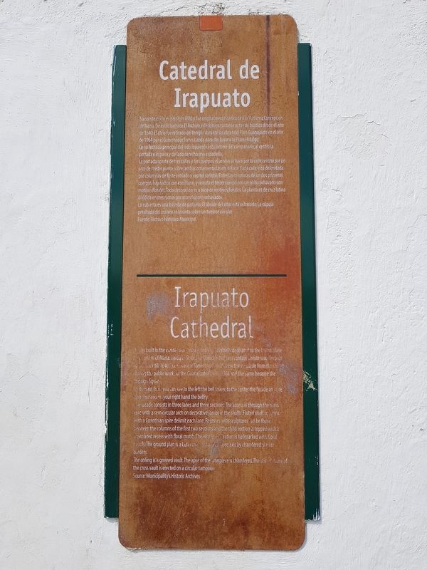
1. Irapuato Cathedral Marker

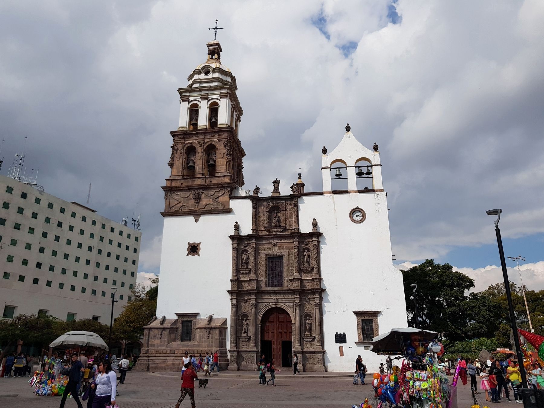
Su construcción es del siglo XVIII y fue originalmente dedicada a la Purísima Concepción de María. De estilo barroco. El Archivo eclesiástico contiene actas de bautizo desde el año de 1640. El atrio fue retirado del templo durante las obras del Plan Guanajuato en el año de 1964 por el Gobernador Torres Landa para dar lugar a la Plaza Hidalgo. En su fachada principal del lado izquierdo está la torre del campanario, al centro la portada e ingreso y de lado derecho una espadaña.
La portada consta de tres calles y tres cuerpos, el acceso se hace por la calle central por un arco de medio punto sobre jambas onamentadas en el fuste. Cada calle está delimitada por columnas de fuste estriado y capitel corintio.Entre las columnas de los dos primeros cuerpos, hay nichos con esculturas y remata el tercer cuerpo con un nicho ochavado con motivos florales.Toda decoración es a base de motivos florales. La planta es de cruz latina dividida en tres ramos por arcos fajones ochavados. La cubierta es una bóveda de panuelo. El ábside del altar está ochavado. La cúpula peraltada del crucero se levanta sobre un tambor
this page online
Fuente: Archivo Histórico Municipal.
English:
Irapuato Cathedral
It was built in the Eighteenth century and was originally dedicated to the Immaculate Conception of Maria. Baroque Style. The Church’s Archives contain Christening Records going back till 1640. The Governor Torres Landa withdrew the vestibule from the church during the public works of the Guanajuato Plan in 1964 and the same became the Hidalgo Square. In its main front you can see to the left the bell tower, to the center the facade and the entrance and on your right hand the belfry.
The facade consists in three lanes and three sections. The access is through the main lane with a semicircular arch on decorative jambs in the shafts. Fluted shaft columns with a Corinthian spire delimit each lane. Recesses with sculptures can be found between the columns of the first two sections and the third section is topped with a chamfered recess with floral motifs. The whole decoration is hallmarked with floral motifs. The ground plan is a Latin cross divided into three axes by chamfered plaster borders.
The ceiling is a groined vault. The apse of the altarpiece is chamfered.
Photographed by J. Makali Bruton, December 8, 2018
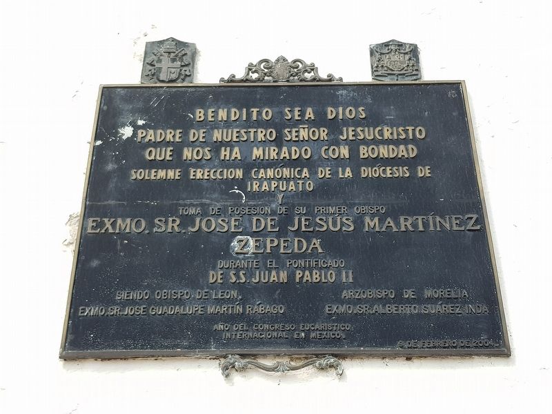
2. An additional Irapuato Cathedral Marker
This marker describes the canonical erection of the Diocese of Irapuato that took place in 2004.
Source: Municipality's Historic Archives
Topics. This historical marker is listed in these topic lists: Architecture • Colonial Era • Man-Made Features • Religion & Religious Structures. A significant historical year for this entry is 1640.
Location. 20° 40.478′ N, 101° 20.795′ W. Marker is in Irapuato, Guanajuato. It is on Plazuela Miguel Hidalgo just north of Portal Libertad, on the left when traveling north. This area around the cathedral and Plaza Hidalgo is pedestrian-only. Touch for map. Marker is in this post office area: Irapuato GTO 36500, Mexico. Touch for directions.

Regionally, this marker is in Central Mexico and in the Bajío. Globally, it is in North America, on the Ring of Fire, and in the Western Hemisphere. Historically, it finds itself in what was once New Spain, a Spanish colony, and the Aztec Empire.
Other nearby markers. At least 8 other markers are within 18 kilometers of this marker, measured as the crow flies: Saint Joseph Church (within shouting distance of this marker); Plaza Madero (within shouting distance of this
Photographed by J. Makali Bruton, December 8, 2018
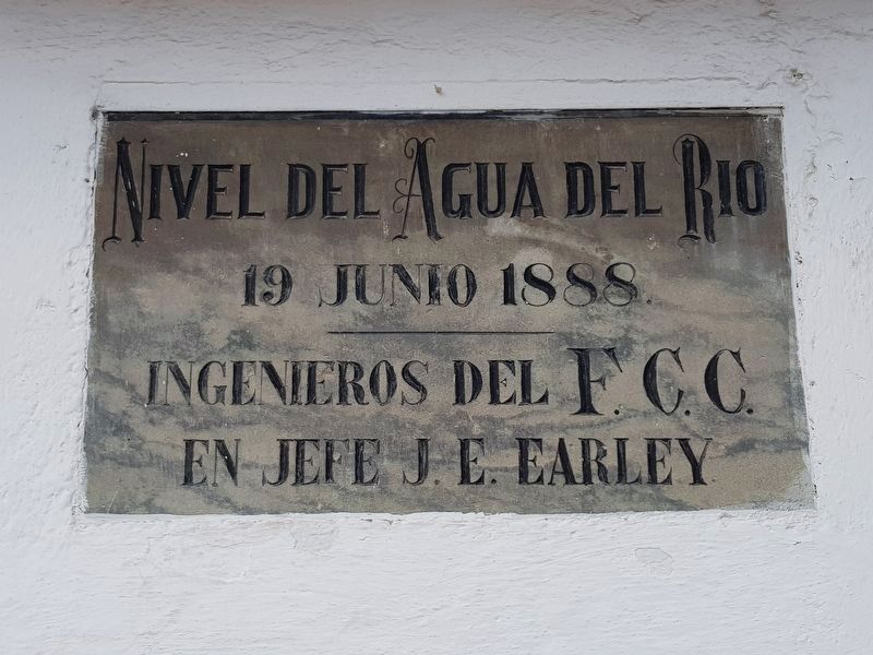
3. An additional marker on the Irapuato Cathedral indicating historic flooding in 1888
This marker was placed by a J.E. Early, possibly a Chief of Railroad Engineers ("F.C.C." or ferrocarriles).
Photographed by J. Makali Bruton, December 8, 2018
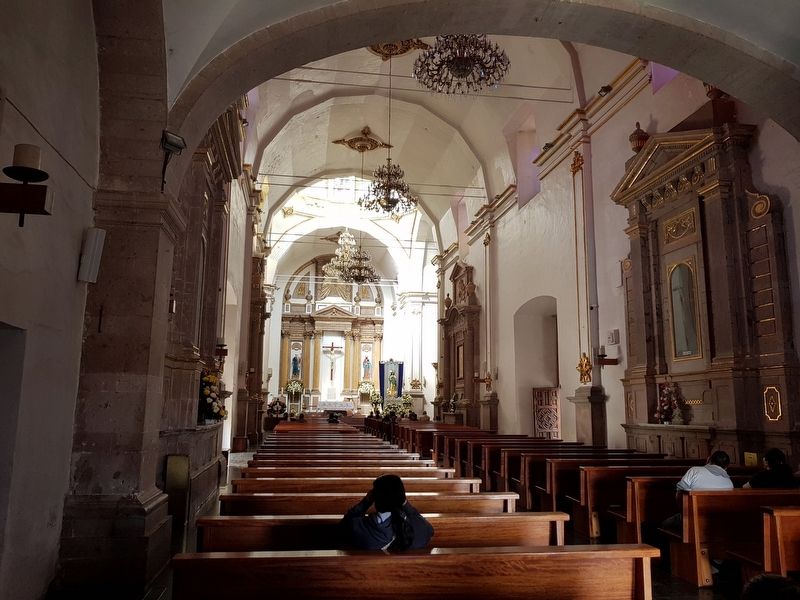
4. An interior view of the Irapuato Cathedral
Photographed by J. Makali Bruton, December 8, 2018
5. The Irapuato Cathedral and Marker
The marker is to the right of the main entrance in this view.
Credits. This page was last revised on February 4, 2025. It was originally submitted on December 12, 2018, by J. Makali Bruton of Washington, District of Columbia. This page has been viewed 634 times since then and 108 times this year. Photos: 1, 2, 3, 4, 5. submitted on December 12, 2018, by J. Makali Bruton of Washington, District of Columbia.
