Irapuato, Guanajuato, Mexico — The Central Highlands (North America)
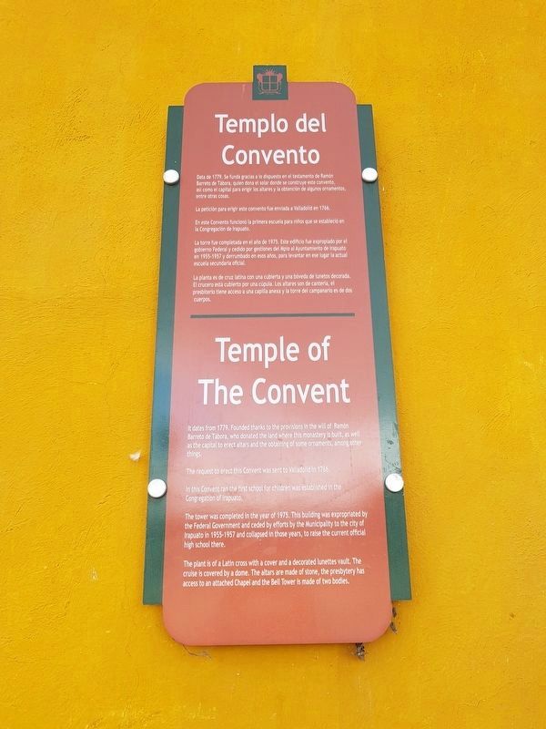
Temple of the Convent
Photographed by J. Makali Bruton, December 8, 2018
1. Temple of the Convent Marker

Data de 1779. Se funda gracias a lo dispuesto en el testamento de Ramón Barreto de Tábora, quien dona el solar donde se construye este convento, así como el capital para erigir los altares y la obtención de algunos ornamentos, entre otras cosas.
La petición para erigir este convento fue enviada a Valladolid en 1766.
En este Convento funcionó la primera escuela para niños que se estableció en la Congregación de Irapuato.
La torre fue completada en el año de 1975. Este edificio fue expropiado por el gobierno Federal y cedido por gestiones del Mpio al Ayuntamiento de Irapuato en 1955-1957 y derrumbado en esos años, para levantar en ese lugar la actual escuela secundaria oficial.
La planta es de cruz latina con una cubierta y una bóveda de lunetos decorada. El crucero está cubierto por una cúpula. Los altares son de canteria, el presbiterio tiene acceso a una capilla anexa y la torre del campanario es de dos cuerpos.
Templo of the Convent
It dates from 1779. Founded thanks to the provisions in the will of Ramón Barreto de Tábora, who donated the land where this monastery is built, as well
this page online
The request to erect this Convent was sent to Valladolid in 1766.
In this Convent ran the first school for children was established in the Congregation of Irapuato.
The tower was completed in the year of 1975. This building was expropriated by the Federal Government and ceded by efforts by the Municipality to the city of Irapuato in 1955-1957 and collapsed in those years, to raise the current official high school there.
The plant is of a Latin cross with a cover and a decorated lunettes vault. The cruise is covered by a dome. The altars are made of stone, the presbytery has access to an attached Chapel and the Bell Tower is made of two bodies.
Topics. This historical marker is listed in these topic lists: Architecture • Colonial Era • Man-Made Features • Religion & Religious Structures. A significant historical year for this entry is 1779.
Location. 20° 40.36′ N, 101° 20.768′ W. Marker is in Irapuato, Guanajuato. It is on Juárez just south of Calle Ramón Barreto de Tábora, on the left when traveling south. Touch for map. Marker is in
Photographed by J. Makali Bruton, December 8, 2018
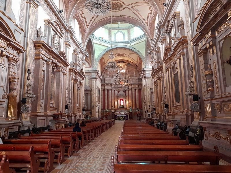
2. An interior view of the Temple of the Convent

Regionally, this marker is in Central Mexico and in the Bajío. Globally, it is in North America, on the Ring of Fire, and in the Western Hemisphere. Historically, it finds itself in what was once New Spain, a Spanish colony, and the Aztec Empire.
Other nearby markers. At least 8 other markers are within 18 kilometers of this marker, measured as the crow flies: Temple of the Convent / Temple of the Third Order (a few steps from this marker); Temple of the Third Order (within shouting distance of this marker); Temple of Solitude (about 210 meters away, measured in a direct line); Plaza Madero (about 210 meters away); Irapuato Cathedral (about 210 meters away); Saint Joseph Church (about 240 meters away); Founding of Irapuato (approx. 0.3 kilometers away); Darío Díaz (approx. 16.5 kilometers away). Touch for a list and map of all markers in Irapuato.
Photographed by J. Makali Bruton, December 8, 2018
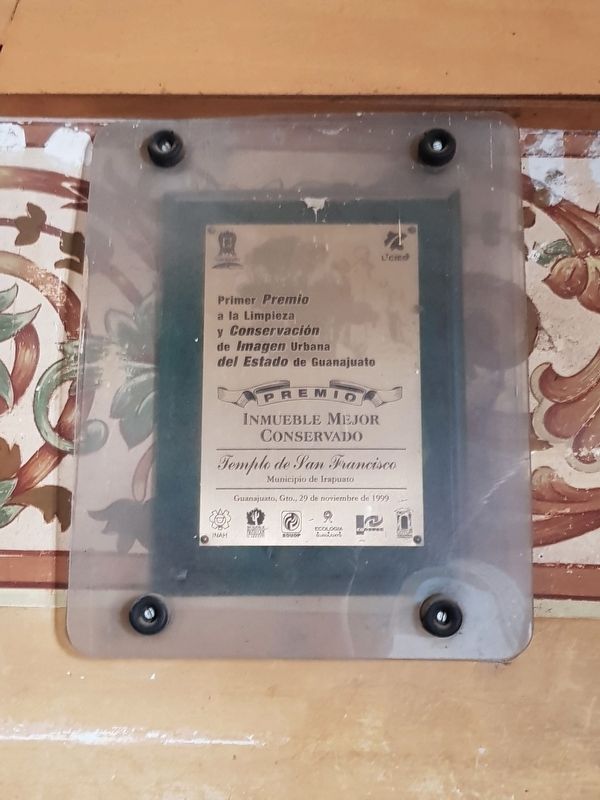
3. In 1999 the Temple of the Convent was awarded a Guanajuato state-level prize for its conservation
Photographed by J. Makali Bruton, December 8, 2018
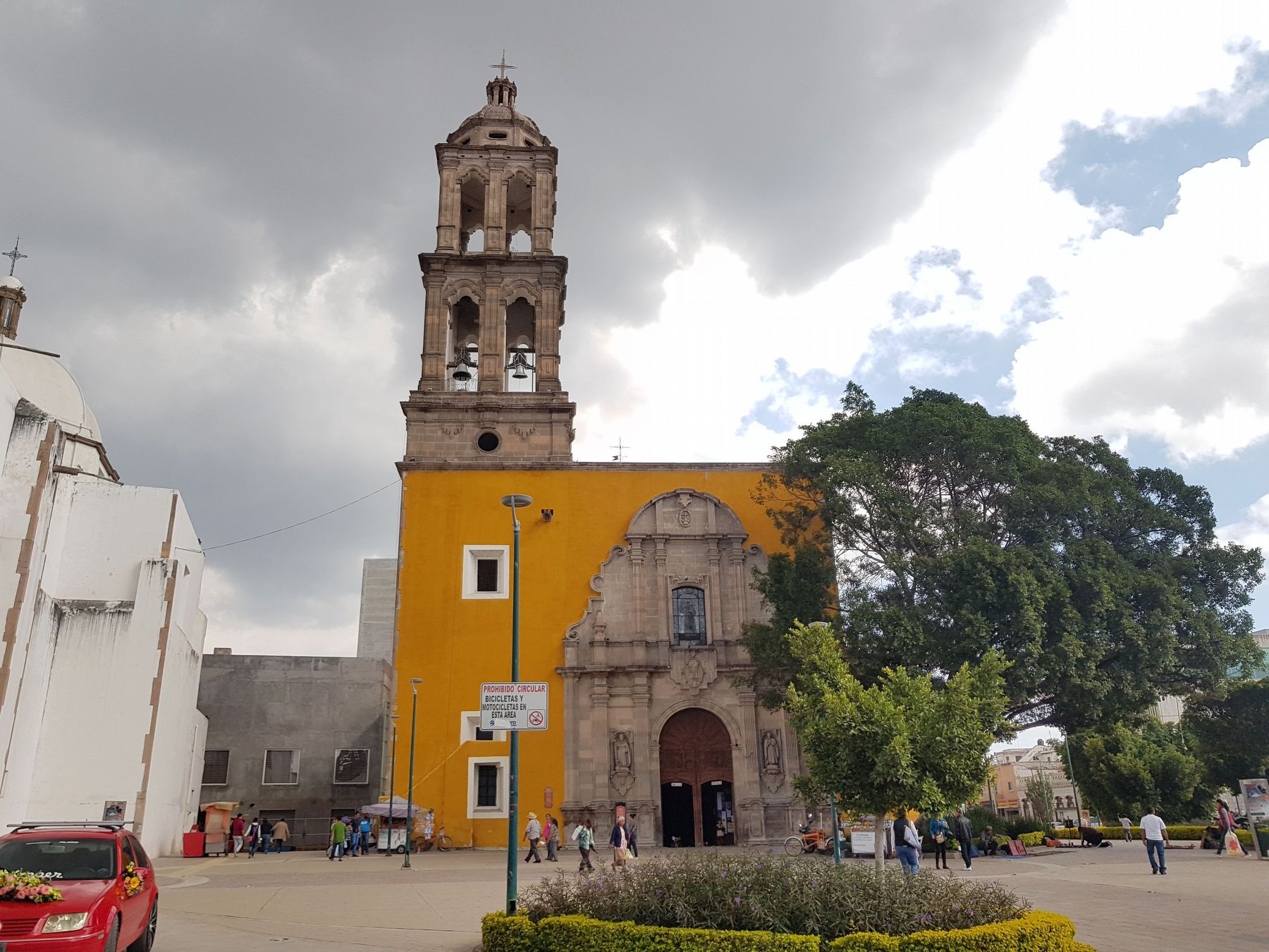
4. Temple of the Convent and Marker
The marker can be seen to the left of the main entrance to the temple, also known as the Temple of San Francisco.
Credits. This page was last revised on December 12, 2018. It was originally submitted on December 12, 2018, by J. Makali Bruton of Washington, District of Columbia. This page has been viewed 167 times since then and 11 times this year. Photos: 1, 2, 3, 4. submitted on December 12, 2018, by J. Makali Bruton of Washington, District of Columbia.
