
Richmond Hill in Bryan County, Georgia — The American South (South Atlantic)
Position of the Monitors
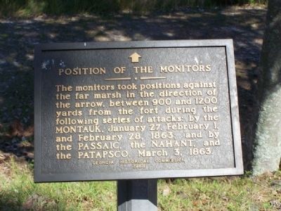
Photographed by Mike Stroud, October 5, 2008
1. Position of the Monitors Marker
Erected 1963 by Georgia Historical Commission.
Topics. This historical marker is listed in these topic lists: Forts and Castles • War, US Civil • Waterways & Vessels. A significant historical date for this entry is January 27, 1964.
Location. 31° 53.492′ N, 81° 11.75′ W. Marker is in Richmond Hill, Georgia, in Bryan County. It can be reached from Fort McAllister Road. Located in Fort McAllister State Park. Touch for map. Marker is in this post office area: Richmond Hill GA 31324, United States of America. Touch for directions.

Regionally, this marker is in Georgia’s Coastal Plain, on the Georgia Coast and the Golden Isles, and in Greater Savannah. It is also in the American South, specifically in the Deep South, and on the Eastern Seaboard. Globally, it is in the North Atlantic Region, North America, the Western Hemisphere,
this page online
Other nearby markers. At least 8 other markers are within walking distance of this marker: Obstruction of River (here, next to this marker); Damage From Naval Bombardments (a few steps from this marker); Columbiad (a few steps from this marker); Cheves' Rice Mill (within shouting distance of this marker); Capt. Nicholas Clinch (within shouting distance of this marker); Major Gallie's Gun (within shouting distance of this marker); Confederate Land Mines (about 300 feet away, measured in a direct line); Tom Cat (approx. 0.2 miles away). Touch for a list and map of all markers in Richmond Hill.
Also see . . . Haunted Forts - Ft MCallister. On February 1, 1863, the U.S.S. Montauk and several wooden support craft returned to Fort McAllister determined to win the day. During the first attack, both sides traded numerous volleys of cannon fire with pretty much the same results
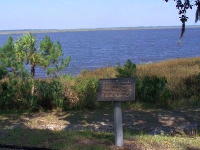
Photographed by Mike Stroud, 2008
2. Position of the Monitors on the Ogeechee River
During the bombardment, the U.S.S. Montauk steamed within 150 yards of the river pilings in front of Fort McAllister, its belching cannon plowing gaping holes in the fort’s defenses. During the attack, Fort McAllister would be reportedly struck by over 450 cannon balls, each being absorbed by the fort’s earth and sod embankments. Confederate gunners found their mark on the iron hull of the U.S.S. Montauk 15 times during the battle, but the ships armor deflected the rounds without significant damage or casualties. At the same time, the hardened defenders of Fort McAllister also reported no casualties or significant damage as a result of feverish Union shelling. At the end of the engagement, he U.S.S. Montauk and the remaining Federal Fleet steamed away, vowing to return.
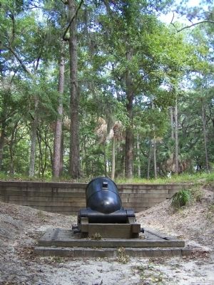
Photographed by Mike Stroud, October 5, 2008
3. A mortar used at Fort McAllister
Credits. This page was last revised on March 20, 2019. It was originally submitted on October 21, 2008, by Mike Stroud of Bluffton, South Carolina. This page has been viewed 1,276 times since then and 20 times this year. Photos: 1, 2, 3. submitted on October 21, 2008, by Mike Stroud of Bluffton, South Carolina. • Craig Swain was the editor who published this page.
