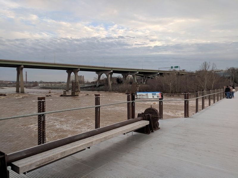
Belle and Mayo Islands in Richmond, Virginia — The American South (Mid-Atlantic)
Harnessing the River
The canal powered large water-driven machines under the 12th Street Power Station until it was decommissioned in 1968. The power station also burned coal when the flow of the river was unreliable.
The mechanism in the bench on this overlook was part of the hoist that operated the dam's gates, and was left on the structure since it was abandoned in 1968.
The dam changed over time, as successive floods would wash away equipment. You can see the part of the dam machinery and the rails it traveled on at the entrance to the bridge on Brown's Island.
The dam gates (Fig. 1) were curved, radial gates that rotated on pin bearings embedded in the concrete piers. When the gate was closed (Fig. 2), water collected on the upstream side and fed into the canal. When the gate was raised by the hoist, the rush of the river passing underneath helped to open and close the gate.
(captions)
Early image of Brown’s Island Dam. Photo courtesy of The Valentine.
Hoist mechanism that is now part of the bench on the abandoned structure, 2013. Photo courtesy of T. Tyler Potterfield.
Early view of the 12th Street Power Station. Photo courtesy of Prints & Photographs, Library of Virginia.
VEPCO Business Women’s Club inspecting 12th Street Power Station’s No5 Steam Turbine, May 1940. Photo courtesy of Prints & Photographs, Library of Virginia.
Topics. This historical marker is listed in these topic lists: Industry & Commerce • Waterways & Vessels. A significant historical year for this entry is 1901.
Location. 37° 31.9′ N, 77° 26.717′ W. Marker is in Richmond, Virginia. It is in Belle and Mayo Islands. Marker can be reached from Tredegar Street west of South 5th Street, on the left when traveling west. Marker is located on the T. Tyler Potterfield Memorial Bridge accessible from Brown's Island. Touch for map. Marker is in this post office area: Richmond VA 23219, United States of America. Touch for directions.
Other nearby markers. At least 8 other markers are within walking distance of this marker. The Falls of the James (about 500 feet away, measured in a direct line); Richmond and Petersburg Railroad Bridge (approx. 0.2 miles away); Three Days in April 1865 (approx. 0.2 miles away); Belle Isle (approx. 0.2 miles away); What’s That? (approx. 0.2 miles away); Potterfield Bridge (approx. 0.2 miles away); Hurricane Agnes (approx. 0.2 miles away); Haxall Headgates (approx. 0.2 miles away). Touch for a list and map of all markers in Richmond.
Credits. This page was last revised on February 1, 2023. It was originally submitted on December 31, 2018, by Bernard Fisher of Richmond, Virginia. This page has been viewed 481 times since then and 35 times this year. Photos: 1, 2. submitted on December 31, 2018, by Bernard Fisher of Richmond, Virginia.

