Delaware in Delaware County, Ohio — The American Midwest (Great Lakes)
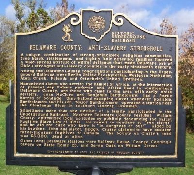
Delaware County: Anti-Slavery Stronghold
⎯⎯⎯
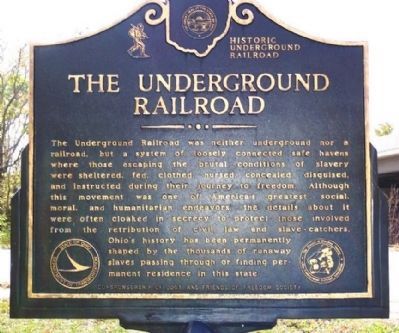
The Underground Railroad
Historic Underground Railroad
Photographed by William Fischer, Jr., October 21, 2008
1. Delaware County: Anti-Slavery Stronghold
Among the Delaware County congregations participating in the Underground Railroad were Berlin United Presbyterian, Wesleyan Methodist, Alum Creek, Friends and Otterbein's United Brethren.
Manumitted slaves who settled the hamlet of Africa, at the intersection of present day Polaris parkway and Africa Road in southeastern Delaware County, and those who came to the area with early white settlers, John McClure and Benjamin Bartholomew, had a fierce hatred of bondage, they helped escaping slaves whenever possible. Bartholomew and his son, Major Bartholomew, operated a station near the Olentangy River in southern Liberty Township.
Sometimes more than one member of a family participated in the Underground Railroad. Northern Delaware County resident, William Cratty, epitomized local attitudes by publicly denouncing
this page online
Other local Delaware stations were Halfway House, George Gooding's tavern on State Route 23, and Seven Oaks on William Street.
Ohio's history has been permanently shaped by the thousands of runaway slaves passing through or finding permanent residence in this state.
Erected by Ohio Department
Photographed by William Fischer, Jr., October 21, 2008
2. The Underground Railroad Marker
Topics and series. This historical marker is listed in these topic lists: Abolition & Underground RR • African Americans • Cemeteries & Burial Sites • Charity & Public Work • Civil Rights. In addition, it is included in the Ohio Friends of Freedom Underground Railroad Sites series list. A significant historical year for this entry is 1850.
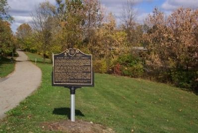
Location. 40° 17.917′ N, 83° 3.756′ W. Marker is in Delaware, Ohio, in Delaware County. It is at the intersection of William Street and Columbus Pike (U.S. 23), on the right when traveling west on William Street. Marker is across William Street from northbound US 23 William Street Exit ramp. Touch for map. Marker is in this post office area: Delaware OH 43015, United States of America. Touch for directions.

Regionally, this marker is in the Scioto Valley and in the Columbus Metropolitan Area. It is also in the American Midwest and in the Corn Belt. Globally, it is in North America, the Western Hemisphere, the Western World, and the Anglosphere. Historically, it finds itself in what
Photographed by William Fischer, Jr., October 21, 2008
3. Delaware County: Anti-Slavery Stronghold / The Underground Railroad Marker
Other nearby markers. At least 8 other markers are within walking distance of this marker: The March 1913 Flood (within shouting distance of this marker); Patrick J. Foley Memorial Bridge (about 300 feet away, measured in a direct line); Site of the First Ohio State Football Game (approx. 0.2 miles away); 1897 Memorial Tree (approx. 0.2 miles away); The Harrison Trail (approx. 0.2 miles away); In Memory of Dr. Roy Paul Wittlinger (approx. 0.2 miles away); The Sulphur Spring (approx. 0.2 miles away); Branch Rickey, J.D. (approx. 0.2 miles away). Touch for a list and map of all markers in Delaware.
Credits. This page was last revised on November 29, 2019. It was originally submitted on October 22, 2008, by William Fischer, Jr. of Reynoldsburg, Ohio. This page has been viewed 9,535 times since then and 171 times this year. Photos: 1, 2, 3. submitted on October 22, 2008, by William Fischer, Jr. of Reynoldsburg, Ohio. • Kevin W. was the editor who published this page.
