Pateros in Okanogan County, Washington — The American West (Northwest)
Wells Dam Construction
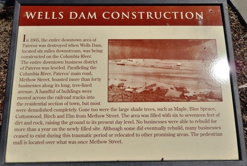
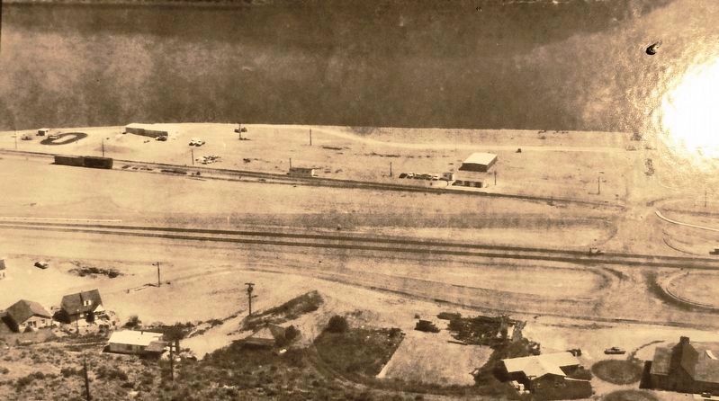
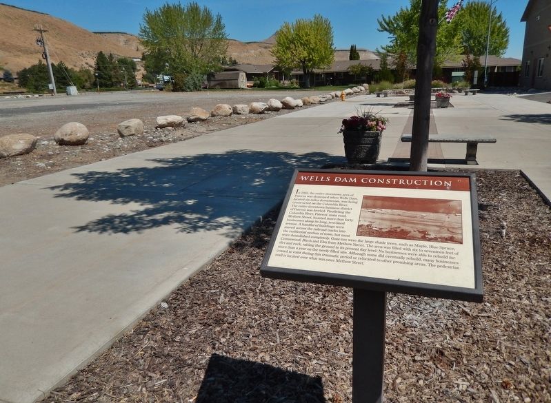
In 1965, the entire downtown area of Pateros was destroyed when Wells Dam, located six miles downstream, was being constructed on the Columbia River. The entire downtown business district of Pateros was leveled. Paralleling the Columbia River, Pateros' main road, Methow Street, boasted more than forty businesses along its long, tree-lined avenue. A handful of buildings were moved across the railroad tracks into the residential section of town, but most were demolished completely. Gone too were the large shade trees, such as Maple, Blue Spruce, Cottonwood, Birch and Elm from Methow Street. The area was filled with six to seventeen feet of dirt and rock, raising the ground to its present day level. No businesses were able to rebuild for more than a year on the newly filled site. Although some did eventually rebuild, many businesses ceased to exist during this traumatic period or relocated to other promising areas. The pedestrian mall is located over what was once Methow Street.
Topics. This historical marker is listed in these topic lists: Industry & Commerce • Man-Made Features • Notable Events • Waterways & Vessels. A significant historical year for this entry is 1965.
Location. 48° 3.205′ N, 119° 53.988′ W. Marker is in Pateros, Washington, in Okanogan County. Marker can be reached from Commercial Avenue south of South Dawson, on the right when traveling north. Marker is located along the central walkway of the Pateros Mall, near the south end of the north mall parking lot. Touch for map. Marker is at or near this postal address: 110 Lakeshore Drive, Pateros WA 98846, United States of America. Touch for directions.
Other nearby markers. At least 5 other markers are within walking distance of this marker. Pateros Veterans (within shouting distance of this marker); Methow Indians (within shouting distance of this marker); Pateros in the 1950's (about 300 feet away, measured in a direct line); Ive's Landing Hotel (about 600 feet away); The China Ditch (approx. 0.7 miles away).
More about this marker. Marker is a large framed composite plaque, mounted horizontally on a waist-high metal post.
Related markers. Click here for a list of markers that are related to this marker. Pateros, Washington
Also see . . .
1. Pateros, Washington. Wikipedia entry:
In 1962, the Federal Power Commission granted the Douglas County Public Utility District a 50-year license to build and operate Wells Dam about 8 miles downstream of Pateros. Construction of the dam would flood much of the original city. The Pateros City Council accepted an offer to relocate the town, and the PUD spent about $1,000,000 on moving or demolishing buildings and improving the town's infrastructure. Wells Dam went into operation in 1967. Despite relocation of the city, the population dropped by almost a third from 1960 to 1970. (Submitted on January 23, 2019, by Cosmos Mariner of Cape Canaveral, Florida.)
2. Wells Dam. Douglas County PUD :
Wells Dam is located in North Central Washington state between Seattle and Spokane at river mile 515.8 on the Columbia River. It can be reached by driving north from Wenatchee along Highway 97 up the Columbia River to Chelan then continuing north another 15 minutes. The Methow River joins the Columbia just north of the dam site at the Town of Pateros. (Submitted on January 23, 2019, by Cosmos Mariner of Cape Canaveral, Florida.)
Credits. This page was last revised on November 27, 2021. It was originally submitted on January 22, 2019, by Cosmos Mariner of Cape Canaveral, Florida. This page has been viewed 413 times since then and 47 times this year. Photos: 1, 2, 3. submitted on January 23, 2019, by Cosmos Mariner of Cape Canaveral, Florida. • Andrew Ruppenstein was the editor who published this page.


