
Bel Alton in Charles County, Maryland — The American Northeast (Mid-Atlantic)
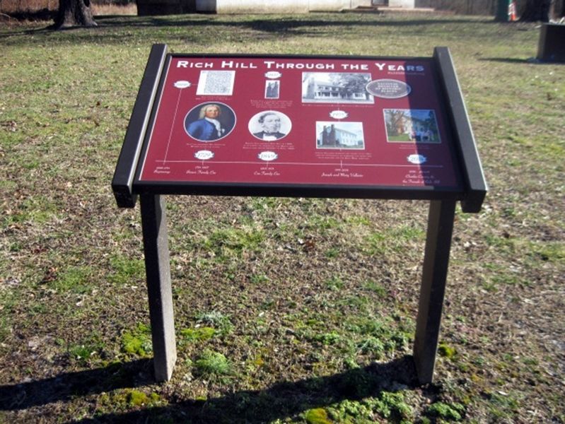
Rich Hill Through the Years
National Park Service, Thomas Stone National Historic Site, January 22, 2019
1. Rich Hill Through the Years Marker
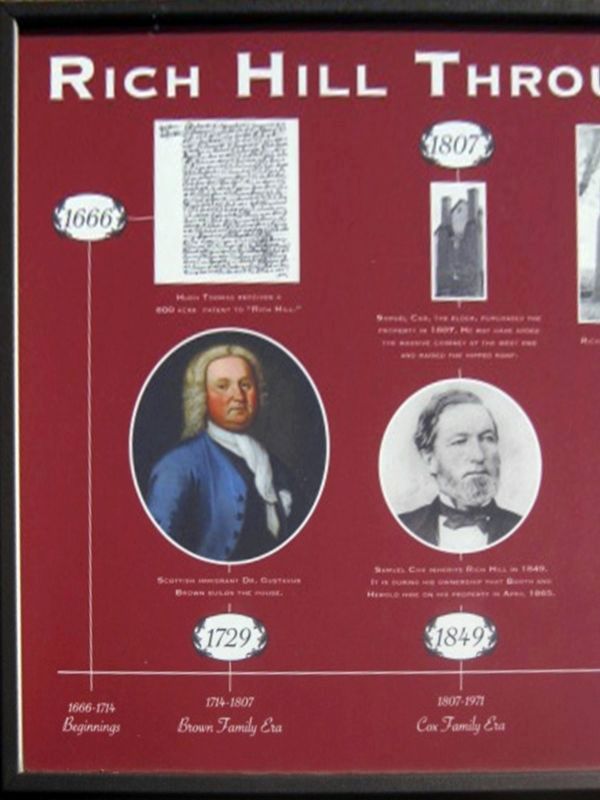
) 1666 Hugh Thomas receives a 600 acre patent to "Rich Hill."
) 1666—1714 Beginnings
) 1714—1807 Brown Family Era
) (Image of Dr. Gustavus Brown)
) Scottish immigrant Dr. Gustavus Brown builds the house. 1729
) 1807—1971 Cox Family Era
) (Image of chimneys.)
) 1807 Samuel Cox, the elder, purchases the property in 1807. He may have added the massive chimney at the west end and raised the hipped roof.
) (Image of Samuel Cox)
) Samuel Cox inherits Rich Hill in 1849. It is during his ownership that Booth and Herold hide on his property in April 1865.
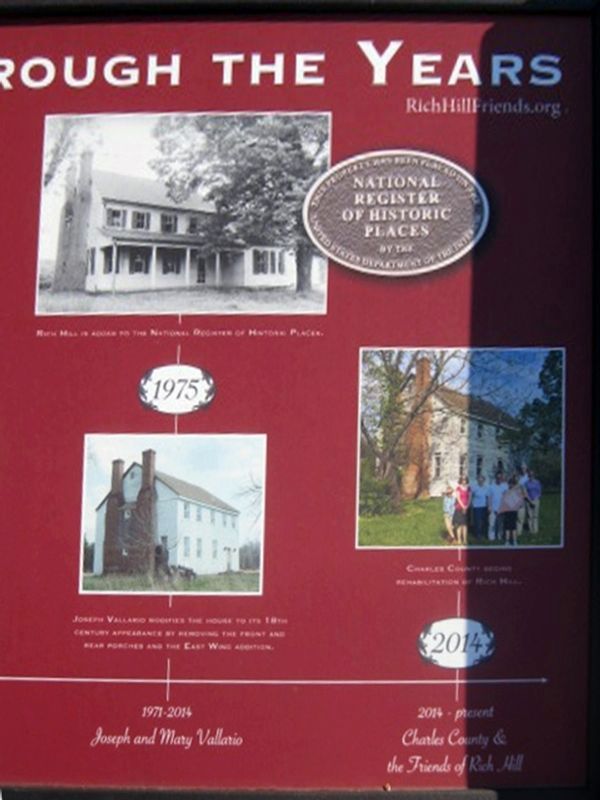
) 1971-2014 Joseph and Mary Vallario
) (Images of house and National Register of Historic Places marker.)
) Rich Hill is added to the National Register of Historic Places.
) (Image of house.)
) Joseph Vallario modifies the house to its 18th century appearance by removing the front and rear porches and the East Wing addition.
) 2014 2014—present Charles County & the Friends of Rich Hill
) (Image of the house and eight people.)
) Charles County begins rehabilitation of Rich Hill.
) Richhill.org
Erected 2017 by Friends
this page online
Topics and series. This historical marker is listed in these topic lists: Colonial Era • War, US Civil. In addition, it is included in the Booth's Escape series list. A significant historical year for this entry is 1666.
Location. 38° 28.267′ N, 76° 57.933′ W. Marker is in Bel Alton, Maryland, in Charles County. It can be reached from Rich Hill Farm Road 0.1 miles Bel Alton Newtown Rd. Marker between parking lot and house. Touch for map. Marker is in this post office area: Bel Alton MD 20611, United States of America. Touch for directions.

Regionally, this marker is in the Washington Metropolitan Area and in Southern Maryland. It is also in the American South, specifically in the Upper South, in the Mid-Atlantic, in the Tidewater, and on the Eastern Seaboard. Globally, it is in the North Atlantic Region, North America, the Western Hemisphere, the Western World, and the Anglosphere. Historically, it finds itself in what was once one of the original Thirteen Colonies and also the Antebellum South.
Other nearby markers. At least 8 other markers are within 2 miles of this marker,
National Park Service, Thomas Stone National Historic Site, January 22, 2019
2. Left half of the Rich Hill Through the Years Marker
Other markers no longer nearby. Rich Hill Historic Site (was within shouting distance of this marker but has been permanently removed); a different marker also named Rich Hill (was about 300 feet away, measured in a direct line but has been confirmed missing).
Also see . . .
1. Rich Hill. Maryland's National Register Properties (Submitted on January 23, 2019.)
2. Booth's Escape Byway. Maryland Office of Tourism website entry (Submitted on August 19, 2019.)
National Park Service, Thomas Stone National Historic Site, January 22, 2019
3. Right half of the Rich Hill Through the Years Marker
National Park Service, Thomas Stone National Historic Site, January 22, 2019
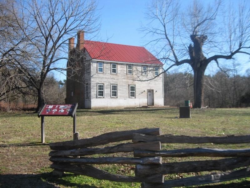
4. Rich Hill Through the Years Marker & house exterior.
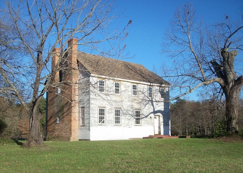
National Park Service, Thomas Stone National Historic Site, November 15, 2015
5. Rich Hill exterior
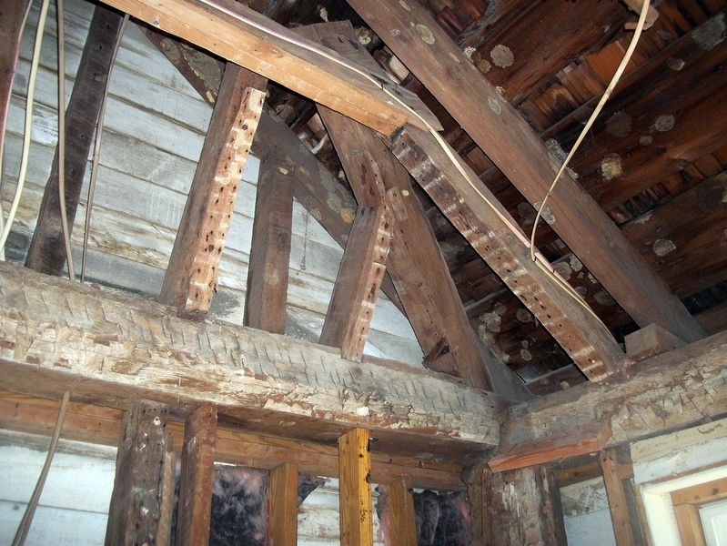
National Park Service, Thomas Stone National Historic Site, November 1, 2015
6. Rich Hill Through the Years Marker
Credits. This page was last revised on December 27, 2023. It was originally submitted on January 23, 2019. This page has been viewed 647 times since then and 32 times this year. Photos: 1, 2, 3, 4, 5, 6. submitted on January 23, 2019. • Bill Pfingsten was the editor who published this page.
