Gaspé, une ville au coeur de la découverte
Gaspé, a city in the heart of discovery
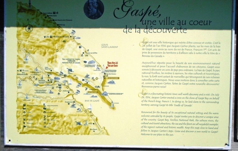
Gaspé est une ville historique qui mérite d'être connue et visitée. C'est le 24 juillet de l'an 1534 que Jacques Cartier planta, sur les rives de la baie de Gaspé, une croix au nom du roi de France, François 1er. Cet acte de prise de possession du territoire a d'ailleurs valu à notre ville le titre de « Berceau du Canada ».
[La balance du marqueur est informative et non transcrite]
Gaspé is a fascinating historic town well worth discovery and a visit. On July 24, 1534, Jacques Cartier erected a cross on the shore of Gaspé Bay on behalf of the French king, Francis I. In doing so, he laid claim to the surrounding territory, earning Gaspé its title 'Cradle of Canada'.
[Balance of marker is informational and not transcribed]
Erected by Site historique maritime du Phare de Cap-des-Rosiers.
Topics. This historical marker is listed in these topic lists: Colonial Era • Environment • Exploration • Settlements & Settlers. A significant historical year for this entry is 1534.
Location. 48°
Other nearby markers. At least 7 other markers are within walking distance of this marker. La tour - La "light" / The tower - The light (within shouting distance of this marker); Passer le cap / Keeping on course (within shouting distance of this marker); Le criard / Fog horn (within shouting distance of this marker); Le phare de Cap des Rosiers Lighthouse (within shouting distance of this marker); Cloche du "Carrick's" voilier Irlandais / Bell of the "Carrick's" Irish Sailboat (approx. 0.4 kilometers away); Carricks of Whitehaven Shipwreck Memorial (approx. 0.4 kilometers away); Hommages aux Anciens / Honoring Our Pioneers (approx. 0.8 kilometers away).
Credits. This page was last revised on January 25, 2019. It was originally submitted on January 25, 2019, by William Fischer, Jr. of Scranton, Pennsylvania. This page has been viewed 129 times since then and 13 times this year. Photos: 1, 2, 3, 4. submitted on January 25, 2019, by William Fischer, Jr. of Scranton, Pennsylvania.


