Dayton in Columbia County, Washington — The American West (Northwest)
Columbia County
Historical Points of Interest
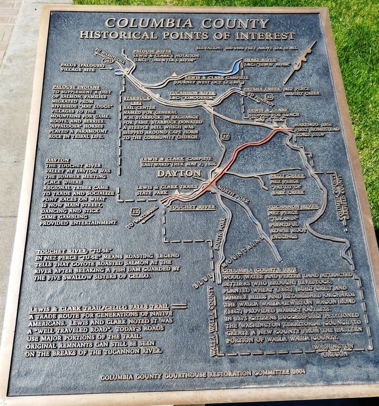
Palouse Indians
To supplement a diet of salmon, families migrated from riverside “mat lodge” villages to the mountains for game, roots, and berries. “Appaloosa” horses played a paramount role in tribal life.
Dayton
The Touchet River valley at Dayton was the summer meeting place where regional tribes came to trade and socialize. Pony races on what is now Main Street, dancing and stick game gambling provided entertainment.
Touchet River
In Nez Perce “Tu-Se” means roasting. Legend tells that coyote roasted salmon at the river after breaking a fish dam guarded by the five swallow sisters of Celilo.
Lewis & Clark Trail / Celilo Falls Trail
A trade route for generations of Native Americans. Lewis and Clark noted it was a “well traveled road.” Today’s roads use major portions of the trail. Original remnants can still be seen on the breaks of the Tucannon River.
Starbuck: 1882
Rail center named for General W.H. Starbuck. In exchange for fame, Starbuck donated a steeple bell which was shipped around Cape Horn to the community church.
Columbia County: 1875
Wood, water and fertile land attracted settlers who brought livestock, planted wheat (1861), built grist and lumber mills and established orchards. The Walla Walla-Lewiston Wagon Road (1862) provided market outlets. In 1875 citizens successfully petitioned the Washington Territorial Council to create a new county from the eastern portion of Walla Walla County.
Erected 2004 by Columbia County Courthouse Restoration Committee.
Topics. This historical marker is listed in these topic lists: Exploration • Native Americans • Roads & Vehicles • Settlements & Settlers.
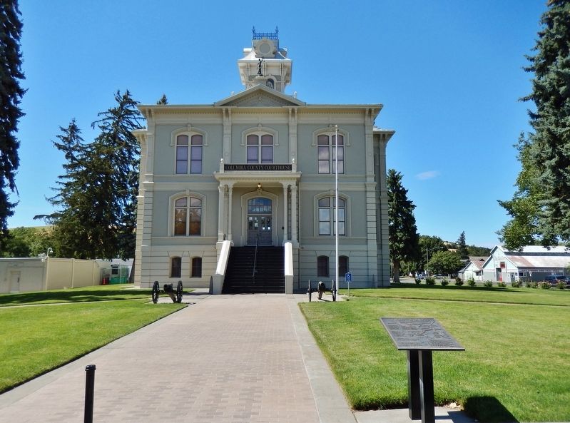
Location. 46° 19.255′ N, 117° 58.696′ W. Marker is in Dayton, Washington, in Columbia County. Marker is on East Main Street west of North 3rd Street, on the right when traveling west. Marker is located beside the sidewalk, directly in front of the Columbia County Courthouse, overlooking the courthouse south entrance. Touch for map. Marker is at or near this postal address: 341 East Main Street, Dayton WA 99328, United States of America. Touch for directions.
Other nearby markers. At least 8 other markers are within walking distance of this marker. City of Dayton (here, next to this marker); Columbia County Courthouse (within shouting distance of this marker); Railroad Track Park (about 400 feet away, measured in a direct line); Oldest Existing Depot in the State of Washington (about
500 feet away); The Celilo Falls Trail (about 700 feet away); Cayuse, Umatilla, and Walla Walla Homeland (approx. ¼ mile away); "a good road" (approx. ¼ mile away); Smith Hollow Schoolhouse (approx. ¼ mile away). Touch for a list and map of all markers in Dayton.
More about this marker. Marker is a large, rectangular, engraved metal tablet, mounted horizontally on waist-high metal posts.
Also see . . .
1. Columbia County History: Lewis & Clark. On October 12 and 13, 1805, Lewis and Clark canoed on the Snake River along the boundary separating Columbia and Whitman counties on the outbound leg of their expedition to the Pacific Ocean. They did not stop in the future Columbia County on the night of October 12. But on their return trip to St. Louis on May 2, 1806, Lewis and Clark spent the night on Patit Creek about two-and-a-half miles east of present-day (2006) Dayton. (Submitted on February 2, 2019, by Cosmos Mariner of Cape Canaveral, Florida.)
2. Columbia County History: Starbuck. The railroad town of Starbuck came into being in the 1880s. In its early years Starbuck was a
division point on the main line of the Oregon Railroad and Navigation Company. At one time up to 24 trains a day went through the town.
In 1914 the opening of the High Line Bridge across the Snake River downstream from Lyon's Ferry eliminated some of the train traffic that went through Starbuck, and after that time it was no longer a railroad division point. The town was a grain-shipping point for a number of years, but by the mid-twentieth century Starbuck's fortunes were fading. (Submitted on February 2, 2019, by Cosmos Mariner of Cape Canaveral, Florida.)
Credits. This page was last revised on February 4, 2019. It was originally submitted on February 2, 2019, by Cosmos Mariner of Cape Canaveral, Florida. This page has been viewed 200 times since then and 9 times this year. Photos: 1, 2, 3. submitted on February 2, 2019, by Cosmos Mariner of Cape Canaveral, Florida. • Andrew Ruppenstein was the editor who published this page.


