Cumberland Township near Gettysburg in Adams County, Pennsylvania — The American Northeast (Mid-Atlantic)
The Peach Orchard Salient
— July 2, 1863 - Second Day —
Inscription.
"Sickles's movement practically destroyed his own corps...; and with what result? - driving us back to the position he was ordered to hold originally."
Maj. Gen. George C. Meade, U.S.A.
Commander, Army of the Potomac
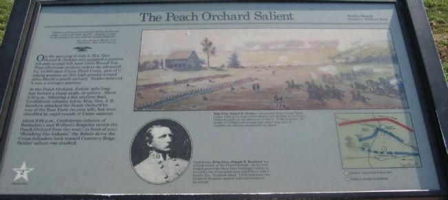
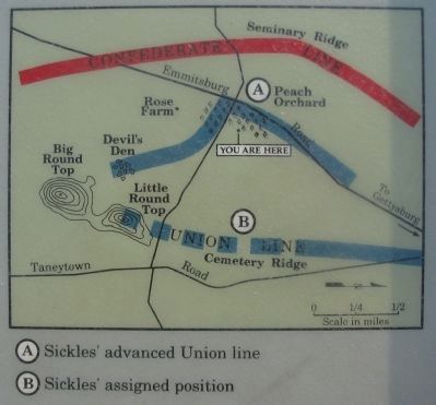
On the morning of July 2, Maj. Gen. Daniel E. Sickles was assigned a position 3/4-mile to your left near Little Round Top. That afternoon - without orders - he advanced his 10,000-man Union Third Corps, part of it taking position on this high ground around John Sherfy's peach orchard. Sickles believed it was a stronger position.
At the Peach Orchard, Sickles' mile-long line formed a sharp angle, or salient. About 5:30 p.m., following a hot artillery duel, Confederate infantry led by Brig. Gen. J.B. Kershaw attacked the Peach Orchard by way of the Rose Farm (to your left), but were shredded by rapid rounds of Union canister.
About 6:00 p.m., Confederate infantry of Barksdale's and Wofford's Brigades struck the Peach Orchard from the west (in front of you), "Shrieking like Indians," the Rebels drove the Union defenders back toward Cemetery Ridge. Sickles' salient was crushed.
Erected by Gettysburg National Military Park.
Topics. This historical marker is listed in these topic lists: Agriculture • Horticulture & Forestry • War, US Civil. A significant historical date for this entry is July 2, 1894.
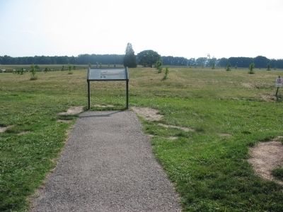
Location. Marker has been permanently removed. It was located near 39° 48.062′ N, 77° 14.93′ W. Marker was near Gettysburg, Pennsylvania, in Adams County. It was in Cumberland Township. Marker was at the intersection of Wheatfield Road and Birney Lane, on the right when traveling east on Wheatfield Road. Located near stop 10, the Peach Orchard, on the driving tour of Gettysburg National Military Park. Touch for map. Marker was in this post office area: Gettysburg PA 17325, United States of America.
We have been informed that this sign or monument is no longer there and will not be replaced. This page is an archival view of what was.
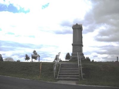
Other nearby markers. At least 8 other markers are within walking distance of this location. Piercing the Union Line (here, next to this marker); 141st Pennsylvania Infantry (here, next to this marker); 68th Pennsylvania Infantry (within shouting distance of this marker); 15th New York Battery (within shouting distance of this marker); Battery F, Pennsylvania Light Artillery (within shouting distance of this marker); Battery C, Pennsylvania Light Artillery (about 300 feet away, measured in a direct line); Artillery Brigade (about 300 feet away); Second Division (about 300 feet away). Touch for a list and map of all markers in Gettysburg.
More about this marker. In the upper center is a painting of the action near the Peach Orchard, captioned Maj. Gen. Daniel E. Sickles, commander of the Union Third Corps, rides to inspect his infantry and artillery at the Peach Orchard (right) on the afternoon of July 2. In the distance, the smoke of Confederate cannon rises above the long lines of Confederate infantry massing for an attack.
In the lower center is a portrait of Confederate Brig. Gen. Joseph B. Kershaw who led a flank attack on the Peach Orchard. As his men surged around the Rose farm buildings (visible on your left), the Union guns here raked them with a terrific fire. Kershaw noted, "I well remember the clatter of the grape against wall and houses as we passed."
On the lower right is a map detailing the action at the Peach Orchard with Sickles' advanced Union line and Sickles' assigned position
indicated.
Related markers. Click here for a list of markers that are related to this marker. Peach Orchard Virtual Tour by Markers
Credits. This page was last revised on May 27, 2023. It was originally submitted on October 25, 2008, by Craig Swain of Leesburg, Virginia. This page has been viewed 3,377 times since then and 32 times this year. Photos: 1, 2, 3. submitted on October 25, 2008, by Craig Swain of Leesburg, Virginia. 4. submitted on November 13, 2010, by Bill Coughlin of Woodland Park, New Jersey.


