Shady Side in Anne Arundel County, Maryland — The American Northeast (Mid-Atlantic)
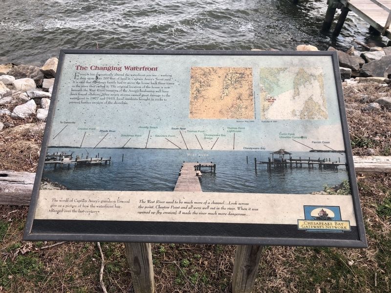
The Changing Waterfront
The words of Captain Avery's grandson Erwood gave us a picture of how the waterfront has changed over the last century:
The West River used to be much more of a channel...Look across the point. Cheston Point and all were well out in the river. When it was opened up [by erosion], it made the river much more dangerous...
Erected by Chesapeake Bay Gateways Network.
Topics. This historical marker is listed in these topic lists: Environment • Industry & Commerce • Waterways & Vessels. A significant historical year for this entry is 1927.
Location. 38° 51.004′ N, 76° 30.713′ W. Marker is in Shady Side, Maryland, in Anne Arundel County. Marker can be reached from East West Shady Side Road west of Bast Avenue , on the right when traveling north. Touch for map. Marker is at or near this postal address: 1420 East West Shady Side Road, Shady Side MD 20764, United States of America. Touch for directions.
Other nearby markers. At least 8 other markers are within walking distance of this marker. Cannon - From Shady Side's Rural Home Hotel (here, next to this marker); Imagine Yourself on the River (a few steps from this marker); At Work — At Play on the Bay (a few steps from this marker); Vanity — The boat that inspired the Chesapeake 20 (within shouting distance of this marker); Boatbuilding in Shady Side (within shouting distance of this marker); Edna Florence (within shouting distance of this marker); Going to Market (within shouting distance of this marker); Transformation of the Avery House and over a Century of Expansion (about 300 feet away, measured in a direct line). Touch for a list and map of all markers in Shady Side.
Credits. This page was last revised on February 18, 2019. It was originally submitted on February 16, 2019, by Devry Becker Jones of Washington, District of Columbia. This page has been viewed 126 times since then and 7 times this year. Photos: 1, 2. submitted on February 16, 2019, by Devry Becker Jones of Washington, District of Columbia. • Bill Pfingsten was the editor who published this page.

