Phoebus in Hampton, Virginia — The American South (Mid-Atlantic)
A National Cemetery System
Photographed by Brandon D Cross, January 30, 2019
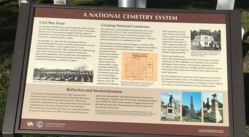
1. A National Cemetery System Marker
Civil War Dead
An estimated 700,000 Union and Confederate soldiers died in the Civil War between April 1861 and April 1865. As the death toll rose, the U.S. government struggled with the urgent but unplanned need to bury fallen Union troops. This propelled the creation of a national cemetery system.
On September 11, 1861, the War Department directed commanding officers to keep “accurate and permanent records of deceased soldiers.” It also required the U.S. Army Quartermaster General, the office responsible for administering to the need of troops in life and in death, to mark each grave with a headboard. A few months later, the department mandated interment of the dead in graves marked with numbered headboards, recorded in a register.
Creating National Cemeteries
The authority to create military burial grounds came in an Omnibus Act of July 17, 1862. It directed the president to purchase land to be used as “a national cemetery for the soldiers who shall die in the service of the country.” Fourteen national cemeteries were established by 1862.
When hostilities ended, a grim task began.
this page online
Most cemeteries were less than 10 acres, and layouts varied. In the Act to Establish and to Protect National Cemeteries of February 22, 1867, Congress funded new permanent walls or fences, grave markers, and lodges for cemetery superintendents.
At first only soldiers and sailors who died during the Civil War were buried in national cemeteries. In 1873, eligibility was expanded to all honorably discharged Union veterans, and Congress appropriated $1 million to mark the graves. Upright marble headstones honor individuals whose names were known; 6-inch-square blocks mark unknowns.
By 1873, military post cemeteries on the Western frontier joined the national cemetery system. The National Cemeteries Act of 1973 transferred
Library of Congress
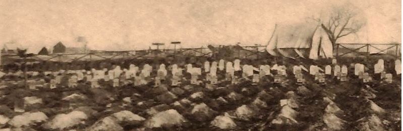
2. Marker detail: Soldiers’ graves near General Hospital, City Point, Va., c.
(sidebar)
Reflection and Memorialization The country reflected upon the Civil War's human toll—2 percent of the U.S. population died. Memorials honoring war service were built in national cemeteries. Most were donated by regimental units, state governments and veterans' organizations such as the Grand Army of the Republic. Decoration Day, later Memorial Day, was a popular patriotic spring event that started in 1868. Visitors placed flowers on graves and monuments, and gathered around rostrums to hear speeches. Construction of Civil War monuments peaked in the 1890s. By 1920, as the number of aging veterans was dwindling, more than 120 monuments had been placed in the national cemeteries.
Erected by U.S Department of Veteran Affairs, National Cemetery Administration.
Topics and series. This historical marker is listed in these topic lists: Cemeteries & Burial Sites • War, Spanish-American • War, US Civil • War, World II. In addition, it is included in the National Cemeteries series list.
Location. 37° 1.292′ N,
National Archives and Records Administration
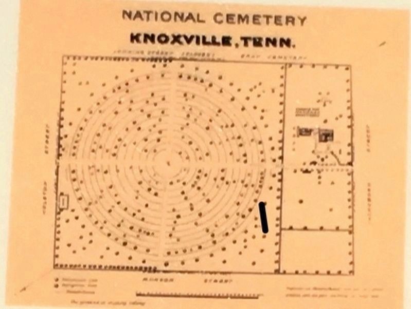
3. Marker detail: Knoxville National Cemetery Plan, 1982.
Knoxville [National Cemetery] was established after the siege of the city and Battle of Fort Sanders in 1863.

Regionally, this marker is on Virginia’s Peninsula and in Coastal Virginia. It is also in the American South, specifically in the Upper South, in the Tidewater, and on the Eastern Seaboard. Globally, it is in the North Atlantic Region, North America, the Western Hemisphere, the Western World, and the Anglosphere. Historically, it finds itself in what was once the territory of the Mississippian Culture, one of the original Thirteen Colonies, one of the Confederate States of America, and the Antebellum South.
Other nearby markers. At least 8 other markers are within walking distance of this marker: Phoebus (about 700 feet away, measured in a direct line); a different marker also named Emancipation Oak
Photographed by Brandon D Cross
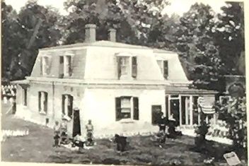
4. Marker detail: Lodge at City Point, Va., pre-1928
The first floor contained a cemetery office, and living room and kitchen for the superintendent’s family; three bedrooms were upstairs.
Other markers no longer nearby. Emancipation Oak (was approx. ¼ mile away but has been replaced with another marker now near it); a different marker also named Emancipation Oak (was approx. ¼ mile away but has been replaced with another marker now near it).
Also see . . . Hampton National Cemetery. U.S. Department of Veterans Affairs, National Cemetery Administration (Submitted on February 19, 2019.)
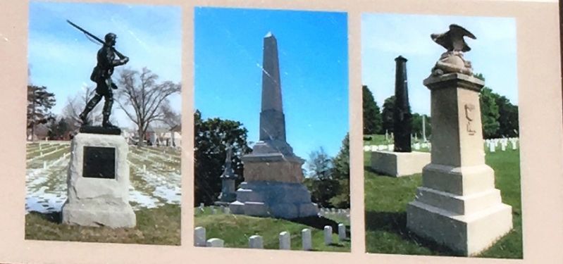
5. Marker detail: National Cemetery Monuments
Left to right: Massachusetts Monument, Winchester, Va., 1907; Maryland Sons Monument, Loudon Park, Baltimore, Md., 1885; and Women’s Relief Corps/Grand Army of the Republic Monument to the Unknown Dead, Crown Hill, Indianapolis, Ind., 1889
Photographed by Brandon D Cross, January 30, 2019
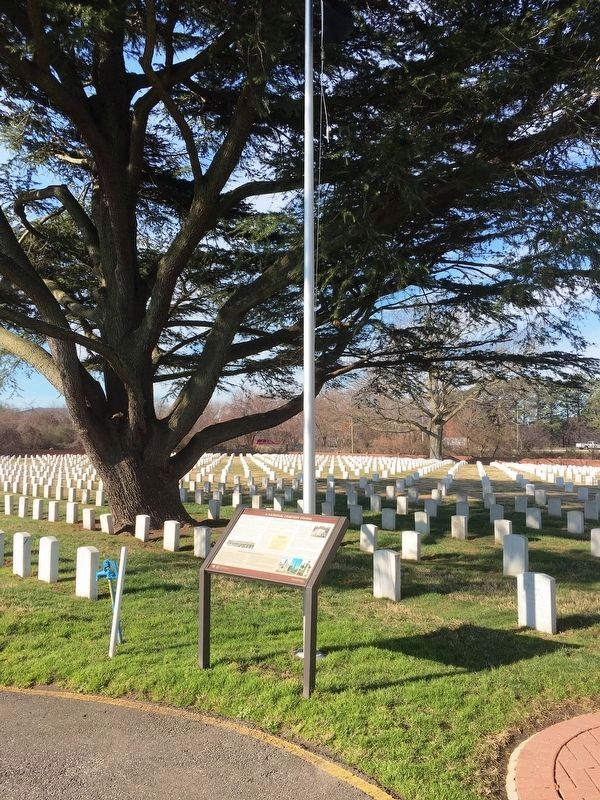
6. A National Cemetery System Marker from a distance
Credits. This page was last revised on February 1, 2023. It was originally submitted on February 18, 2019, by Brandon D Cross of Flagler Beach, Florida. This page has been viewed 333 times since then and 17 times this year. Photos: 1, 2, 3, 4, 5, 6. submitted on February 18, 2019, by Brandon D Cross of Flagler Beach, Florida. • Bernard Fisher was the editor who published this page.
