
Leesburg in Loudoun County, Virginia — The American South (Mid-Atlantic)
The Farmhand House
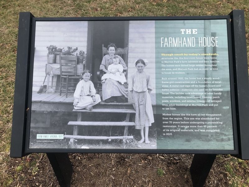
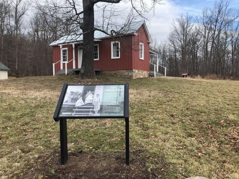
Built around 1920, the home has a sturdy wood-frame girt construction and a foundation of local stone. A metal roof cps off the home's board and batten exterior—materials also used on the brooder house. The builder took advantage of other handy materials, including bead-board, framing, porch posts, windows, and exterior boards—all salvaged from other buildings at Morven Park and put to use here.
Modest homes like this have all but disappeared from the region. This one was abandoned for over 70 years before undergoing a painstaking restoration. It retains more than 85 percent of its original materials, and was completed in 2015.
(caption)
Farm Family, Virginia, 1911. Courtesy of the Library of Congress
Topics. This historical marker is listed in these topic lists: Agriculture • Notable Buildings. A significant historical year for this entry is 1920.
Location. 39° 8.56′ N, 77° 34.281′ W.
this page online

Regionally, this marker is in the Washington Metropolitan Area and in Northern Virginia. It is also in the American South, specifically in the Upper South, and in the Mid-Atlantic. Globally, it is in North America, the Western Hemisphere, the Western World, and the Anglosphere. Historically, it finds itself in what was once the territory of the Mississippian Culture, one of the original Thirteen Colonies, one of the Confederate States of America, and the Antebellum South.
Other nearby markers. At least 8 other markers are within 2 miles of this marker, measured as the crow flies: The Garden (here, next to this marker); A Serious Business (a few steps from this marker); Mile Hill (approx. 1.1 miles away); Early’s Washington Campaign (approx. 1.2 miles away); Goose Creek Chapel (approx. 1.3 miles away);
Other markers no longer nearby. Swann's Castle (was approx. ¼ mile away but has been permanently removed); 1862 Antietam Campaign (was approx. 1.1 miles away but has been permanently removed).
Credits. This page was last revised on March 19, 2019. It was originally submitted on February 18, 2019, by Devry Becker Jones of Washington, District of Columbia. This page has been viewed 430 times since then and 19 times this year. Photos: 1, 2. submitted on February 18, 2019, by Devry Becker Jones of Washington, District of Columbia. • Bernard Fisher was the editor who published this page.
