Leesville in Saluda County, South Carolina — The American South (South Atlantic)
Delmar School
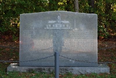
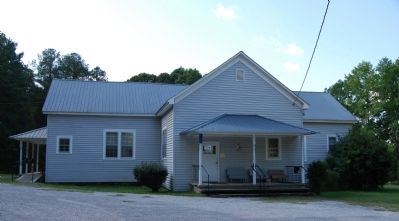
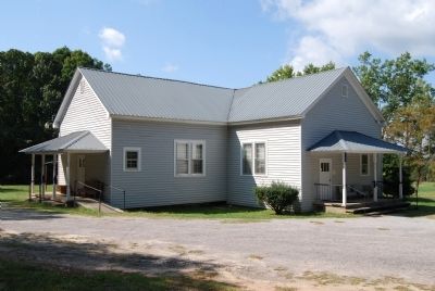
Delmar School was established in 1896 on property obtained from Elijah Wilson & Lula Fulmer Shealy. This property was previously owned by his parents, Mary Ann Gorley & Simeon Richard Shealy. A Confederate soldier who died during the war, Richard had purchased the land from his father, Mathias Shealy, who married first Polly Fulmer and second Barbara Risinger. Mathias is buried in the family plot located .3 mile southwest of this site. The Mt. Hebron Lutheran Church Cemetery, located .1 mile south was also part of this tract. The cemetery was begun in 1901 when Elijah & Lula Shealy buried their child, Wyman, in a cornfield adjacent to the church. Numerous students of Delmar School and many members of the Mt. Hebron Lutheran Church are descendants of Mathias Shealy.
Erected by Grandchildren of Elijah and Lula Shealy.
Topics. This historical marker is listed in these topic lists: Cemeteries & Burial Sites • Education • War, US Civil. A significant historical year for this entry is 1896.
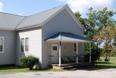
Location. 34° 1.217′ N, 81° 31.45′ W. Marker is in Leesville, South Carolina, in Saluda County. Marker is on Old Delmar School Road. Marker is located to the left of the school's front entrance. Touch for map. Marker is in this post office area: Leesville SC 29070, United States of America. Touch for directions.
Other nearby markers. At least 10 other markers are within 11 miles of this marker, measured as the crow flies. A different marker also named Delmar School (about 400 feet away, measured in a direct line); Hare’s Mill (approx. 2.8 miles away); Old Lexington Baptist Church (approx. 4˝ miles away); Hartley House (approx. 7.3 miles away); Lee's Tavern Site (approx. 7.6 miles away); Old Batesburg-Leesville High School (approx. 7.6 miles away); Site of the "Swamp Rabbit" Bridge / The Swamp Rabbit (approx. 7.7 miles away); Blinding of Isaac Woodard (approx. 8 miles away); Batesburg Institute (approx. 8.3 miles away); Flat Grove (approx. 10.1 miles away). Touch for a list and map of all markers in Leesville.
Regarding Delmar School. The building is the current home of Delmar Nutrition Site.
Credits. This page was last revised on January 23, 2020. It was originally submitted on October 26, 2008, by Brian Scott of Anderson, South Carolina. This page has been viewed 1,172 times since then and 21 times this year. Photos: 1, 2, 3, 4. submitted on October 26, 2008, by Brian Scott of Anderson, South Carolina.


