Speigle Heights in Lexington in Fayette County, Kentucky — The American South (East South Central)
Fort Clay

Photographed by Daulton Cox, June 25, 2026
1. Fort Clay Marker
Erected by Historical Markers Society. (Marker Number 9.)
Topics and series. This historical marker is listed in these topic lists: Forts and Castles • War, US Civil. In addition, it is included in the Kentucky Historical Society series list. A significant historical month for this entry is May 1862.
Location. 38° 3.015′ N, 84° 30.842′ W. Marker is in Lexington, Kentucky, in Fayette County. It is in Speigle Heights. It is on West High Street (U.S. 60), on the right when traveling east. Located at the west end of viaduct over the railroad. Touch for map. Marker is in this post office area: Lexington KY 40508, United States of America. Touch for directions.

Regionally, this marker is in Kentucky’s Bluegrass Region. It is also in the American South and specifically in the Upper South. Globally, it is in North America, the Western Hemisphere, the Western World, and the Anglosphere. Historically, it finds itself in what was once the territory of the Mississippian Culture
this page online
Other nearby markers. At least 8 other markers are within walking distance of this marker: Lexington Historic Distillery District (approx. 0.3 miles away); Historic Botherum (approx. 0.4 miles away); Historic Land (approx. half a mile away); Lexington Cemetery (approx. half a mile away); Address by President Lincoln (approx. 0.6 miles away); Mary Desha (approx. 0.6 miles away); A National Cemetery System (approx. 0.6 miles away); Vertner Woodson Tandy (approx. 0.6 miles away). Touch for a list and map of all markers in Lexington.
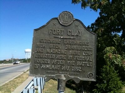
Photographed by Matt Carter, September 17, 2010
2. Fort Clay Marker
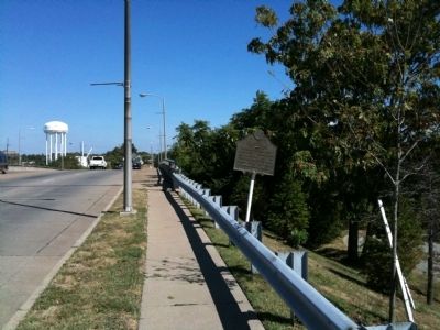
Photographed by Matt Carter, September 17, 2010
3. Marker traveling east
Credits. This page was last revised on July 2, 2026. It was originally submitted on September 17, 2010, by Matt Carter of Lexington, Kentucky. This page has been viewed 1,796 times since then and 31 times this year. Last updated on February 23, 2019, by Bradley Owen of Morgantown, West Virginia. Photos: 1. submitted on July 2, 2026, by Daulton Cox of Muncie, Indiana. 2, 3. submitted on September 17, 2010, by Matt Carter of Lexington, Kentucky. • Andrew Ruppenstein was the editor who published this page.
