Palatka in Putnam County, Florida — The American South (South Atlantic)
Native Americans at the River
5000 BC to 1842

Photographed by Cosmos Mariner, March 13, 2019
1. Native Americans at the River Marker
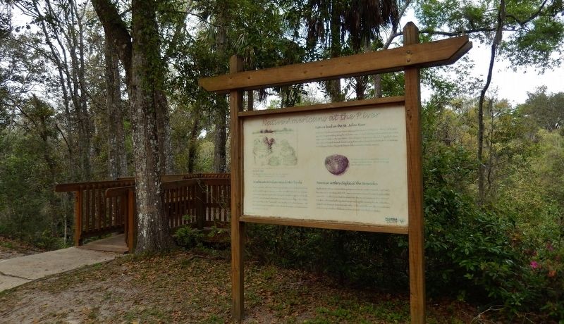
Natives lived on the St. Johns River
Northwest Florida was home to Native Americans for some 15,000 years. About 7,000 years ago, they began settling along the St. Johns River. French and Spanish explorers arrived in what is now Palatka in the late 1500’s. Here they met Timucuan Indians led by Chief Utina. The Timucuan farmed, hunted, fished, and gathered snails and mussels from the waterways. Archeologists believe they probably used the ravines freshwater source.
Southeastern Indians moved into Florida
By the mid 1700’s, the Native American population of Florida had died from warfare and European diseases. Creeks and other Indians from Alabama and Georgia migrated into Florida. During the British occupation of Florida (1763-83), famed botanist William Bartram visited a Creek village in the Palatka areas, possibly in the “hammock” area south of St. Johns Avenue. He describes being welcomed there with a feast of oranges and watermelons grown by the Indians.
American settlers displaced the Seminoles
By the 1800's, these various Indian groups were known as the Seminole. As Florida became a U.S. territory (1821-45), American
this page online
Erected by Florida State Parks.
Topics. This historical marker is listed in these topic lists: Colonial Era • Indigenous Peoples and Communities • Settlements & Settlers. A significant historical year for this entry is 1836.
Location. 29° 37.941′ N, 81° 38.671′ W. Marker is in Palatka, Florida, in Putnam County. It can be reached from Twigg Street east of South 18th Street, on the right when traveling east. Marker is located within Ravine Gardens State Park, along the gardens loop road, overlooking the ravine. Touch for map. Marker is at or near this postal address: 1600 Twigg Street, Palatka FL 32177, United States of America. Touch for directions.

Regionally, this marker is in First Coast. It is also in the American South. Globally, it is in the North Atlantic
Photographed by Cosmos Mariner, March 13, 2019
2. Native Americans at the River Marker (wide view; ravine overlook platform on the left)
Other nearby markers. At least 8 other markers are within 2 miles of this marker, measured as the crow flies: Suspension Bridges and Amphitheater (about 600 feet away, measured in a direct line); Palatka Waterworks (about 800 feet away); Saw Palmetto (approx. 0.2 miles away); Ravine State Gardens (approx. ¼ mile away); William Bartram Trail (approx. 0.3 miles away); Garden Center History (approx. 0.3 miles away); Grand Gables Inn (approx. 0.9 miles away); The Hammock (approx. 1.1 miles away). Touch for a list and map of all markers in Palatka.
Another marker is no longer nearby. The Civil War and the Ravines (was approx. ¼ mile away but has been confirmed missing).
Also see . . . Utina, chief of Timacauns, encountering the aggressive Spanish Soldiers. The Spanish were friendly at first meeting with Outina/Utina, chief of the
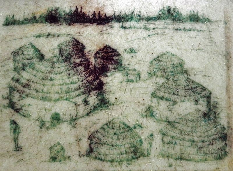
3. Marker detail: St. Johns Village
The high land between here and the river may have been a village site for native St. Johns people.
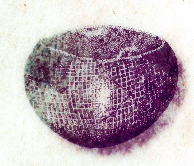
4. Marker detail: Native pottery
St. Johns people often stamped their pottery with a unique checked pattern. Sherds of this type were found in the Gardens.
Credits. This page was last revised on November 29, 2024. It was originally submitted on March 13, 2019, by Cosmos Mariner of Cape Canaveral, Florida. This page has been viewed 2,107 times since then and 113 times this year. Photos: 1, 2, 3, 4. submitted on March 13, 2019, by Cosmos Mariner of Cape Canaveral, Florida.
