Brownsville in Cameron County, Texas — The American South (West South Central)
Field-Pacheco Complex
Photographed by Cosmos Mariner, May 18, 2018
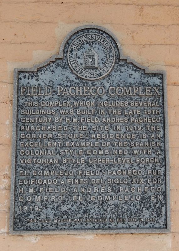
1. Field-Pacheco Complex Marker

English:
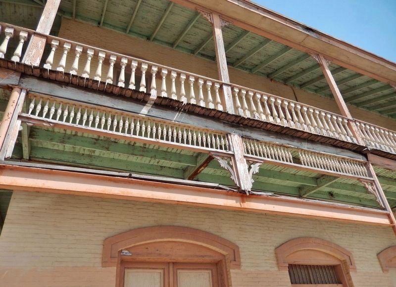
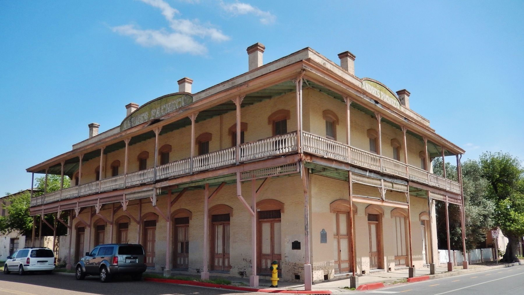
This complex, which includes several buildings, was built in the late 19th century by H.M. Field. Andres Pacheco purchased the site in 1919. The corner store – residence is an excellent example of the Spanish colonial style combined with a Victorian style upper-level porch.
Spanish:
Erected 1993 by City of Brownsville.
Topics. This historical marker is listed in these topic lists: Architecture • Hispanic Americans • Industry & Commerce • Man-Made Features.
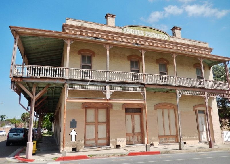
Location. 25° 54.295′ N, 97° 29.721′ W. Marker is in Brownsville, Texas, in Cameron County. It is at the intersection of East 11th Street and East Monroe Street, on the left when traveling east on East 11th Street. Marker is mounted at eye-level, directly on the subject building, at the southwest corner, facing East 11th Street. Touch for map. Marker is at or near this postal address: 1049 East Monroe
this page online

Regionally, this marker is in South Texas. It is also in the American Borderlands, in the South, and on the Gulf Coast. Globally, it is in North America, a Gulf of Mexico state, the Western Hemisphere, the Western World, and the Anglosphere. Historically, it finds itself in what was once New Spain, the Republic of Texas, and one of the Confederate States of America.
Other nearby markers. At least 8 other markers are within walking distance of this marker: A different marker also named Field/Pacheco Complex (here, next to this marker); Campo Santo Viejo (within shouting distance of this marker); 1912 Cameron County Courthouse (within shouting distance of this marker); Cameron County (about 300 feet away, measured in a direct line); Cameron County Courthouse (about 400 feet away); La Madrileña (about 400 feet away); Old Cameron County Courthouse/Dancy Building (about 500 feet away); a different marker also named La Madrileña (about 500 feet away). Touch for a list and map of all markers in Brownsville.
Regarding Field-Pacheco Complex. Marker
Photographed by Cosmos Mariner, May 18, 2018
2. Field-Pacheco Complex Marker (wide view from East 11th Street)
Photographed by Cosmos Mariner, May 18, 2018
3. Field-Pacheco Complex (Victorian veranda detail)
Photographed by Cosmos Mariner, May 18, 2018
4. Field-Pacheco Complex (southwest corner view)
Credits. This page was last revised on January 14, 2021. It was originally submitted on March 17, 2019, by Cosmos Mariner of Cape Canaveral, Florida. This page has been viewed 742 times since then and 76 times this year. Photos: 1, 2, 3, 4. submitted on March 18, 2019, by Cosmos Mariner of Cape Canaveral, Florida.
