Bacalar, Quintana Roo, Mexico — The Yucatan Peninsula (The Southeast)
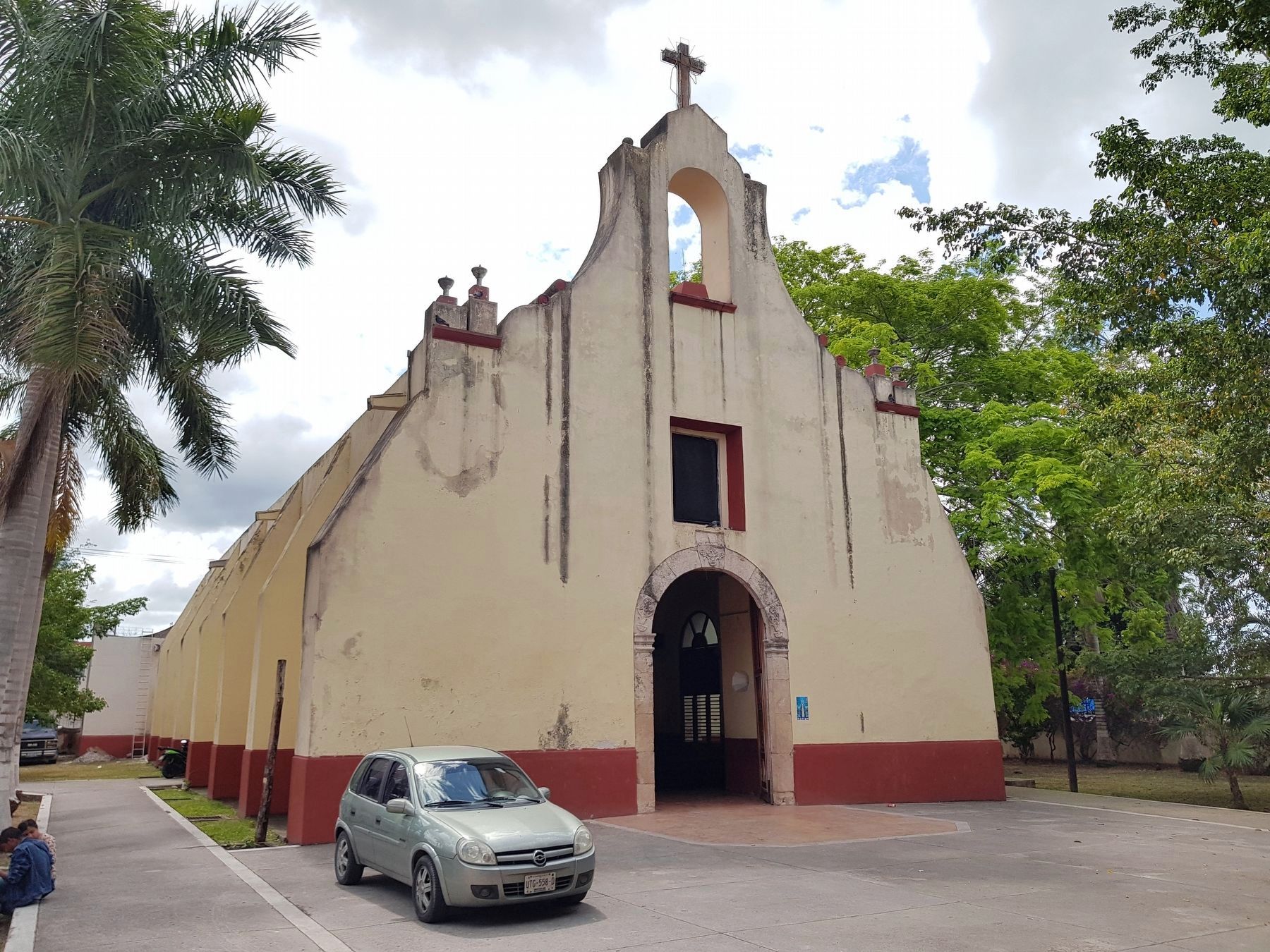
Church of San Joaquín
Photographed by J. Makali Bruton, March 31, 2019
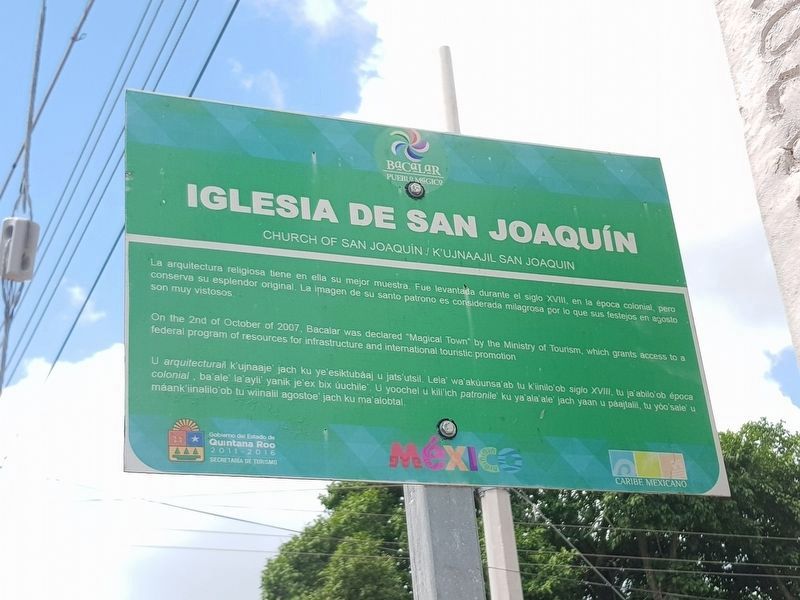
1. Church of San Joaquín Marker

La arquitectura religiosa tiene en ella su mejor muestra. Fue levantada durante el siglo XVIII, en la época colonial, pero conserva su esplendor original. La imagen de su santo patrono es considerada milagrosa por lo que sus festejos en agost son muy vistosos.
Church of San Joaquín
On the 2nd of October of 2007, Bacalar was declared "Magical Town" by the Ministry of Tourism, which grants access to a federal program of resources for infrastructure and international touristic promotion.
Kujnaajil San Joaquín
U arquitectural k’ujnaaje’ jach ku ye’esiktubáaj u jats’utsil. Lela’ wa’akúunsa’ab tu k’iinilo’ob siglo XVIII, tu ja’abilo’ob época colonial, ba’ale la'ayli’ yanik je'ex bix úuchile’. U yoochel u kilil’ich patronile’ ku ya’ala'ale' jach yaan u páajtalil, tu yóo’sale’ u máank’iinalilo’ob tu wiinalil agostoe’ jach ku ma’alobtal.
Erected by Gobierno del Estado de Quintana Roo 2011-2016.
Topics. This historical marker is listed in these topic lists: Colonial Era • Man-Made Features • Religion & Religious Structures. A significant historical date for this entry is October 2, 2007.
Location. 18° 40.708′ N,
this page online

Regionally, this marker is in the Mexican Maya Heartland and on the Yucatán Peninsula. Globally, it is on the Caribbean Sea, in North America, in Mesoamerica, in a Gulf of Mexico state, and in the Western Hemisphere. Historically, it finds itself in what was once New Spain and also a Spanish colony.
Other nearby markers. At least 8 other markers are within walking distance of this marker: Bacalar (a few steps from this marker); Ichkabal Bacalar (about 90 meters away, measured in a direct line); Miguel Hidalgo y Costilla (about 180 meters away); Creation of the Municipality of Bacalar (about 180 meters away); Bacalar in the XVI Century (about 240 meters away); Bacalar During the XVth Century (approx. 0.3 kilometers away); San Felipe Fort (approx. 0.3 kilometers away); The House of Culture (approx. 0.3 kilometers away). Touch for a list and map of all markers
Photographed by J. Makali Bruton, March 31, 2019
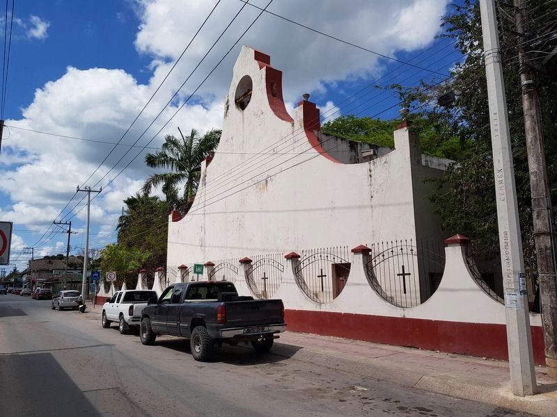
2. Church of San Joaquín and Marker
The marker can be seen at the far left in this view of the rear facade of the Church of San Joaquín.
Regarding Church of San Joaquín. For some reason, the English text does not match the Spanish or Maya-Yucateco. A translation of the Spanish text into English is as follows:
Church of San Joaquin
Religious architecture here has its best example. It was built during the 18th century, in the colonial era, but retains its original splendor. The image of the patron saint is considered miraculous, so his celebrations in August are popular and well adorned.
Photographed by J. Makali Bruton, March 31, 2019
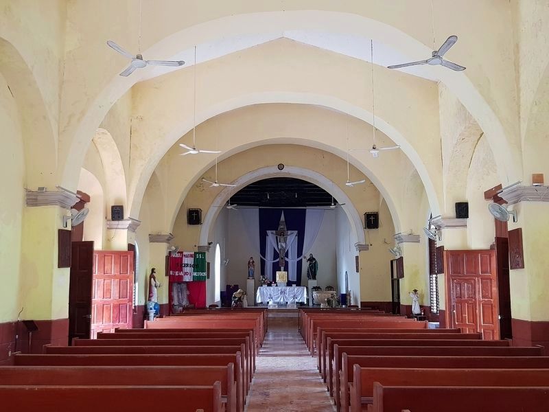
3. The interior of the Church of San Joaquín
Photographed by J. Makali Bruton, March 31, 2019
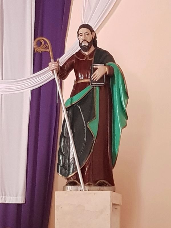
4. The image of San Joaquín, mentioned in the marker text
Photographed by J. Makali Bruton, March 31, 2019
5. The Church of San Joaquín
Credits. This page was last revised on April 2, 2019. It was originally submitted on April 2, 2019, by J. Makali Bruton of Washington, District of Columbia. This page has been viewed 837 times since then and 107 times this year. Photos: 1, 2, 3, 4, 5. submitted on April 2, 2019, by J. Makali Bruton of Washington, District of Columbia.
