Mackinaw City in Cheboygan County, Michigan — The American Midwest (Great Lakes)
Fort Michilimackinac
⎯⎯⎯
Michilimackinac State Park

Photographed by Cosmos Mariner, July 19, 2011
1. Fort Michilimackinac side of marker
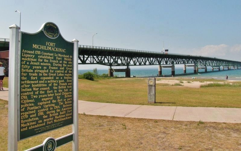
Fort Michilimackinac
Around 1715 Constant Le Marchand de Lignery established Fort Michilimackinac for the French at the site of a Jesuit mission. During the next fifty years as France and Great Britain struggled for control of the fur trade in the Great Lakes region, the fort expanded as a trading settlement and a military post. Soon after hostilities of the French and Indian War ceased, the British took control of the fort in the fall of 1761. Two years later local Chippewa (Ojibwa), angered by British policies, captured the fort as part of Pontiac’s Uprising. The British regained control in 1764. Between 1779 and 1781, during the American Revolution, the British built Fort Mackinac on nearby Mackinac Island and abandoned Fort Michilimackinac.
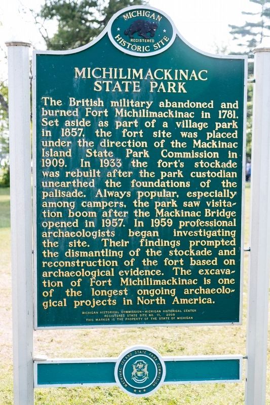
Michilimackinac State Park
The British military abandoned and burned Fort Michilimackinac in 1781. Set aside as part of a village park in 1857, the fort site was placed under the direction of the Mackinac Island State Park Commission in 1909. In 1933 the fort's stockade was rebuilt after the park custodian unearthed the foundations of the pallisade. Always popular, especially
this page online
Registered State Site No. 11, 2009
This marker is the property of the State of Michigan
Erected 2009 by Michigan Historical Commission - Michigan Historical Center and Mackinac Island State Park Commission. (Marker Number S11.)
Topics and series. This historical marker is listed in these topic lists: Anthropology & Archaeology • Colonial Era • Forts and Castles • Indigenous Peoples and Communities. In addition, it is included in the Michigan Historical Commission, and the National Historic Landmarks series lists. A significant historical year for this entry is 1715.
Location. 45° 47.263′ N, 84° 43.889′ W. Marker is in Mackinaw City, Michigan, in Cheboygan County. It can be reached
Photographed by J. J. Prats, August 2, 2024
2. Michilimackinac State Park side of marker

Regionally, this marker is in Northern Michigan Lower Peninsula, on the Straits of Mackinac, and in one of the Lake Huron Shore counties. It is also in the American Midwest. Globally, it is in North America, in the Great North Woods, on the Great Lakes, in the Western Hemisphere, in the Western World, and in the Anglosphere. Historically, it finds itself in what was once the Northwest Territory.
Other nearby markers. At least 8 other markers are within walking distance of this marker: Michilimackinac State Park (a few steps from this marker); Mackinac Bridge (within shouting distance of this marker); Fort Michilimackinac (within shouting distance of this marker); Mackinac State Historic Parks (within shouting distance of this marker); Revolutionary Times (about 300 feet away, measured in a direct line); Michigan's First Jewish Settler (about 300 feet away); Michilimackinac State Park (about 300 feet away); a different marker also named Mackinac State Historic Parks (about 300 feet away). Touch for a list and map of all markers in Mackinaw City.
Regarding Fort Michilimackinac / Michilimackinac State Park. National Historic Landmark (1962), and National Register of Historic Places #66000395 (1966).
Also see . . .
1. Fort Michilimackinac Origin and Importance. Military History of the Upper Great Lakes entry:
When the fort was built, it stood 380 feet by 360 feet, and contained
Photographed by Mike Wintermantel, November 26, 2004
3. Fort Michilimackinac
Previous marker
2. Fort Michilimackinac. Wikipedia entry:
The primary purpose of the fort was as part of the French-Canadian trading post system, which stretched from the Atlantic Coast and the St. Lawrence River to the Great Lakes, and south to the Mississippi River through the Illinois Country. The fort served as a supply depot for traders in the western Great Lakes. (Submitted on April 4, 2019, by Cosmos Mariner of Cape Canaveral, Florida.)
3. The Trade History of Fort Michilimackinac. Military History of the Upper Great Lakes entry:
Fort Michilimackinac played a pivotal role in the Northwestern fur trading industry from its founding in 1715, up to its abandonment in 1783 . (Submitted on April 4, 2019, by Cosmos Mariner of Cape Canaveral, Florida.)
Additional commentary.
1.
Photographed by Cosmos Mariner, July 19, 2011
4. Fort Michilimackinac / Michilimackinac State Park Marker (wide view)
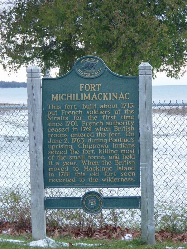
The original marker was a one-sided Fort Michilimackinac marker (No. 11) that was placed in 1958. The text read:
"This fort, built about 1715, put French soldiers at the Straits for the first time since 1701. French authority ceased in 1761 when British troops entered the fort. On June 2, 1763, during Pontiac's uprising, Chippewa Indians seized the fort, killing most of the small force, and held it for a year. When the British moved to Mackinac Island in 1781 this old fort soon reverted to the wilderness."
Dunbar, W. F. (1967). Michigan Historical Markers. Michigan Historical Commission.
Editor's note: Thank you! If you have more information or photos please consider adding them here.
— Submitted January 22, 2022, by Joel Seewald of Madison Heights, Michigan.
Photographed by Cosmos Mariner, July 19, 2011
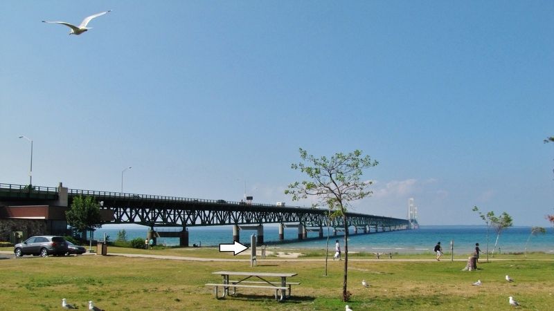
5. Fort Michilimackinac Marker (Henry Alexander Park & Mackinac Bridge in background)
Photographed by Cosmos Mariner, July 19, 2011
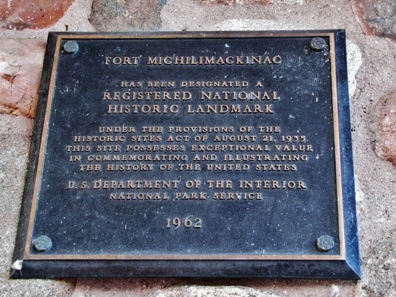
6. National Register of Historic Places plaque
(at park Visitor Center near marker)
(at park Visitor Center near marker)
has been designated a
Registered National
Historic Landmark
Under the provisions of the
Historic Sites Act of August 21, 1935
This site possesses exceptional value
in commemorating and illustrating
the history of the United States
U.S. Department of the Interior
National Park Service
1962
via NPS, unknown
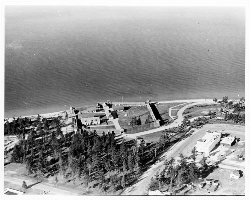
7. Fort Michilimackinac
NPGallery Digital Asset Management System website entry
Click for more information.
Click for more information.
Credits. This page was last revised on August 10, 2024. It was originally submitted on April 4, 2019, by Cosmos Mariner of Cape Canaveral, Florida. This page has been viewed 960 times since then and 77 times this year. Photos: 1. submitted on April 4, 2019, by Cosmos Mariner of Cape Canaveral, Florida. 2. submitted on August 10, 2024, by J. J. Prats of Powell, Ohio. 3. submitted on December 18, 2020, by Mike Wintermantel of Pittsburgh, Pennsylvania. 4, 5, 6. submitted on April 4, 2019, by Cosmos Mariner of Cape Canaveral, Florida. 7. submitted on January 30, 2022, by Larry Gertner of New York, New York.
