Civic Center in Manhattan in New York County, New York — The American Northeast (Mid-Atlantic)
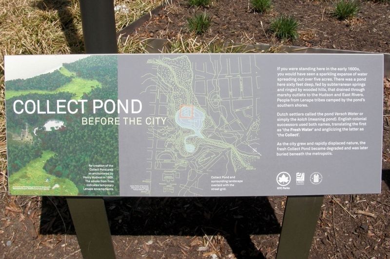
Collect Pond Before The City
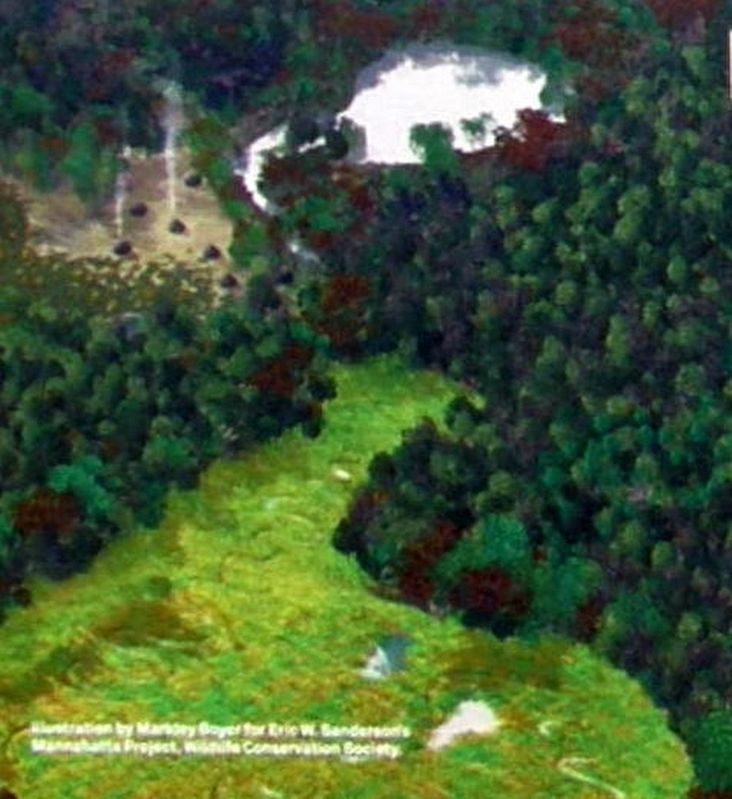
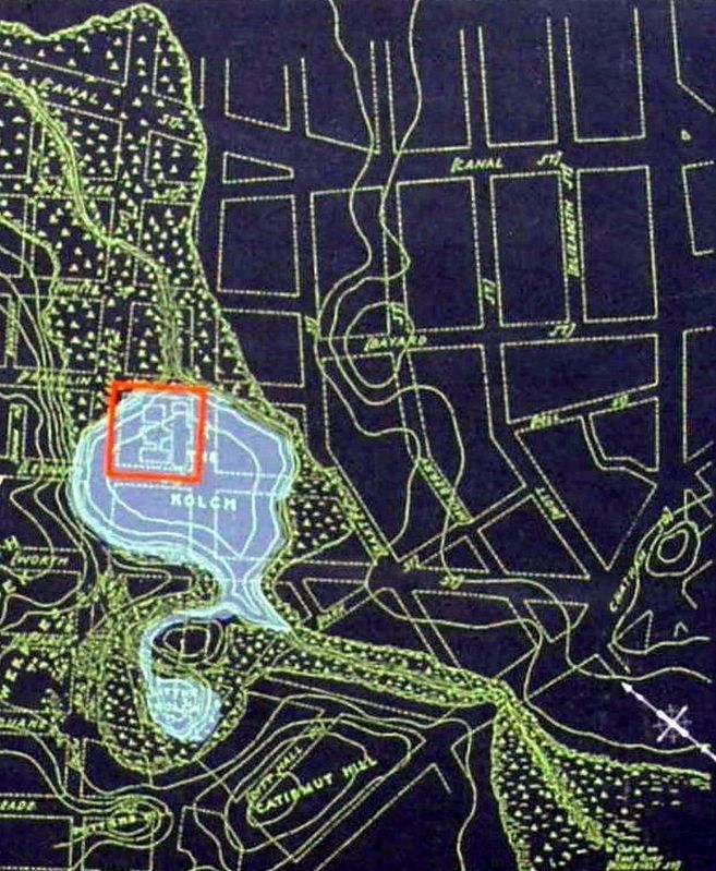
If you were standing here in the early 1600s, you would have seen a sparkling expanse of water spreading out over five acres. There was a pond here sixty feet deep, fed by a subterranean springs and ringed by wooded hills, that drained through marshy outlets to the Hudson and East Rivers. People from Lenape tribes camped by the pond’s southern shores.
Dutch settlers called the pond Versch Water of simply the kolch (meaning pond). English colonial successors used both names, translating the first as ‘the Fresh Water” and anglicizing the later as ‘the Collect’.
As the city grew and rapidly displaced nature, the fresh Collect Pond became degraded and was later buried beneath the metropolis.
Erected by NYC Parks.
Topics. This historical marker is listed in these topic lists: Colonial Era • Native Americans • Parks & Recreational Areas.
Location. 40° 42.979′ N, 74° 0.123′ W. Marker is in Manhattan, New York, in New York County. It is in Civic Center. Marker is on Lafayette Street near Leonard Street, on the left when traveling south. Touch for map. Marker is in this post office area: New York NY 10013, United States of America. Touch for directions.
Other nearby markers. At least 8 other markers are within walking distance of this marker. Collect Pond and the City (here, next to this marker); Death of the Collect Pond (here, next to this marker); The Legendary Collect Pond (here, next to this marker); From Collect Pond To Park (here, next to this marker); The Jerry and Maria McAuley Center (about 400 feet away, measured in a direct line); Engine Company 31 (about 400 feet away); Abraham De Peyster (about 400 feet away); The Mudd Club, 1978-1981 (about 500 feet away). Touch for a list and map of all markers in Manhattan.
Credits. This page was last revised on January 31, 2023. It was originally submitted on April 5, 2019, by Larry Gertner of New York, New York. This page has been viewed 231 times since then and 40 times this year. Photos: 1, 2, 3, 4. submitted on April 5, 2019, by Larry Gertner of New York, New York. • Bill Pfingsten was the editor who published this page.


