Millcreek Township near Erie in Erie County, Pennsylvania — The American Northeast (Mid-Atlantic)
Leo's Landing
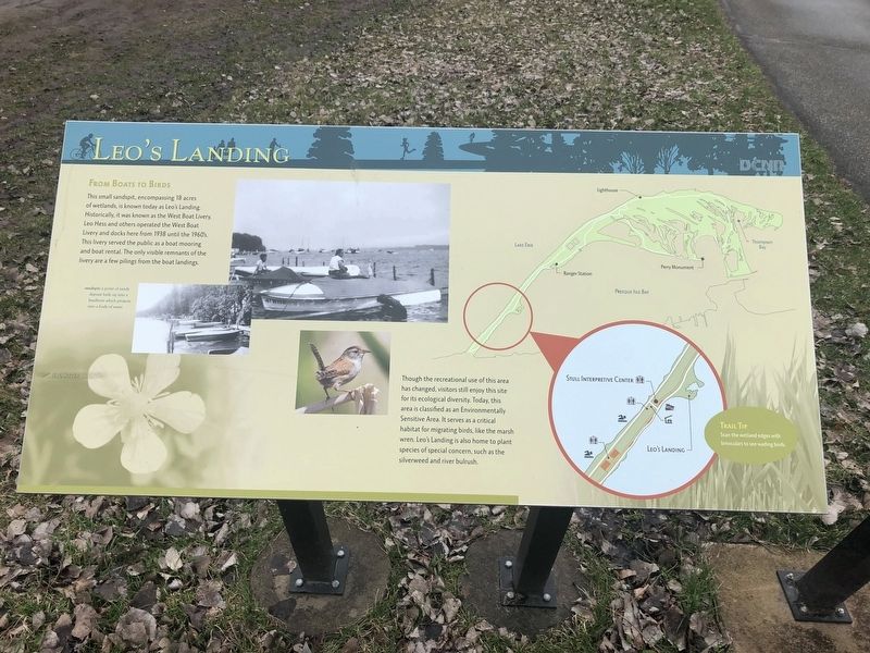
From Boats to Birds
This small sandpit, encompassing 18 acres of wetlands, is known today as Leo's Landing. Historically, it was known as the West Boat Livery. Leo Hess and others operated the West Boat Livery and docks here from 1938 until the 1960's. This livery served the public as a boating mooring and boat rental. The only visible remnants of the livery are a few pilings from the boat landings.
Though the recreational use of this area has changed, visitors still enjoy this site for its ecological diversity. Today, this area is classified as an Environmentally Sensitive Area. It serves as a critical habitat for migrating birds, like the marsh wren. Leo's Landing is also home to the plant species of special concern, such as the silverweed and river bulrush.
[Captions:]
sandspit: a point of sandy deposit built up into a landform which projects into a body of water.
Trail Tip
Scan the wetland edges with binoculars to see wading birds.
Erected by Pennsylvania Department of Conservation & Natural Resources.
Topics. This historical marker is listed in these topic lists: Environment • Industry & Commerce • Parks & Recreational Areas • Waterways & Vessels. A significant historical year for this entry is 1938.
Location. 42° 7.604′ N, 80° 8.727′ W. Marker is near Erie, Pennsylvania, in Erie County. It is in Millcreek Township. Marker is on Presque Isle Bike Trail. Touch for map. Marker is in this post office area: Erie PA 16507, United States of America. Touch for directions.
Other nearby markers. At least 8 other markers are within 2 miles of this marker, measured as the crow flies. A Partnership Is Born (approx. 0.2 miles away); The Barracks (approx. 0.2 miles away); A Walk in the Park (approx. ¼ mile away); The Old Road (approx. one mile away); Presque Isle (approx. 1.2 miles away); Giant Gondola Wheel (approx. 1.3 miles away); The Bell Tower and Carillon (approx. 1½ miles away); Expanding Erie (approx. 1.7 miles away). Touch for a list and map of all markers in Erie.
Credits. This page was last revised on February 7, 2023. It was originally submitted on April 16, 2019, by Devry Becker Jones of Washington, District of Columbia. This page has been viewed 854 times since then and 132 times this year. Photos: 1, 2. submitted on April 16, 2019, by Devry Becker Jones of Washington, District of Columbia.

