Hurricane in Washington County, Utah — The American Mountains (Southwest)
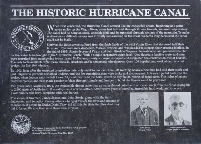
The Historic Hurricane Canal
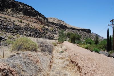
Upriver, the little towns suffered from the flash floods of the wild Virgin River that devoured half their farmland. The men were desperate. More cultivated land was needed to support their growing families. In the fall of 1893, James Jepson of Virgin and John Steele of Toquierville envisioned and promoted the plan for the water to be brought to the “Hurricane Bench.” With a simple carpenter’s spirit level, they figured a feasible route, and men were recruited from neighboring towns. Isaac McFarlane, county surveyor, surveyed and estimated the construction cost at $53,000. The only tools available were picks, shovels, crowbars, and a homemade wheelbarrow. Over 100 hopeful me worked on the canal project the first few winters.
By 1902, long after the expected completion date, only eight to ten men were left working. Many of the men had sold their stock and quit. Expensive portions remained undone, and the few remaining men were broke and discouraged. Life was injected back into the project when Jepson went to Salt Lake City and convinced the LDS Church to buy $5,000 worth of canal stock. The influx of money restored morale; and now, giant powder to blast through tunnels and lumber to build the flumes could be purchased.
Two years later, August 6, 1904, the impossible dream came true as water flowed onto the Hurricane Bench from the canal, giving life to 2,000 acres of fertile land. The valley could now be settled. After twelve years of sacrifice, incredibly hard work, and true grit, a community was born, complete with real heroes.
The vision of two men, James Jepson and John Sttele, along with the faith, dedication, and tenacity of many others, changed forever the lives and dreams of thousands of people in Utah’s Dixie. They did all this for their families. And they did it for us. We give thanks to these men of valor.
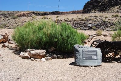
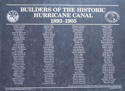
Erected by Sons of Utah Pioneers. (Marker Number 100A.)
Topics and series. This historical marker is listed in these topic lists: Notable Events • Waterways & Vessels. In addition, it is included in the Sons of Utah Pioneers series list. A significant historical year for this entry is 1893.
Location. 37° 10.777′ N, 113° 16.954′ W. Marker is in Hurricane, Utah, in Washington County. Marker is on 200 North, in the median. Touch for map. Marker is at or near this postal address: 284 E 200 North, Hurricane UT 84737, United States of America. Touch for directions.
Other nearby markers. At least 5 other markers are within walking distance of this marker. Pioneer Bowery (a few steps from this marker); Birth of Hurricane (a few steps from this marker); Convict Camp and Wagon Road (a few steps from this marker); The Historic Dixie-Long Valley, Utah Pioneer Trail (approx. 0.3 miles away); a different marker also named The Historic Hurricane Canal (approx. 0.3 miles away). Touch for a list and map of all markers in Hurricane.
Credits. This page was last revised on June 16, 2016. It was originally submitted on June 25, 2007, by Dawn Bowen of Fredericksburg, Virginia. This page has been viewed 1,918 times since then and 12 times this year. Photos: 1, 2, 3, 4. submitted on June 25, 2007, by Dawn Bowen of Fredericksburg, Virginia. • J. J. Prats was the editor who published this page.


