Millwood in Clarke County, Virginia — The American South (Mid-Atlantic)
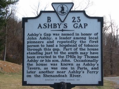
Ashby’s Gap
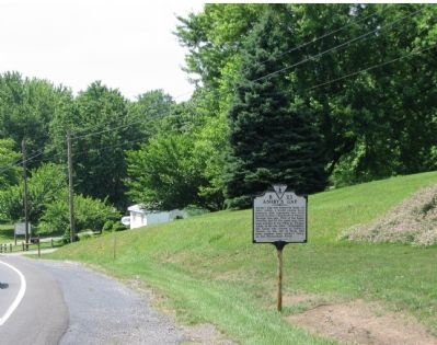
Erected 1997 by Department of Historic Resources. (Marker Number B-23.)
Topics and series. This historical marker is listed in these topic lists: Agriculture • Colonial Era • Industry & Commerce • Settlements & Settlers • Waterways & Vessels. In addition, it is included in the Virginia Department of Historic Resources (DHR) series list.
Location. 39° 1.06′ N, 77° 57.916′ W. Marker is in Millwood, Virginia, in Clarke County. Marker is on John Mosby Highway (U.S. 50), on the right when traveling west. Touch for map. Marker is in this post office area: Millwood VA 22646, United States of America. Touch for directions.
Other nearby markers. At least 8 other markers are within 5 miles of this marker, measured as the crow flies. Clark County / Fauquier County (approx. 0.3 miles away); Jackson’s Bivouac (approx. 1.2 miles away); Mt. Carmel Fight (approx. 1.3 miles away); Mount Bleak Farm (approx. 1.8 miles away); Fight at Berry's Ferry (approx. 2.9 miles away); Vinyard Fight (approx. 3½ miles away); Lee Moves North Again (approx. 4.3 miles away); Battle of Upperville (approx. 4.3 miles away). Touch for a list and map of all markers in Millwood.
Regarding Ashby’s Gap. In addition to the Ashby’s Taverns listed on the marker, there is another tavern which used the same name further south at Manassas Gap.
Also see . . . Picture of the Signal Station marker. (Submitted on June 26, 2007, by Craig Swain of Leesburg, Virginia.)
Additional commentary.
1. Old B-23
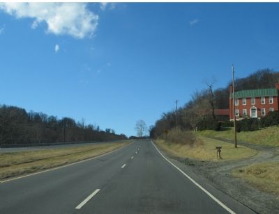
This marker replaces a previous B-23 standing in the near vicinity (before the road was enlarged) with the title “Ashby’s Tavern” and the text, “The old house to the north was Ashby’s Tavern. As early as 1753, Thomas Watts had a license to keep a tavern here. He was succeeded by the Ashbys. In October, 1781, British prisoners from Yorktown rested here on their way to Winchester.”

Photographed By Craig Swain, June 16, 2007
2. Ashby's Gap Marker
The metal post approximately 20 feet further along the road used to support another marker. Signal Station ( B-7), "on the hilltop to the south stood an important signal station used by both armies, 1861-1865. It was the objective of many attacks."
— Submitted July 23, 2007, by Craig Swain of Leesburg, Virginia.
Credits. This page was last revised on December 24, 2019. It was originally submitted on June 26, 2007, by Craig Swain of Leesburg, Virginia. This page has been viewed 3,281 times since then and 173 times this year. Photos: 1, 2, 3. submitted on June 26, 2007, by Craig Swain of Leesburg, Virginia. • J. J. Prats was the editor who published this page.

