Carillon in Richmond, Virginia — The American South (Mid-Atlantic)
Water Water Everywhere
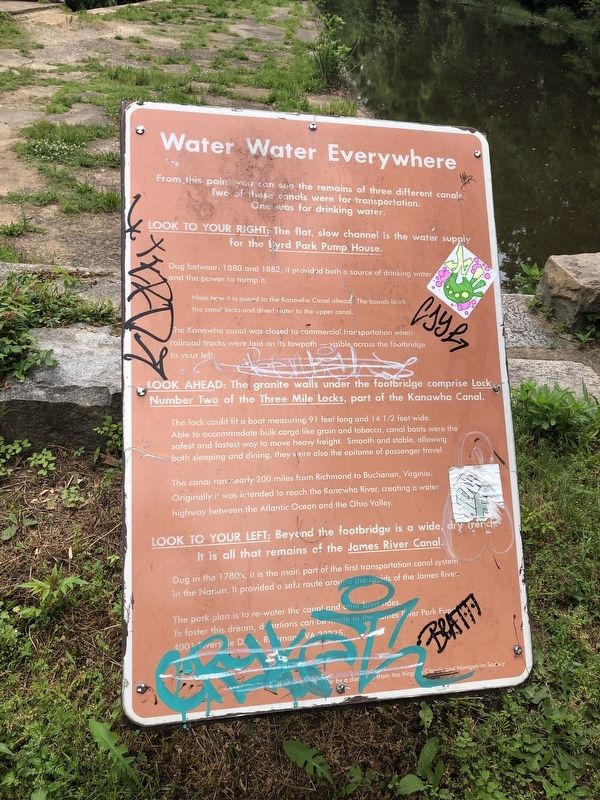
From this point you can see the remains of three different canals. Two of these canals were for transportation. One was for drinking water.
Look to your right: The flat, slow channel is the water supply for the Byrd Park Pump House.
Dug between 1880 and 1882, it provided both a source of drinking water and the power to pump it.
Note how it is joined to the Kanawha Canal ahead. The boards block the canal locks and divert water to the upper canal.
The Kanawha canal was closed to commercial transportation when railroad tracks were laid on its towpath — visible across the footbridge to your left.
Look ahead: The granite walls under the footbridge comprise Lock Number Two of the Three Mile Locks, part of the Kanawha Canal.
The lock could fit a boat measuring 91 feet long and 14 1/2 feet wide. Able to accommodate bulk cargo like grain and tobacco, canal boats were the safest and fastest way to move heavy freight. Smooth and stable, allowing both sleeping and dining, they were also the epitome of passenger travel.
The canal ran nearly 200 miles from Richmond to Buchanan, Virginia. Originally it was intended
this page online
Look to your left: Beyond the footbridge is a wide, dry trench. It is all that remains of the James River Canal.
Dug in the 1780's, it is the main part of the first transportation canal system in the Nation. It provided a safe route around the rapids of the James River.
The park plan is to re-water the canal and other boat rides. To foster this dream, donations can be made to the James Park Fund, 4001 Riverside Drive, Richmond, VA 23225.
Erected by Virginia Canals and Navigation Society.
Topics. This historical marker is listed in these topic lists: Industry & Commerce • Waterways & Vessels. A significant historical year for this entry is 1880.
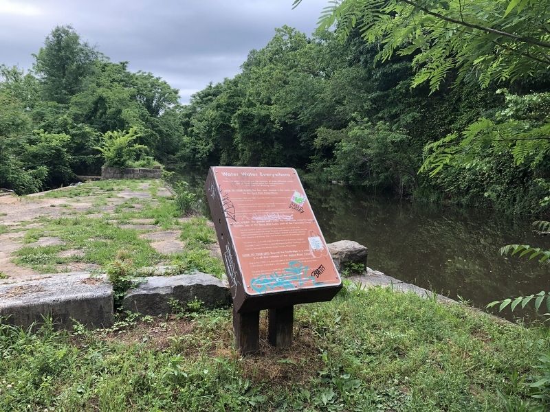
Location. 37° 32.243′ N, 77° 29.31′ W. Marker has been reported damaged. Marker is in Richmond, Virginia. It is in Carillon. It can be reached from Pump House Drive west of Park Drive (Virginia Route 161), on the left when traveling west. Touch for map. Marker is at or near this postal address: 1600 Pump House Drive, Richmond VA 23221, United States of America. Touch for directions.

Regionally,
Other nearby markers. At least 8 other markers are within walking distance of this location: Mule-Fueled Waterway (about 600 feet away, measured in a direct line); Breaking Stones with Feathers (about 700 feet away); Pumps and Parties (about 700 feet away); Richmond at the Falls (about 700 feet away); Byrd Park Pump House (approx. 0.2 miles away); Dooley Creek: Then and Now (approx. 0.4 miles away); River & Canal (approx. half a mile away); The Carillon (approx. half a mile away). Touch for a list and map of all markers in Richmond.
Other markers no longer nearby. Bald Eagles (was approx. 0.4 miles away but has been permanently removed); a different marker also named Bald Eagles (was approx. 0.4 miles away but has been permanently removed).
Credits. This page was last revised on February 1, 2023. It was originally submitted on May 11, 2019, by Devry Becker Jones of Washington, District of Columbia. This page has been viewed 284 times since then and 17 times this year. Photos: 1, 2. submitted on May 11, 2019, by Devry Becker Jones of Washington, District of Columbia.
