Berwyn Heights in Prince George's County, Maryland — The American Northeast (Mid-Atlantic)
Edmonston Road
Historic Berwyn Heights
| — | Town of Berwyn Heights, Maryland | — |
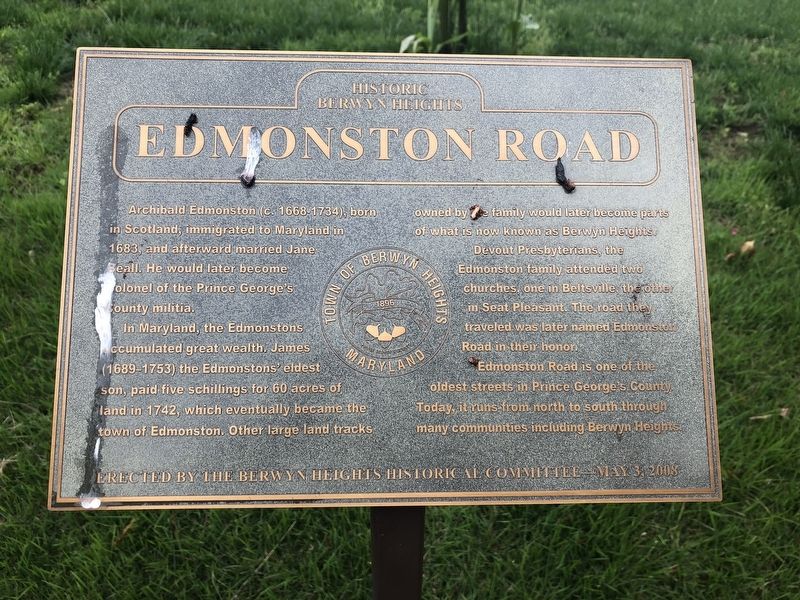
In Maryland, the Edmonstons accumulated great wealth. James (1689-1753) the Edmonston's eldest son, paid five schillings for 60 acres of land in 1742, which eventually became the town of Edmonston. Other large land tracks owned by the family would later become parts of what is now known as Berwyn Heights.
Devout Presbyterians, the Edmonston family attended two churches, one in Beltsville, the other in Seat Pleasant. The road they traveled was later named Edmonston Road in their honor.
Edmonston Road is one of the oldest streets in Prince George's County. Today, it runs from north to south through many communities including Berwyn Heights.
Erected 2008 by The Berwyn Heights Historical Committee.
Topics. This historical marker is listed in these topic lists: Colonial Era • Religion & Religious Structures • Roads & Vehicles • Settlements & Settlers. A significant historical year for this entry is 1683.
Location. 38° 59.491′ N, 76° 54.33′ W.
this page online

Regionally, this marker is in the Washington Metropolitan Area. It is also in the American South, specifically in the Upper South, in the Mid-Atlantic, and on the Eastern Seaboard. Globally, it is in the North Atlantic Region, North America, the Western Hemisphere, the Western World, and the Anglosphere. Historically, it finds itself in what was once one of the original Thirteen Colonies and also the Antebellum South.
Other nearby markers. At least 8 other markers are within walking distance of this marker: Town of Berwyn Heights (about 400 feet away, measured in a direct line); Carrington Avenue (approx. 0.2 miles away); La Belle Avenue (approx. 0.2 miles away); Schools of Berwyn Heights (approx. 0.2 miles away); Charlton Avenue (approx. 0.4 miles away); Duncanson Avenue (approx. 0.4 miles away); Greenbelt Park (approx. half
Credits. This page was last revised on May 18, 2019. It was originally submitted on May 18, 2019, by Devry Becker Jones of Washington, District of Columbia. This page has been viewed 543 times since then and 44 times this year. Photos: 1, 2. submitted on May 18, 2019, by Devry Becker Jones of Washington, District of Columbia.
