Bacalar, Quintana Roo, Mexico — The Yucatan Peninsula (The Southeast)
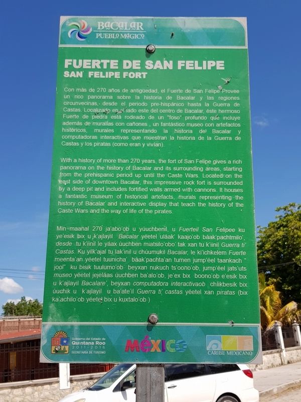
San Felipe Fort
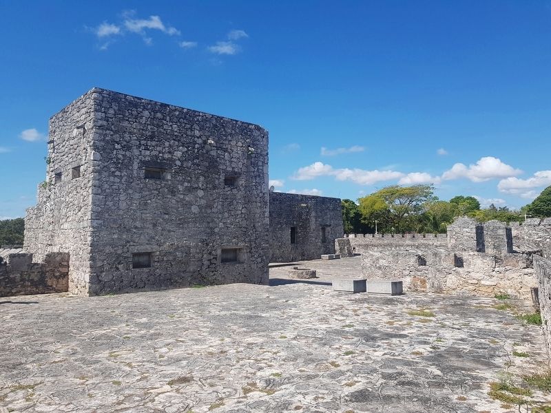
Con más de 270 años de antigüedad, el Fuerte de San Felipe Provee un rico panorama sobre la historia de Bacalar y las regiones circunvecinas, desde el periodo pre-hispánico hasta la Guerra de Castas. Localizo en el lado este del centro de Bacalar, éste hermoso Fuerte de piedra está rodeado de un "foso" profundo que incluye además de murallas con cañones, un fantástico museo con artefactos históricos, murales representando la historia de Bacalar y computadoras interactivas que muestran la historia de la Guerra de Castas y los piratas (como eran y vivían).
San Felipe Fort
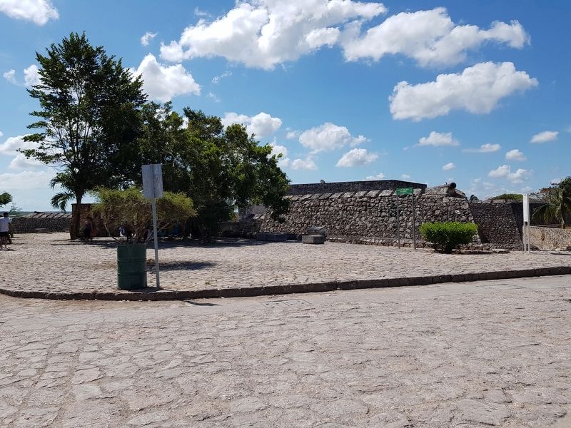
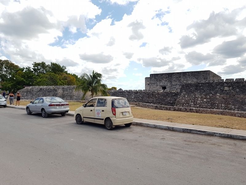
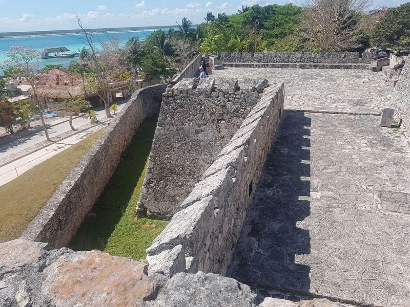
With a history of more than 270 years, the fort of San Felipe gives a rich panorama on the history of Bacalar and its surrounding areas, starting from the prehispanic period up until the Caste Wars. Located on the east side of downtown Bacalar, this impressive rock fort is surrounded by a deep pit and includes fortified walls armed with cannons. It houses a fantastic museum of historical artifacts, murals representing the history of Bacalar and interactive display that teach the history of the Caste Wars and the way of life of the pirates.
Fuerte de San Felipe
Min maanal 270 ja'abo'ob u yúuchbenil, u Fuerteil San Felipee ku ye'esik bix u k'ajlayil Bacalar yéetel uláak kaajo'ob báak pachtmilo desde tu kiinil le yáax úuchben miatsilo'obo tak xan tu k'iinil Guerra ti Castas. Ku yilk'ajal tu lak'inil u chúumukil Bacalar, le kiichkelem Fuerte meenta'an yéetel tuunicha' báak pachta'an tumen jump'éel taankach jool" ku bisik tuulumo'ob beyxan nukuch ts'ooho'ob, jump'éel jats'uts museo yéetel jejeláas úuchben ba'alo'ob, je'ex bix boono'ob e'esik bix u k'ajlayil Bacalare, beyxan computadora interactivaob chlikbesik bix úuchik u k'ajlayil u ba'ate'il Guerra ti castas yéetel xan piratas (bix ka'achilo'ob yéeteł bix u kuxtalo'ob)
Erected by Gobierno del Estado de Quintana Roo 2011-2016.
Topics. This historical marker is listed in these topic lists: Colonial Era • Forts and Castles • Man-Made Features • Wars, Non-US.
Location. 18° 40.65′ N, 88° 23.319′ W. Marker is in Bacalar, Quintana Roo. Marker is on Avenida 3 just north of Calle 22, on the right when traveling north. Touch for map. Marker is in this post office area: Bacalar QR 77930, Mexico. Touch for directions.
Other nearby markers. At least 8 other markers are within walking distance of this marker.
Bacalar as a Municipality (a few steps from this marker); Fort of San Felipe (within shouting distance of this marker); Bridge of the Fort of San Felipe (within shouting distance of this marker); Moat of the Fort of San Felipe (within shouting distance of this marker); Miguel Hidalgo y Costilla (about 120 meters away, measured in a direct line); Creation of the Municipality of Bacalar (about 210 meters away); Church of San Joaquín (approx. 0.3 kilometers away); Bacalar (approx. 0.3 kilometers away). Touch for a list and map of all markers in Bacalar.
Credits. This page was last revised on May 21, 2019. It was originally submitted on May 21, 2019, by J. Makali Bruton of Accra, Ghana. This page has been viewed 139 times since then and 11 times this year. Photos: 1, 2, 3, 4, 5, 6. submitted on May 21, 2019, by J. Makali Bruton of Accra, Ghana.
