Bacalar, Quintana Roo, Mexico — The Yucatan Peninsula (The Southeast)
Bacalar
Inscription.
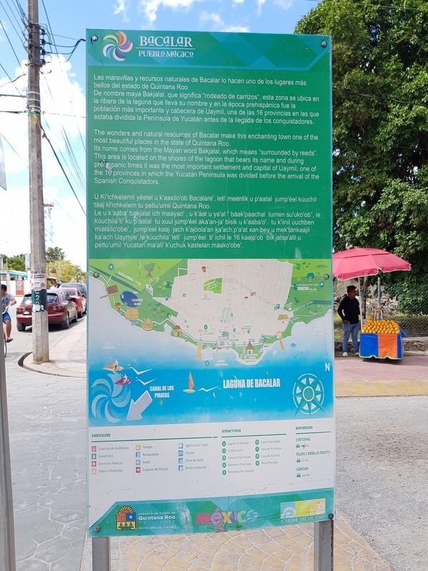
Las maravillas y recursos naturales de Bacalar lo hacen uno de los lugares más bellos del estado de Quintana Roo. De nombre maya Bakjalal, que significa "rodeado de carrizos", esta zona se ubica en la ribera de la laguna que lleva su nombre y en la época prehispánica fue la población más importante y cabecera de Uaymil, una de las 16 provincias en las que estaba dividida la Peninsula de Yucatán antes de la llegada de los conquistadores.
Bacalar
The wonders and natural resources of Bacalar make this enchanting town one of the most beautiful places in the state of Quintana Roo. Its name comes from the Mayan word Bakjalal, which means "surrounded by reeds". This area is located on the shores of the lagoon that bears its name and during prehispanic times it was the most important settlement and capital of Uaymil, one of the 16 provinces in which the Yucatán Peninsula was divided before the arrival of the Spanish Conquistadors.
Bacalar
U Kiichkelemil yéetel u k'aaxilo' ob Bacalare', leti meentik u p'aatal jump'éel kúuchl táaj ki'ichkelem tu petlu'umil Quintana Roo. Le u k'aaba' bakjalal ich maayao', u k'áat u ya'al báak paachal tumen su'uko'ob", le kúuchila ti' ku p'áatal tu xuul jump'éel aka'an-ja' bisik u k'aaba'o. tu k'inil úuchben miatsilo'obe', jumpéel kaaj jach k'ajóola'an ka'ach, p'a'at xan bey u mek'tankaaljil kalach Uaymile', le kúuchila' leti' jump'éel ti' ichil le 16 kaajo'ob bix jatsa'alil u petlu'umil Yucatan ma'ali' k'uchuk kastelan máako'obe.
Erected by Gobierno del Estado de Quintana Roo 2011-2016.
Topics. This historical marker is listed in these topic lists: Colonial Era • Native Americans • Wars, Non-US.
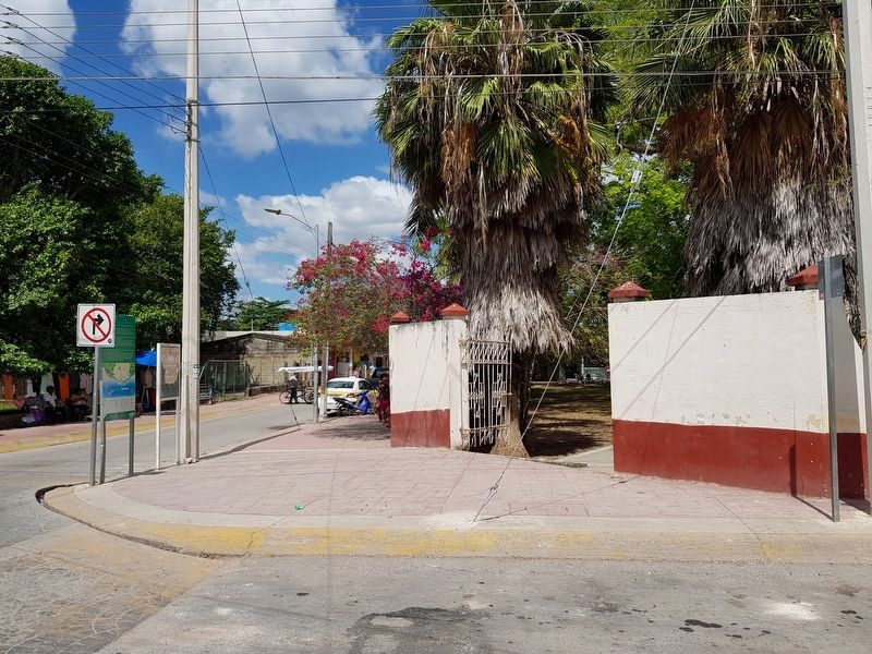
Location. 18° 40.705′ N, 88° 23.479′ W. Marker is in Bacalar, Quintana Roo. Marker is at the intersection of Calle 22 and Calle 7, on the right when traveling west on Calle 22. Touch for map. Marker is in this post office area: Bacalar QR 77930, Mexico. Touch for directions.
Other nearby markers. At least 8 other markers are within walking distance of this marker. Church of San Joaquín (a few steps from this marker); Ichkabal Bacalar (about 90 meters away, measured in a direct line); Miguel Hidalgo y Costilla (about 180 meters away); Creation of the Municipality of Bacalar (about 180 meters away); Bacalar in the XVI Century (about 210 meters away); Bacalar During the XVth Century
(approx. 0.3 kilometers away); San Felipe Fort (approx. 0.3 kilometers away); Bacalar as a Municipality (approx. 0.3 kilometers away). Touch for a list and map of all markers in Bacalar.
Credits. This page was last revised on May 21, 2019. It was originally submitted on May 21, 2019, by J. Makali Bruton of Accra, Ghana. This page has been viewed 138 times since then and 8 times this year. Photos: 1, 2. submitted on May 21, 2019, by J. Makali Bruton of Accra, Ghana.

