Fort Edward in Washington County, New York — The American Northeast (Mid-Atlantic)
The Hudson River at Fort Edward, NY
The Colonial and Revolutionary Periods
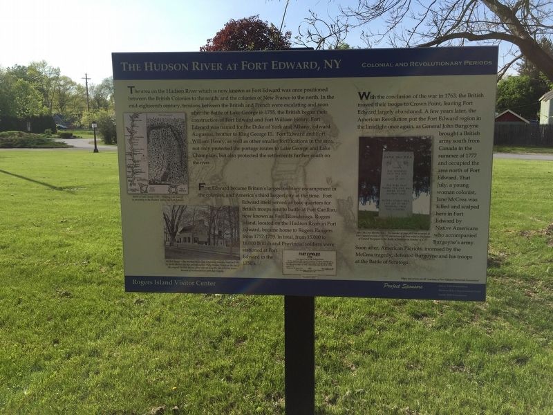
The area on the Hudson River which is now known as Fort Edward was once positioned between the British Colonies to the south, and the colonies of New France to the north. In the mid-eighteenth century, tensions between the British and French were escalating and soon after the battle of Lake George in 1755, the British began their construction of Fort Edward and Fort William Henry. Fort Edward was named for the Duke of York and Albany, Edward Augustus, brother to King George III. Fort Edward and Fort William Henry, as well as smaller fortifications in the area, not only protected the portage routes to Lake George and Lake Champlain, but also protected the settlements further south on the river.
Fort Edward became Britain’s largest military encampment in the colonies, and America’s third largest city at the time. Fort Edward itself served as base quarters for British troops sent to battle at Fort Carillon, now known as Fort Ticonderoga. Rogers Island, located on the Hudson River in Fort Edward, became home to Rogers’ Rangers from 1757-1759. In total, from 15,000 to 16,000 British and Provincial soldiers were stationed at Fort Edward in the 1750’s.
With the conclusion of the war in 1763, the British moved their troops to Crown Point, leaving Fort Edward largely abandoned. A few years later, the American Revolution put the Fort Edward region in the limelight again, as General John Burgoyne brought a British south from Canada in the summer of 1777 and occupied the area north of Fort Edward. That July, a young woman colonist, Jane McCrea was killed and scalped here in Fort Edward by Native Americans who accompanied Burgoyne’s army. Soon after, American Patriots, incensed by the McCrea tragedy, defeated Burgoyne and his troops at the Battle of Saratoga.
Topics. This historical marker is listed in these topic lists: Settlements & Settlers • War, French and Indian • War, US Revolutionary • Waterways & Vessels. A significant historical year for this entry is 1755.
Location. 43° 15.905′ N, 73° 35.242′ W. Marker is in Fort Edward, New York, in Washington County. Touch for map. Marker is in this post office area: Fort Edward NY 12828, United States of America. Touch for directions.
Other nearby markers. At least 8 other markers are within walking distance of this marker. A different marker also named The Hudson River at Fort Edward, NY (a few steps from this marker); a different marker also named The Hudson River at Fort Edward, NY (within shouting distance of this marker); a different marker also named The Hudson River at Fort Edward (within shouting distance of this marker); Jane McCrea (within shouting distance of this marker); Rogers Island - Fort Edward, NY (within shouting distance of this marker); a different marker also named The Hudson River at Fort Edward (within shouting distance of this marker); a different marker also named Rogers Island - Fort Edward, NY (within shouting distance of this marker); Fort Edward War Memorial (about 300 feet away, measured in a direct line). Touch for a list and map of all markers in Fort Edward.
Credits. This page was last revised on June 5, 2019. It was originally submitted on May 31, 2019, by Steve Stoessel of Niskayuna, New York. This page has been viewed 262 times since then and 31 times this year. Photo 1. submitted on May 31, 2019, by Steve Stoessel of Niskayuna, New York. • Bill Pfingsten was the editor who published this page.
