Seacliff SS Palo Alto 100 years
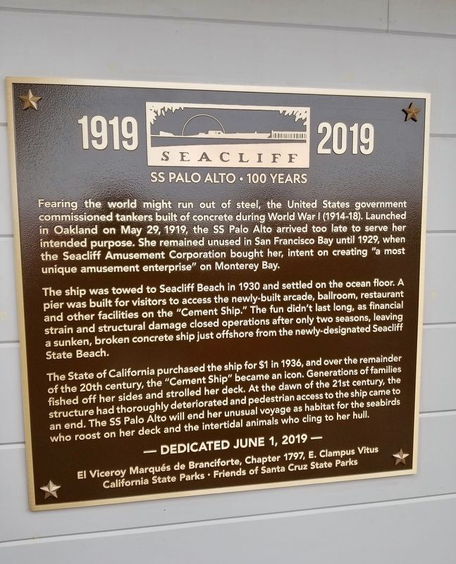
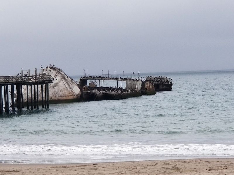
The ship was towed to Seacliff Beach in 1930 and settled on the ocean floor. A pier was built for visitors to access the newly-built arcade, ballroom, restaurant and other facilities on the "Concrete Ship." The fun didn't last long, as financial strain and structural damage closed operations after only two seasons. Leaving a sunken, broken concrete ship just offshore from the newly-designated Seacliff State Beach.
The State of California purchased the ship for a $1 in 1936 and over the remainder of the 20th century, the "Cement Ship" became an icon. Generations of families fished off her sides and strolled her deck. At the dawn of the 21st century, the structure had thoroughly deteriorated and pedestrian access
this page online
Dedicated June 1, 2019
El Viceroy Marqués de Branciforte, Chapter 1797, E. Clampus Vitus
California State Parks, Friends of Santa Cruz State Parks
Erected 2019 by E Clampus Vitus El Viceroy Marqués de Branciforte Chapter 1797 , California State Parks, Friends of Santa Cruz State Parks.
Topics and series. This historical marker is listed in these topic lists: Parks & Recreational Areas • War, World I • Waterways & Vessels. In addition, it is included in the E Clampus Vitus series list. A significant day of the year for for this entry is May 31.
Location. 36° 58.349′ N, 121° 54.821′ W. Marker is in Aptos, California, in Santa Cruz County. It is on State Park Drive, on the left when traveling south. Marker is on the wall left of the main entrance of the Seacliff Visitor Center and Park Store. Touch for map. Marker is at or near this postal address: State Park Drive, Aptos CA 95003, United States of America. Touch for directions.
Regionally, this marker
Other nearby markers. At least 8 other markers are within 2 miles of this marker, measured as the crow flies: S.S. Palo Alto (here, next to this marker); Aptos Grocery & Post Office (approx. ¾ mile away); Hotel Bayview (approx. 0.8 miles away); China Beach (approx. 1.4 miles away); Capitola’s Natural Riches (approx. 2 miles away); Camp Capitola Superintendent’s Office (approx. 2 miles away); First Capitola City Hall (approx. 2 miles away); Historic Lawn Way Cottages (approx. 2.1 miles away). Touch for a list and map of all markers in Aptos.
Credits. This page was last revised on June 3, 2019. It was originally submitted on June 2, 2019, by Frank Gunshow Sanchez of Hollister, California. This page has been viewed 604 times since then and 33 times this year. Photos: 1. submitted on June 3, 2019, by Frank Gunshow Sanchez of Hollister, California. 2. submitted on June 2, 2019, by Frank Gunshow Sanchez of Hollister, California. • Andrew Ruppenstein was the editor who published this page.
