Greenville in Greenville County, South Carolina — The American South (South Atlantic)
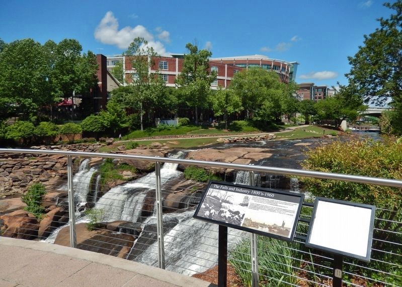
The Falls and Industry 1800’s – 1960
Reedy River, with its Falls and Gorge, constitutes the most distinctive feature in the topography and landscape of Greenville. It is without a doubt the most important single feature to be considered in the development and beautifying of the city.
Kelsey & Guild, Boston Landscape Architects,
Beautifying and Improving South Carolina, 1907
For most of Greenville's history, Reedy River Falls has served as the centerpiece of downtown. Throughout the 19th and early 20th centuries the falls, with their accessibility and beauty, were a favorite gathering space and source of community pride. Over time however, industrialization along the river polluted the waters and the city turned its back on the historic and once-popular area.
Topics. This historical marker is listed in these topic lists: Environment • Industry & Commerce • Parks & Recreational Areas • Waterways & Vessels.
Location. 34° 50.687′ N, 82° 24.038′ W. Marker is in Greenville, South Carolina, in Greenville County. Marker can be reached from Falls Street south of Murphy Street, on the right when traveling south. Marker is located in Falls Park, along the east approach to Liberty Bridge, overlooking the Reedy River Falls. Touch for map. Marker is in this post office area: Greenville SC 29601, United States of America. Touch for directions.
Other nearby markers. At least 8 other markers are within walking distance of this marker. The Falls Forgotten 1960 - 2002 (here, next to this marker); Falls Reclaimed and the Liberty Bridge 2004 (a few steps from this marker); Camperdown Mill (a few steps from this marker); Richard Pearis (a few steps from this marker); Cradle of Greenville (a few steps from this marker); Liberty Bridge (within shouting distance of this marker); The Reedy River (within shouting distance of this marker); Paul Ellis, III Overlook (within shouting distance of this marker). Touch for a list and map of all markers in Greenville.
Also see . . . Reedy River’s Mill History. The area that is now Falls Park was once part of a thriving mill community. Several factories set up along the river, processing textiles, paper, wood, iron, corn, and more. While textile mills were foundational to Greenville’s economy, in the mid-20th century an unfortunate side effect was the pollution of the Reedy River. The water was filled with chemicals—including dyes that discolored the water. And as the textile industry failed, abandoned and derelict mill buildings surrounded the river. (Submitted on June 16, 2019, by Cosmos Mariner of Cape Canaveral, Florida.)
Credits. This page was last revised on June 16, 2019. It was originally submitted on June 11, 2019, by Cosmos Mariner of Cape Canaveral, Florida. This page has been viewed 245 times since then and 26 times this year. Photos: 1, 2. submitted on June 16, 2019, by Cosmos Mariner of Cape Canaveral, Florida.

