Roseau, Saint George Parish, Dominica — Caribbean Region of the Americas (Lesser Antilles of the West Indies)
Methodist Church
Explore Roseau
Photographed by J. Makali Bruton, June 9, 2019
1. Methodist Church Marker
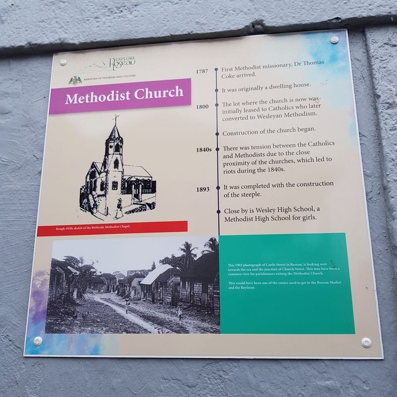
Methodist Church
1787 • First Methodist missionary, Dr. Thomas Coke arrived.
It was originally a dwelling house.
1800 • The lot where the church is now was initially leased to Catholics who later converted to Wesleyan Methodism.
Construction of the church began.
1840s • There was tension between the Catholics and Methodists due to the close proximity of the churches, which led to riots during the 1840s.
1893 • It was completed with the construction of the steeple.
Close by is Wesley High School, a Methodist High School for girls.
Captions
Rough 1920s sketch of the Bethesda Methodist Chapel.
This 1902 photograph of Castle Street in Roseau, is looking west towards the sea and the junction of Church Street. This may have been a common view for parishioners exiting the Methodist Church.
This would have been one of the routes used to get to the Roseau Market and the Bayfront.
Erected by Ministry of Tourism and Culture.
Topics. This historical marker is listed in these topic lists: Colonial Era • Man-Made Features • Religion & Religious Structures. A significant historical year for this entry is 1787.
Location. 15° 17.846′ N,
this page online

Regionally, it is one of the Lesser Antilles on the Caribbean Sea, on in the Atlantic Ocean, in North America, in the Western Hemisphere, and in the Anglosphere. Historically, it finds itself in what was once a British colony.
Other nearby markers. At least 8 other markers are within walking distance of this marker: Roseau Cathedral (within shouting distance of this marker); World Wars Memorial (about 150 meters away, measured in a direct line); Glory to the French from Dominica (about 150 meters away); Neg Mawon Emancipation Monument (about 150 meters away); Anglican Church (about 150 meters away); Old Prison (about 150 meters away); Old Market Square (about 180 meters away); Roseau Bayfront (about 210 meters away). Touch for a list and map of all markers in Roseau.
Photographed by J. Makali Bruton, June 9, 2019
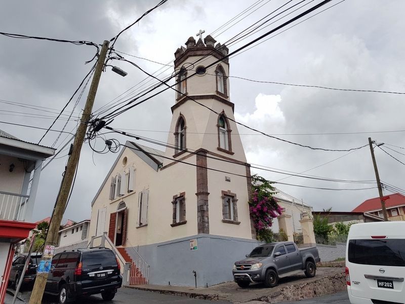
2. Methodist Church and Marker
Note the marker on the left of the near corner.
Photographed by J. Makali Bruton, June 9, 2019
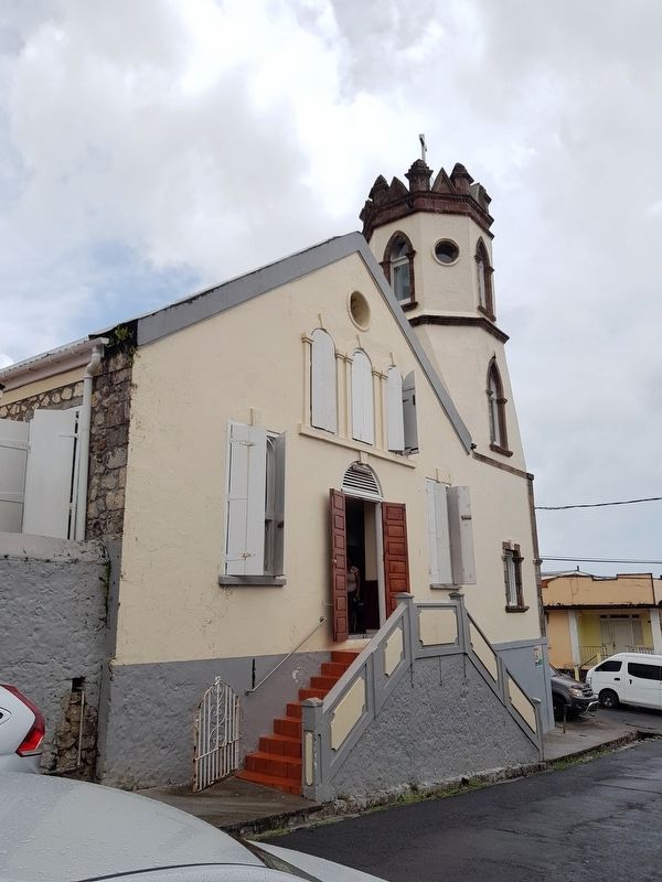
3. Methodist Church and Marker
The marker is far to the right in this view.
Photographed by J. Makali Bruton, August 1, 2013
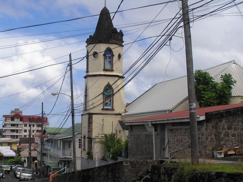
4. Roseau's Methodist Church, prior to Hurricane Maria
Note the tower's previous steeple.
Credits. This page was last revised on March 1, 2026. It was originally submitted on June 15, 2019, by J. Makali Bruton of Washington, District of Columbia. This page has been viewed 429 times since then and 37 times this year. Photos: 1, 2, 3. submitted on June 15, 2019, by J. Makali Bruton of Washington, District of Columbia. 4. submitted on June 18, 2019, by J. Makali Bruton of Washington, District of Columbia.
