Bowery in Manhattan in New York County, New York — The American Northeast (Mid-Atlantic)
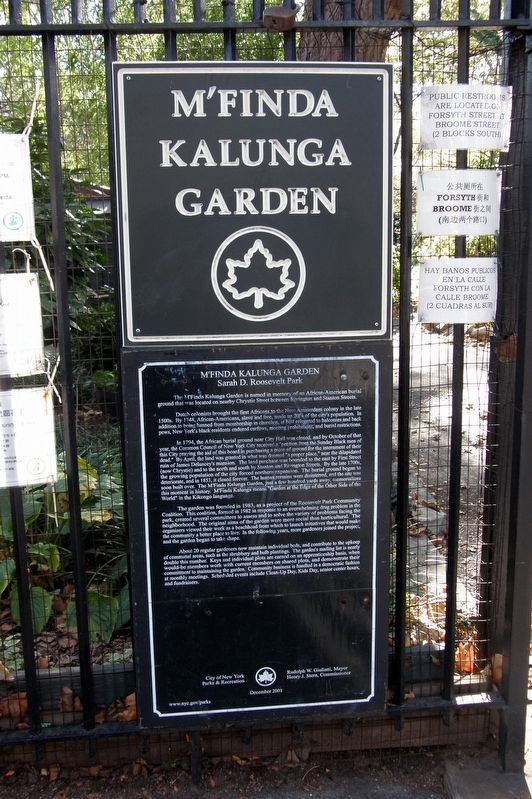
M’Finda Kalunga Garden
Sarah D. Roosevelt Park
The M’Finda Kalunga Garden is named in memory of an African-American burial ground that was located on nearby Chrystie Street between Rivington and Stanton Streets.
Dutch colonists brought the first enslaved Africans to the New Amsterdam colony in the late 1500s. By 1748, African-Americans, slave and free, made up 20% of the city’s population. In addition to being banned from membership in churches, at best relegated to balconies and back pews, New York’s black residents endured curfews, meeting prohibitions, and burial restrictions.
In 1794, the African Burial ground near City Hall was closed, and by October of that year, the Common Council of New York City received “a petition from the Sunday Black men of the city praying the aid of this board in purchasing a piece of ground for the interment of their dead.” By April, the land was granted in what was deemed “a proper place,” near the dilapidated ruin of James Delancey’s mansion. The land purchase was bounded to the east by First Street (now Chrystie) and to the north and south by Stanton and Rivington Streets. By the late 1700s, the growing population of the city forced northern expansion. The burial ground began to deteriorate, and by 1853, it closed forever. The human remains were disinterred, and the site was soon built over. The M’Finda Kalunga Garden, just a few hundred feet away, memorializes this moment in history. M’Finda Kalunga means “Garden at the Edge of the Other Side of the World” in the Kikongo language.
The garden was founded in 1983, as a project of the Roosevelt Park Community Coalition. The coalition was formed in 1982 in response to an overwhelming drug problem in the park, created several committees to assess and solve the variety of problems facing the neighborhood. The original aims of the garden were more social than horticultural. The organizers viewed their work as a beachhead from which to launch initiatives that would make the community a better place to live. In the following years, more gardeners joined the project, and the garden began to take shape.
About 20 regular gardeners now maintain individual beds and contribute to the upkeep of communal areas, such as the shrubbery and bulb plantings. The garden’s mailing list is nearly double this number. Keys and individual plots are earned on an apprenticeship basis, when would-be members work with current members on shared plots and demonstrate their commitment to maintaining the garden. Community business is handled in a democratic fashion at monthly meetings. Scheduled events include Clean-up Day, Kids Day, senior center hours, and fundraisers.
Erected 2001 by New York City Parks and Recreation (NYC Parks).
Topics and series. This historical marker is listed in these topic lists: African Americans • Colonial Era • Parks & Recreational Areas • Settlements & Settlers. In addition, it is included in the NYC Parks series list. A significant historical year for this entry is 1500.
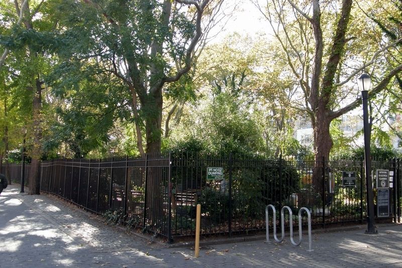
Location. This marker has been replaced by another marker nearby. It was located near 40° 43.264′ N, 73° 59.497′ W. Marker was in Manhattan, New York, in New York County. It was in the Bowery. Marker was at the intersection of Forsyth Street and Rivington Street, in the median on Forsyth Street. Touch for map. Marker was at or near this postal address: Sarah Delano Roosevelt Park, New York NY 10002, United States of America. Touch for directions.
Other nearby markers. At least 8 other markers are within walking distance of this location. M'Finda Kalunga Community Garden (a few steps from this marker); a different marker also named M'Finda Kalunga Garden (a few steps from this marker); University Settlement House (about 300 feet away, measured in a direct line); Longest-Running Catalogue In America (about 500 feet away); “Big Tim” Sullivan’s Clubhouse (about 500 feet away); Italian Renaissance Palazzo On Bowery (about 500 feet away); A Bowery Flop (about 500 feet away); Yiddish Theatre’s 1st American Home (about 500 feet away). Touch for a list and map of all markers in Manhattan.
Related marker. Click here for another marker that is related to this marker. This marker has been replaced with the linked marker.
Also see . . . Sara D. Roosevelt Park Highlights. Official NYC Parks description, including the M’Finda Kalunga Garden. (Submitted on April 11, 2020, by Larry Gertner of New York, New York.)
Credits. This page was last revised on February 19, 2024. It was originally submitted on June 17, 2019, by Larry Gertner of New York, New York. This page has been viewed 277 times since then and 19 times this year. Photos: 1, 2. submitted on June 17, 2019, by Larry Gertner of New York, New York. • Bill Pfingsten was the editor who published this page.

