Franklin in Williamson County, Tennessee — The American South (East South Central)
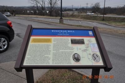
Winstead Hill
Fateful Decision
— Hood's Campaign —
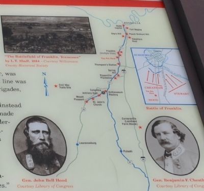
(Preface): In September 1864, after Union Gen. William T. Sherman defeated Confederate Gen. John Bell Hood at Atlanta, Hood led the Army of Tennessee northwest against Sherman's supply lines. Rather than contest Sherman's "March to the Sea," Hood moved north into Tennessee. Gen. John M. Schofield, detached from Sherman's army, delayed Hood at Columbia and Spring Hill before falling back to Franklin. The bloodbath here on November 30 crippled the Confederates, but they followed Schofield to the outskirts of Nashville and Union Gen. George H. Thomas's strong defenses. Hood's campaign ended when Thomas crushed his army on December 15-16.
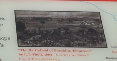
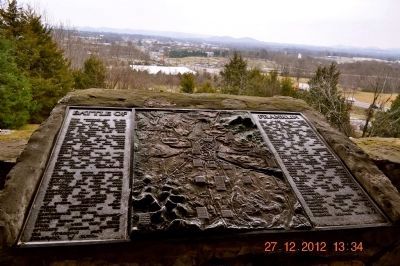
On November 30, 1864, in the waning light of a beautiful Indian summer afternoon, Confederate Gen. John Bell Hood stood here and studied Union Gen. John M. Schofield's strong defensive position two miles in front of you. The night before, Schofield's troops had slipped past Hood's army near Spring Hill. Hood decided that he had one final chance here at Franklin to destroy the Federal army before it escaped to Nashville, and he ordered a massive frontal assault. Gen. Benjamin F. "Frank" Cheatham, Patrick R. Cleburne, and Nathan Bedford Forrest - Hood's subordinates - advised against it, with Forrest advocating a flank attack. Hood countered that the 5,000-man-strong Federal cavalry could impede any flanking movement to the east.
Concerned that daylight was running out and fearing another Federal escape, Hood ordered his general to drive the enemy "in to the river at all hazards." Almost 19,000 Confederate troops formed into line of battle. Cheatham's Corps extended along both sides of Columbia Pike east and west of here. Farther east, nearly to the Harpeth River, was Gen. A.P. Stewart's Corps. The Southern line was two miles long with 100 regiments, 18 brigades, and 6 divisions. At 4 P.M., a signal flag here on Winstead Hill launched the single largest attack made during the American Civil War. The Federal soldiers never forgot the sheer spectacle of the Confederates sweeping across the fields before you with their bands playing "Dixie" and "The Bonnie Blue Flag." One Union observer later wrote that "we were spellbound with admiration, although they were our hated foes."
Erected by Tennessee Civil War Trails.
Topics and series. This historical marker is listed in this topic list: War, US Civil. In addition, it is included in the Tennessee Civil War Trails series list. A significant historical month for this entry is September 1864.
Location. 35° 53.342′ N, 86° 52.668′ W. Marker is in Franklin, Tennessee, in Williamson County. Marker is on Columbia Pike (
U.S. 31), on the right when traveling south. Located in Winstead Hill Park. Touch for map. Marker is in this post office area: Franklin TN 37064, United States of America. Touch for directions.
Other nearby markers. At least 8 other markers are within walking distance of this marker. To The Soldiers Of Florida (within shouting distance of this marker); Tennessee, A Grave or a Free Home (within shouting distance of this marker); Mississippi (within shouting distance of this marker); Hood and Schofield (within shouting distance of this marker); 3" Ordnance Gun (within shouting distance of this marker); Freeman's Battery, Forrest's Artillery (within shouting distance of this marker); Our Ancestors (within shouting distance of this marker); Brigadier's Walk (within shouting distance of this marker). Touch for a list and map of all markers in Franklin.
Credits. This page was last revised on July 11, 2019. It was originally submitted on January 3, 2013, by Sandra Hughes Tidwell of Killen, Alabama, USA. This page has been viewed 837 times since then and 17 times this year. Last updated on June 26, 2019, by Larry Gertner of New York, New York. Photos: 1, 2, 3, 4, 5, 6. submitted on January 3, 2013, by Sandra Hughes Tidwell of Killen, Alabama, USA. 7. submitted on June 28, 2019, by Larry Gertner of New York, New York. • Bernard Fisher was the editor who published this page.
