Caesarea, Haifa District, Israel — West Asia (the Levant in the Middle East)
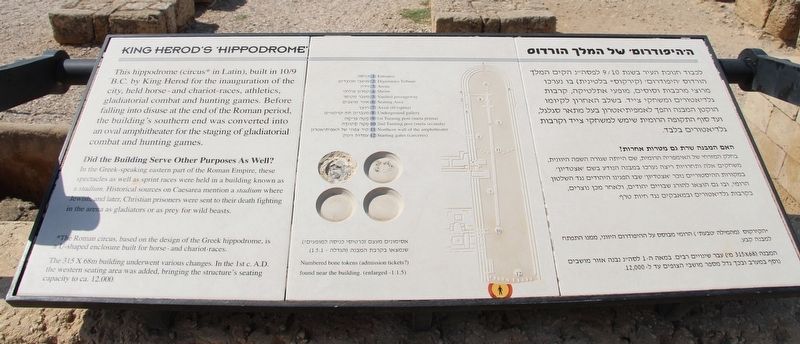
King Herod's 'Hippodrome'
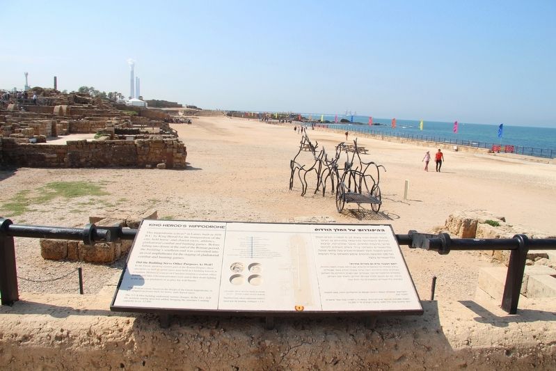
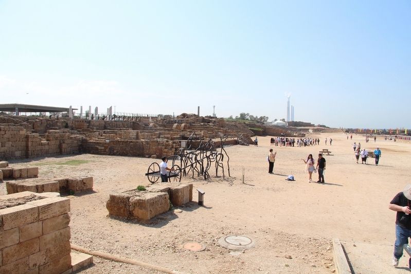
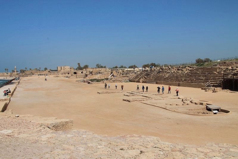
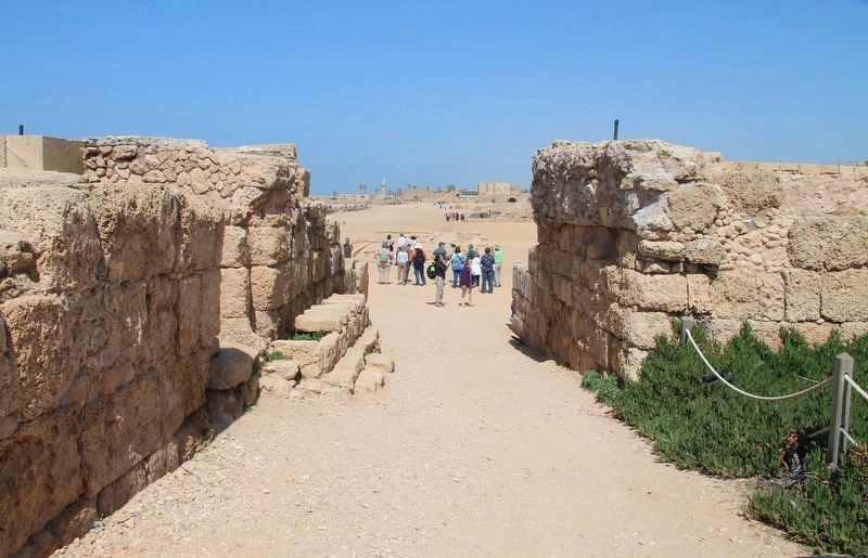
This hippodrome (circus* in Latin), built in 10/9 B.C. by King Herod for the inauguration of the city, held horse - and chariot - races, athletics, gladiatorial combat and hunting games. Before falling into disuse at the end of the Roman period, the building's southern end was converted into an oval amphitheater for the staging of gladiatorial combat and hunting games.
Did the Building Serve Other Purposes as Well?
In the Greek-speaking eastern part of the Roman Empire, these spectacles as well as sprint races were held in a building known as a stadium. Historical sources on Caesarea mention a stadium where Jewish, and later, Christian prisoners were sent to their death fighting in the arena as gladiators or as prey for wild beasts.
*The Roman circus, based on the design of the Greek hippodrome, is a U-shaped enclosure built for horse - and chariot - races.
The 315 X 68 meter building underwent various changes. In the 1st century A.D. the western seating area was added, bringing the structure's seating capacity to approximately 12,000.
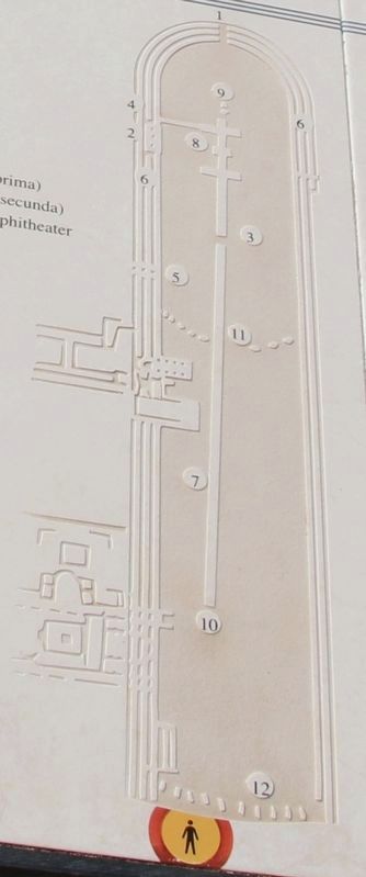
Caption explaining designated points on the Hippodrome illustration:
1. Entrance
2. Dignitaries Tribune
3. Arena
4. Shrine
5. Vaulted passageway
6. Seating Area
7. Axial rib (spina)
8. Underground gallery
9. 1st Turning post (meta prima)
10. 2nd Turning Post (meta secunda)
11. Northern Wall of the amphitheater
12. Starting gates (carceres)
Caption explaining replicas displayed on the marker:
Numbered bone tokens (admission tickets?) found near the building. (enlarged - 1:1.5)
Topics. This historical marker is listed in these topic lists: Anthropology & Archaeology • Entertainment • Parks & Recreational Areas.
Location. 32° 29.993′ N, 34° 53.463′ E. Marker is in Caesarea, Haifa District. Marker can be reached from Kvish HaTe'atron just west of Rothschild, on the right when traveling west. This historical marker is located in the Caesarea Maritima National Park, very near to the western end of Kvish HaTe'atron Street. The marker is situated at the northern end of the Hippodrome ruins. Touch for map. Touch for directions.
Other nearby markers. At least 8 other markers are within walking distance of this marker. The Chariot-Races (here, next to this marker); Tavern (a few steps from this marker); The Palace Vaults (a few steps from this marker); The Governor's Palace Baths (within shouting distance of this marker); The Bathhouse (about 90 meters away, measured in a direct line); Inscribed Sarcophagus adorned with Garlands (about 150 meters
away); Sarcophagus Lid (about 180 meters away); The Amphitheater (about 180 meters away). Touch for a list and map of all markers in Caesarea.
Also see . . .
1. Caesarea Maritima. This is a link to information, regarding Caesarea Maritima, provided by Wikipedia, the free encyclopedia. (Submitted on July 1, 2019, by Dale K. Benington of Toledo, Ohio.)
2. Caesarea Hippodrome - 360 Holy places. This is a link to information, regarding Caesarea Maritima, provided by the Holy Places website. (Submitted on July 1, 2019, by Dale K. Benington of Toledo, Ohio.)
3. Caesarea Maritime. Bible Walks website entry (Submitted on April 30, 2023, by Larry Gertner of New York, New York.)
Credits. This page was last revised on April 30, 2023. It was originally submitted on June 30, 2019, by Dale K. Benington of Toledo, Ohio. This page has been viewed 901 times since then and 172 times this year. Photos: 1, 2, 3, 4, 5, 6. submitted on July 1, 2019, by Dale K. Benington of Toledo, Ohio.
