Safety Harbor in Pinellas County, Florida — The American South (South Atlantic)
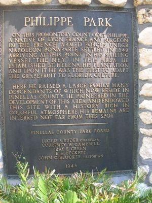
Philippe Park
Erected 1948 by Pinellas County Park Board.
Topics. This historical marker is listed in these topic lists: Agriculture • Cemeteries & Burial Sites • Horticulture & Forestry • Science & Medicine • Settlements & Settlers. A significant historical year for this entry is 1842.
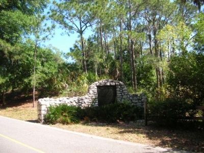
Location. 28° 0.446′ N, 82° 40.686′ W. Marker is in Safety Harbor, Florida, in Pinellas County. Marker is on N. Bayshore Drive, on the right when traveling south. Touch for map. Marker is in this post office area: Safety Harbor FL 34695, United States of America. Touch for directions.
Other nearby markers. At least 8 other markers are within 2 miles of this marker, measured as the crow flies. Odet Philippe (within shouting distance of this marker); Safety Harbor Site (about 500 feet away, measured in a direct line); Tocobaga Temple Mound (about 500 feet away); Bahia Espiritu Santo Mission (approx. 0.2 miles away); Espiritu Santo Church (approx. half a mile away); Safety Harbor Historical Site: Tucker Mansion (approx. 1.1 miles away); Safety Harbor Historical Event: Peace Treaty Between the Tocobaga and the Calusa (approx. 1.2 miles away); Safety Harbor Historical Site: Safety Harbor School (approx. 1.2 miles away). Touch for a list and map of all markers in Safety Harbor.
Also see . . . Philippe Park. (Submitted on November 18, 2008, by Bill Pfingsten of Bel Air, Maryland.)
Additional commentary.
1. Marker Offers Inaccurate "History"
According to a biography* by his descendant, Allison DeFoor, "Count" Odet Philippe was neither a count, nor a native of Lyon, France, nor a surgeon in Napoleon's forces. He was born on Saint-Domingue — a French colony in the western portion of the Caribbean island of Hispaniola, in the area of modern-day Haiti. He was the mixed-race son of a French officer and local woman, and himself, a slaver. The nearby "grave" with marker is empty; he lies in an unmarked grave. See: Odet Philippe: The story behind the namesake of Philippe Park in Safety Harbor
* "Odet Philippe: Pennisular Pioneer" by J. Allison DeFoor II, 1997 (ISBN 0-965395-0-2)
— Submitted April 22, 2024, by Lou Claudio of Safety Harbor, Florida.
Additional keywords. Indian mound
Credits. This page was last revised on April 24, 2024. It was originally submitted on November 17, 2008, by Julie Szabo of Oldsmar, Florida. This page has been viewed 1,867 times since then and 33 times this year. Photos: 1, 2. submitted on November 17, 2008, by Julie Szabo of Oldsmar, Florida. 3. submitted on August 30, 2011, by Glenn Sheffield of Tampa, Florida. • Bill Pfingsten was the editor who published this page.


