Mill Springs in Wayne County, Kentucky — The American South (East South Central)
Mill Springs and the Civil War
Mill Springs Battlefield
— National Historic Landmark —
An Oasis for Zollicoffer's Army
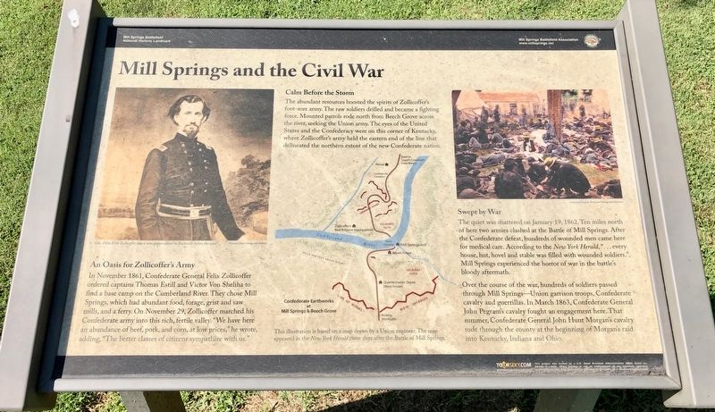
In November 1861, Confederate General Felix Zollicoffer ordered captains Thomas Estill and Victor Von Sheliha to find a base camp on the Cumberland River. They chose Mill Springs, which had abundant food, forage, grist and saw mills, and a ferry. On November 29, Zollicoffer marched his Confederate army into this rich, fertile valley. "We have here an abundance of beef, pork, and corn, at low prices, he wrote, adding, The better classes of citizens sympathize with us."
Calm Before the Storm
The abundant resources boosted the spirits of Zollicoffer's foot-sore army. The raw soldiers drilled and became a fighting force. Mounted patrols rode north from Beech Grove across the river, seeking the Union army. The eyes of the United States and the Confederacy were on this corner of Kentucky, where Zollicoffer's army held the eastern end of the line that delineated the northern extent of the new Confederate nation.
Swept by War
The quiet was shattered on January 19, 1862. Ten miles north of here two armies clashed at the Battle of Mill Springs. After the Confederate defeat, hundreds of wounded men came here for medical care. According to the New York Herald, ". . . every house, hut, hovel and stable was filled with wounded soldiers." Mill Springs experienced the horror of war in the battle's bloody aftermath.
Over the course of the war, hundreds of soldiers passed through Mill Springs—Union garrison troops, Confederate cavalry and guerrillas. In March 1863, Confederate General John Pegram's cavalry fought an engagement here. That summer, Confederate General John Hunt Morgan's cavalry rode through the county at the beginning of Morgan's raid into Kentucky, Indiana and Ohio.
Photo captions:Top left: Gen. Felix Kirk Zollicoffer was a newspaper editor in Nashville before the war.
Middle map: This illustration is based on a map drawn by a Union engineer. The map appeared in the New York Herald three days after the Battle of Mill Springs.
Erected 2014 by Mill Springs Battlefield Association.
Topics and series. This historical marker is listed in these topic lists: Landmarks • War, US Civil • Waterways & Vessels. In addition, it is included in the National Historic Landmarks series list. A significant historical date for this entry is January 19, 1862.
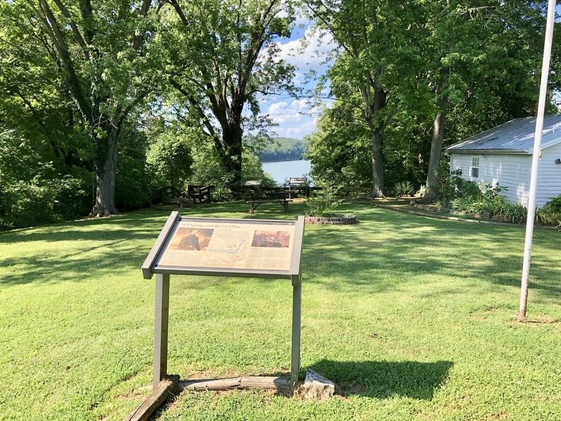
Location. 36° 55.98′ N, 84° 46.749′ W. Marker is in Mill Springs, Kentucky, in Wayne County. Marker is at the intersection of Kentucky Route 1275 and Mill Springs Battlefield Road, on the right when traveling west on State Route 1275
. Touch for map. Marker is at or near this postal address: 9155 KY-1275, Monticello KY 42633, United States of America. Touch for directions.
Other nearby markers. At least 8 other markers are within 2 miles of this marker, measured as the crow flies. The Battle of Mill Springs (a few steps from this marker); The Cumberland River (within shouting distance of this marker); Home, Headquarters, Hospital (within shouting distance of this marker); Mill Springs (about 500 feet away, measured in a direct line); The Noble Ellis Saves an Army (approx. ¾ mile away); The West-Metcalfe House (approx. 1.1 miles away); a different marker also named West-Metcalfe House (approx. 1.1 miles away); Price's Meadow (approx. 1.3 miles away). Touch for a list and map of all markers in Mill Springs.
More about this marker. Warning: this Tour Stop is some 23 miles from the Mill Springs Battlefield Visitors Center near Nancy, KY, which is the beginning location for eight of the Tour Stops. It is some 33 miles from Tour Stop #8, which is right across the Cumberland River on the north side from here.
Also see . . . Battle of Mill Springs. Wikipedia entry (Submitted on October 29, 2022, by Larry Gertner of New York, New York.)
Credits. This page was last revised on October 29, 2022. It was originally submitted on July 23, 2019, by Mark Hilton of Montgomery, Alabama. This page has been viewed 216 times since then and 23 times this year. Photos: 1, 2, 3. submitted on July 23, 2019, by Mark Hilton of Montgomery, Alabama.


