Fort Recovery in Mercer County, Ohio — The American Midwest (Great Lakes)
The Battle of Fallen Timbers and the Treaty of Greeneville
Inscription.
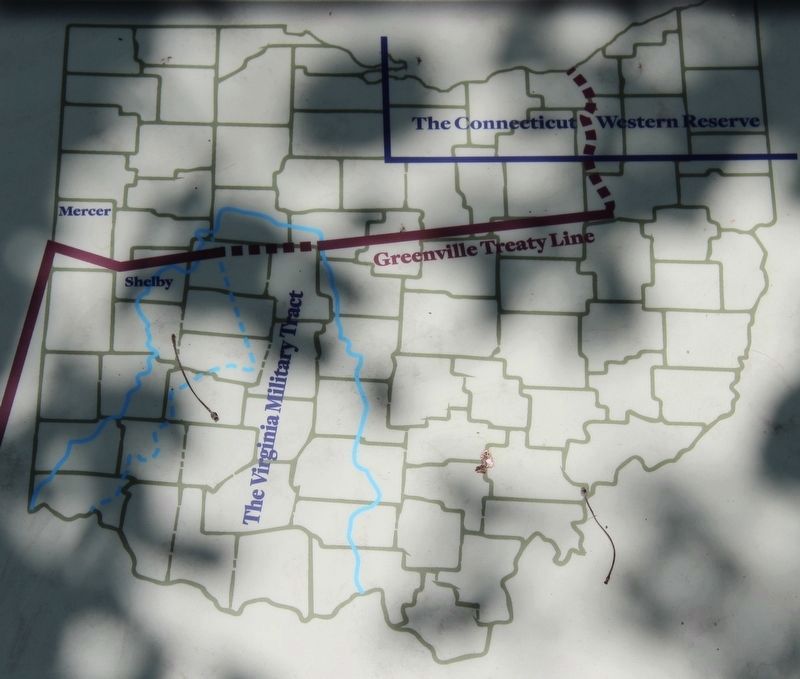
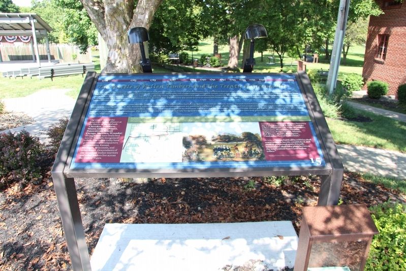
The final battle of the Northwest Indian War, Fallen Timbers, took place on August 20, 1794 in present-day Maumee, near Toledo, less than two months after the Battle of Fort Recovery. The American Indians' loss in the Battle of Fallen Timbers led to the negotiation of the Treaty of Greeneville. The lengthy and complex negotiations began in January 1795 and involved multiple tribes, who knew from the beginning any agreement would not be in their favor. The treaty was signed on August 3, 1795, officially ending the Northwest Indian War and establishing the Greeneville Treaty Line. Fort Recovery was the northwestern-most U.S. military outpost; here the Greeneville Treaty Line turned southwest towards the Ohio River. The treaty line was meant to serve as a boundary between American Indian and Euro-American settlement, but was essentially ignored by settlers and the U.S. government.
Ohio became a state in 1803, only eight years after the Treaty of Greeneville. The tribes in Ohio had been up against early contact with non-Natives and land encroachments for many years already.and statehood further weakened the treaty agreements. In 1830, President Andrew Jackson signed the Indian Removal Act, resulting in the forced removal, often by march and with armed escorts, of tribes in the southern United States. This forced relocation soon extended into Ohio and Indiana. Numerous tribes who were part of the Northwest Indian War and the Greeneville Treaty experienced disease and deaths of their citizens as they were forcibly marched to locations west of the Mississippi. This is why today Ohio is home to no federally recognized tribes. Tribes who once called Ohio home now have their governmental headquarters in Oklahoma, Kansas, Michigan, Wisconsin, and other states.
Bottom left panel of text:
The nine tribes of the American Indian alliance at the Battle of the Wabash (Cherokee, Delaware, Miami, Ojibwa, Ottawa, Potawatomi, Seneca, Cayuga, Shawnee, Wyandot) through time have branched into 35 federally recognized tribes. The tribes today have governmental headquarters in Oklahoma, Kansas, Michigan, Wisconsin, and other states. Descendants of the American Indian warriors and tribal leaders live across the United States.
Bottom right panel of text:
Introduction: "A treaty of peace between the United States of America, and the tribes of Indians called the Wyandots, Delawares, Shawanese, Ottawas, Chipewas, Putawatimes, Miamis, Eel-Rivers, Weea's, Kickapoos, Piankashaws, and Kaskaskias."
Article 1: "Henceforth all hostilities shall cease; peace is hereby established, and shall be perpetual; and a friendly intercourse shall take place between the

Photographed By Dale K. Benington, July 15, 2019
2. The Battle of Fallen Timbers and the Treaty of Greeneville Marker
Close-up view of the map that is displayed on this marker. The caption reads as follows: The Greenville Treaty Line served as the boundary between American Indian territory north and west of the line of land for Euro-American settlement southeast of the line. Credit: After Public Domain, William E. Peters (1918).
--Treaty of Greeneville (1795). Credit: Ohio History Central.
Erected by National Park Service American Battlefield Protection Program and the State of Ohio. (Marker Number 15.)
Topics. This historical marker is listed in these topic lists: Native Americans • Peace • Wars, US Indian. A significant historical month for this entry is January 1795.
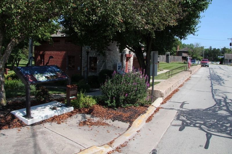
Location. 40° 24.821′ N, 84° 46.824′ W. Marker is in Fort Recovery, Ohio, in Mercer County. Marker is on Fort Site Street south of West Boundary Street, on the right when traveling south. This marker is situated along the west side of the roadway, just south of the Fort Recovery Museum building. Touch for map. Marker is at or near this postal address: 1 Fort Site Street, Fort Recovery OH 45846, United States of America. Touch for directions.
Other nearby markers. At least 8 other markers are within walking distance of this marker. Welcome to the Fort Recovery Battlefield Walking Tour (here, next to this marker); Background of the Log Home and Original Owners (a few steps from this marker); The Franke Historical Walkway (a few steps from this marker); Prologue to 1791 (a few steps from this marker); VanTrees Donation (within shouting distance of this marker); Sha'anoe Warrior Monument (within shouting

Photographed By Dale K. Benington, July 15, 2019
3. The Battle of Fallen Timbers and the Treaty of Greeneville Marker
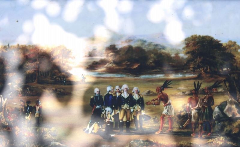
Close-up view of a painting that is displayed on this marker. The caption for this painting reads: The treaty was signed by multiple representatives of 15 American Indian tribes, 10 U.S. military officers, and 16 interpreters. The painter of this scene at the Treaty of Greeneville negotiations is unknown, but may have been one of Major general Anthony Wayne's officers. Credit: Public Domain.
Credits. This page was last revised on January 28, 2021. It was originally submitted on August 5, 2019, by Dale K. Benington of Toledo, Ohio. This page has been viewed 327 times since then and 29 times this year. Photos: 1, 2, 3, 4. submitted on August 5, 2019, by Dale K. Benington of Toledo, Ohio.

