Westminster in Carroll County, Maryland — The American Northeast (Mid-Atlantic)
Corbit's Charge
“Suicidal Bravery”
| — | Gettysburg Campaign | — |
November 24, 2008
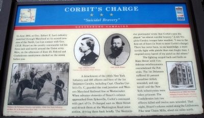
1. Corbit's Charge Marker
In June, 1863, as Gen. Robert E. Lee’s infantry marched through Maryland on its second invasion of the North, Lee lost contact with Gen. J.E.B. Stuart as the cavalry commander led his force east and north around the Union army. Here, on the afternoon of June 29, Federal and Confederate cavalrymen clashed on the street before you.
A detachment of the 150th New York Infantry and 108 officers and men of the 1st Delaware Cavalry, including Capt. Charles Corbit’s Co. C, guarded the road junction and Western Maryland Railroad line at Westminster. When advance elements of Stuart’s column approached from Sykesville, Corbit’s command with part of Co. D charged east on Main Street and struck them at the Washington Road intersection, driving them back briefly. The Westminster postmaster wrote that Corbit’s men displayed “an almost suicidal bravery.” A 4th Virginia Cavalry trooper later recalled, “I was in the first set of fours [in front to meet Corbit’s charge]. There has never been, in my knowledge, a more terrific fight with pistols than was fought then. I emptied every barrel of my pistol as did others.”
The fighting surged back
this page online
Erected by Maryland Civil War Trails.
Topics and series. This historical marker is listed in this topic list: War, US Civil. In addition, it is included in the Maryland Civil War Trails series list. A significant historical month for this entry is June 1863.
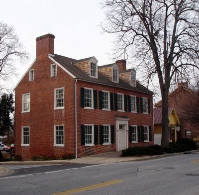
Location. 39° 34.185′ N, 76° 59.43′ W. Marker is in Westminster, Maryland, in Carroll County. It is on East Main Street (Maryland Route 32) east of South Court Street, on the right when traveling east. The marker is located in front of the Sherman-Fisher-Shellman House which is owned by The Historical Society of Carroll County. Touch for map. Marker is at or near this postal address: 206 East Main Street, Westminster MD 21157, United States of America. Touch for directions.

Regionally, this marker is in the

Photographed by Devry Becker Jones (CC0), December 6, 2025
2. Corbit's Charge Marker
The marker has weathered but remains generally legible.
Other nearby markers. At least 8 other markers are within walking distance of this marker: Votes for Women (here, next to this marker); Mary Shellman's Legacy (here, next to this marker); The Loom House (within shouting distance of this marker); The Shellman Home and Gardens (within shouting distance of this marker); American Legion Square (about 300 feet away, measured in a direct line); Army of the Potomac (about 600 feet away); a different marker also named Army of the Potomac (about 600 feet away); Aftermath of Battle (about 600 feet away). Touch for a list and map of all markers in Westminster.
Another marker is no longer nearby. Gettysburg Campaign (was here, next to this marker but has been replaced with another marker now near it).
More about this marker. On the lower left of the marker is a photo captioned,

Photographed by Devry Becker Jones (CC0), December 6, 2025
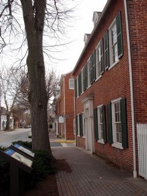
3. Maryland Civil War Trails and the Votes for Women markers
November 24, 2008
4. Corbit's Charge Marker
The left of two Civil War Trails markers in front of the Shellman house. Looking east - Main Street Westminster. This photo was taken before the adjacent marker was changed out and the Votes for Women sign was erected.
November 24, 2008
5. Another view of the Shellman House
November 24, 2008
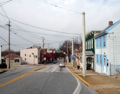
6. Scene of Capt. Charles Corbit's Charge
Looking west down Main Street at intersection of Washington Road (about 500 yards east of the marker).
Credits. This page was last revised on December 7, 2025. It was originally submitted on November 24, 2008. This page has been viewed 4,277 times since then and 160 times this year. Photos: 1. submitted on November 24, 2008. 2, 3. submitted on December 7, 2025, by Devry Becker Jones of Washington, District of Columbia. 4, 5, 6. submitted on November 24, 2008. • Craig Swain was the editor who published this page.
