Troy in Lincoln County, Missouri — The American Midwest (Upper Plains)
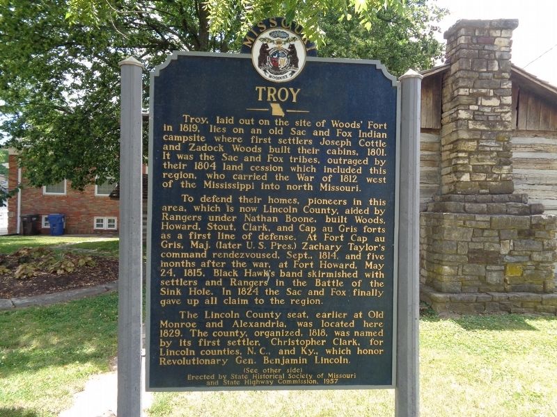
Troy
To defend their homes, pioneers in this area, which is now Lincoln County, aided by Rangers under Nathan Boone built Woods, Howard, Stout, Clark, and Cap au Gris forts as a first line of defense. At Fort Cap au Gris, Maj. (later U.S. Pres.) Zachary Taylor's command rendezvoused, Sept. 1814, and five months after the war, at Fort Howard, May 24, 1815, Black Hawk's band skirmished with settlers and Rangers in the Battle of the Sink Hole. In 1824 the Sac and Fox finally gave up all claim to the region.
The Lincoln County seat, earlier at Old Monroe and Alexandria, was located here 1829. The county, organized, 1818, was named by its first settler, Christopher Clark, for Lincoln counties, N.C., and Ky., which honor Revolutionary Gen. Benjamin Lincoln.
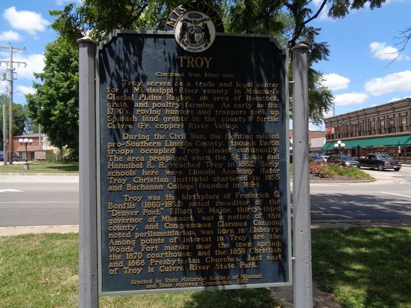
Troy serves as a trade and legal center for a Mississippi River county in Missouri's Glacial Plains region, an area of livestock, grain, and poultry farming. As early as the 1790's, roving hunters and trappers took up Spanish land grants in the country's fertile Cuivre (Fr. copper) River Valley.
During the Civil War, the fighting missed pro-Southern Lincoln County, though Union troops occupied Troy almost continually. The area prospered when the St. Louis and Hannibal R.R. reached Troy in 1882. Early schools here were Lincoln Academy (later Troy Christian Institute) chartered in 1835 and Buchanan College founded in 1894.
Troy was the birthplace of Frederick G. Bonfils (1860-1933) noted co-editor of the "Denver Post," Elliot W. Major, thirty-third governor of Missouri, was a native of this county, and Congressman Clarence Cannon, noted parliamentarian, was born in Elsberry. Among points of interest in Troy are the Woods' Fort marker near the town spring; the 1870 courthouse; and the 1859 Christian and 1868 Presbyterian Churches. Just east of Troy is Cuivre River State Park.
Erected 1957 by State Historical Society of Missouri and State Highway Commission.
Topics and series. This historical marker is listed in these topic lists: Native Americans • Settlements & Settlers • War of 1812 • War, US Civil. In addition, it is included in the Former U.S. Presidents: #12 Zachary Taylor, and the Missouri, The State Historical Society of series lists. A significant historical year for this entry is 1819.
Location. 38° 58.694′ N, 90° 58.852′ W. Marker is in Troy, Missouri, in Lincoln County. Marker is at the intersection of Boone Street and Main Street, on the right when traveling east on Boone Street. The marker is located at the Historic Woods' Fort site, outside a reconstructed cabin. Touch for map. Marker is in this post office area: Troy MO 63379, United States of America. Touch for directions.
Other nearby markers. At least 8 other markers are within 14 miles of this marker, measured as the crow flies. Woods Fort (a few steps from this marker); Shapley Ross House (approx. 4 miles away); Veterans of Foreign Wars Post 10687 Veterans Memorial (approx. 10.3 miles away); Rodger Taylor's Tavern - 1816 (approx. 12.9 miles away); The Nation's First Vietnam Memorial (approx. 13.3 miles away); Wentzville Vietnam Veterans Memorial (approx. 13.4 miles away); Vietnam War Memorial (approx. 13.4 miles away); Bicentennial Park (approx. 13.4 miles away).
Credits. This page was last revised on October 14, 2019. It was originally submitted on August 30, 2019, by Jason Voigt of Glen Carbon, Illinois. This page has been viewed 722 times since then and 93 times this year. Photos: 1, 2, 3. submitted on August 30, 2019, by Jason Voigt of Glen Carbon, Illinois. • Bernard Fisher was the editor who published this page.


