St. Mary's City in St. Mary's County, Maryland — The American Northeast (Mid-Atlantic)
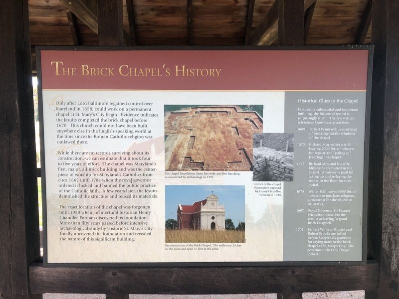
The Brick Chapel's History
Only after Lord Baltimore regained control over Maryland in 1658, could work on a permanent chapel at St. Mary's City begin. Evidence indicates the Jesuits completed the brick chapel before 1670. This church could not have been built anywhere else in the English-speaking world at the time since the Roman Catholic religion was outlawed there.
While there are no records surviving about its construction, we can estimate that it took four to five years of effort. The chapel was Maryland's first, major, all-brick building and was the centerpiece of worship for Maryland's Catholics from circa 1667 until 1704 when the royal governor ordered it locked and banned the public practice of the Catholic faith. A few years later, the Jesuits demolished the structure and reused its materials.
The exact location of the chapel was forgotten until 1938 when architectural historian Henry Chandlee Forman discovered its foundation. More than fifty years passed before intensive archaeological study by Historic St. Mary's City finally uncovered the foundation and revealed the nature of this significant building.
[Captions:]
The chapel foundation, three feet wide and five feet deep, as uncovered by archaeology in 1991.
Reconstruction of the Brick Chapel. The walls soar 24 feet to the eaves and span 57 feet at the arms.
Corner of the chapel foundation exposed by Henry Chandlee Forman in 1938.
[Sidebar:]
Historical Clues to the Chapel
For such a substantial and important building, the historical record is surprisingly silent. The few written references known are given here.
1669 Robert Pennywell is convicted of breaking out the windows of the chapel.
1670 Richard Moy writes a will leaving 2000 lbs. of tobacco for repairs and "paling in" [fencing] the chapel.
1675 Richard Moy and his wife, Elizabeth, are buried in the chapel. A worker is paid for taking up and re-laying the stones in the floor for their burial.
1678 Walter Hall leaves 5000 lbs. of tobacco to purchase religious ornaments for the church at St. Mary's.
1697 Royal Governor Sir Francis Nicholson describes the Jesuits as having "a good brick Chappell."
1704 Fathers William Hunter and Robert Brooke are called before Maryland's governor for saying mass in the brick chapel at St. Mary's City. The governor orders the chapel locked.
Erected by Historic St. Mary's City.
Topics. This historical marker is listed in these topic lists: Anthropology & Archaeology • Churches & Religion • Colonial Era. A significant historical year for this entry is 1658.
Location. 38° 10.991′ N, 76° 25.714′ W. Marker is in St. Mary's City, Maryland, in St. Mary's County. Marker can be reached from Point Lookout Road (Maryland Route 5) 0.4 miles Rosecroft Road, on the left when traveling west. Touch for map. Marker is at or near this postal address: 16721 Point Lookout Road, Saint Marys City MD 20686, United States of America. Touch for directions.
Other nearby markers. At least 8 other markers are within walking distance of this marker. An Experiment with Liberty of Conscience (here, next to this marker); Sacred Ground and Holy Buildings (here, next to this marker); An End of Freedom but Persistence of Faith (here, next to this marker); The Chapel Architecture (here, next to this marker); "…buried…in a most solemn manner" (here, next to this marker); Project Lead Coffins (here, next to this marker); Putting Together the Pieces (here, next to this marker); The "Priests' House" (here, next to this marker). Touch for a list and map of all markers in St. Mary's City.
Credits. This page was last revised on June 8, 2022. It was originally submitted on September 2, 2019, by Devry Becker Jones of Washington, District of Columbia. This page has been viewed 261 times since then and 38 times this year. Photo 1. submitted on September 2, 2019, by Devry Becker Jones of Washington, District of Columbia.
