Downtown in Syracuse in Onondaga County, New York — The American Northeast (Mid-Atlantic)
The Great Central Depot
The Freedom Trail
— The Underground Railroad —
The Underground Railroad: What Was It?
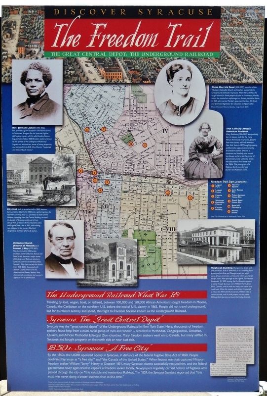
Traveling by foot, wagon, boat, or railroad, between 100,000 and 150,000 African Americans sought freedom in Mexico, Canada, the Caribbean or the northern U.S. before the end of U.S. slavery in 1865. People did not travel underground, but for its relative secrecy and speed, this flight to freedom became known as the Underground Railroad.
Syracuse: The “Great Central Depot”
Syracuse was the "great central depot" of the Underground Railroad in New York State. Here, thousands of freedom seekers found help from a multi-racial group of men and women — centered in Methodist, Congregational, Unitarian, Quaker, and African Methodist Episcopal Zion churches. Many freedom seekers went on to Canada, but many settled in Syracuse and bought property on the north side or near east side.
1850s: Syracuse “A Free City”
By the 1850s, the UGRR operated openly in Syracuse, in defiance of the federal Fugitive Slave Act of 1850. People celebrated Syracuse as "a free city," and "the Canada of the United States." When federal marshals captured Missouri freedom seeker William "Jerry" Henry in October 1851, many Syracuse citizens successfully rescued him, and the federal government never again tried to capture a freedom seeker locally. Newspapers regularly carried notices of fugitives who passed through the city on "this valuable and mysterious Railroad." In 1857, the Syracuse Standard reported that "this road was never doing a better business than at this time."
Erected by Preservation Association of Central New York, City of Syracuse, and Onondaga Historical Association.
Topics and series. This historical marker is listed in these topic lists: Abolition & Underground RR • African Americans • Churches & Religion • Civil Rights. In addition, it is included in the African Methodist Episcopal Zion (AME Zion) Church, and the Unitarian Universalism (UUism) series lists.
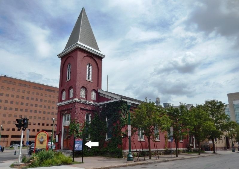
Location. 43° 2.827′ N, 76° 8.904′ W. Marker is in Syracuse, New York, in Onondaga County. It is in Downtown. Marker is at the intersection of East Jefferson Street and East Onondaga Street, on the left when traveling east on East Jefferson Street. Marker is located along the sidewalk, directly in front of the former Wesleyan Methodist Church building. Touch for map. Marker is at or near this postal address: 304 East Onondaga Street, Syracuse NY 13202, United States of America. Touch for directions.
Other nearby markers. At least 8 other markers are within walking distance of this marker. Wesleyan Methodist Church (here, next to this marker); Fayette Park (approx. 0.2 miles away); University Club
Courtesy of Onondaga Historical Association
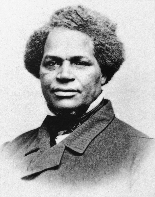
2. Marker detail: Rev. Jermain Loguen
(1813-1872)
(1813-1872)
Rev. Jermain Loguen escaped in 1834 from slavery in Tennessee. As agent for the Syracuse Fugitive Aid Society, Loguen with his wife Caroline Storum Loguen helped about 1500 freedom seekers. Known as the "prince of the Underground Railroad," Loguen was also teacher, owner of many properties, and bishop of the A.M.E. Zion Church, "respected and beloved by all classes."
More about this marker. This marker is replicated at ten other sites around the city of Syracuse, as shown on the map. This is the common "back" panel for eleven of the markers in the Syracuse Freedom Trail & Underground Railroad marker series. Marker locations: Loguen Park, Loguen House, Fayette Park, Wesleyan Methodist Church (this location), Courier Building, Hanover Square, Jerry Rescue Site, Prince Jackson House Site, Enoch Reed House Site, Rose Hill Cemetery, and Barnes House.
Related markers. Click here for a list of markers that are related to this marker. Syracuse Freedom Trail & Underground Railroad
Courtesy of Onondaga Historical Association
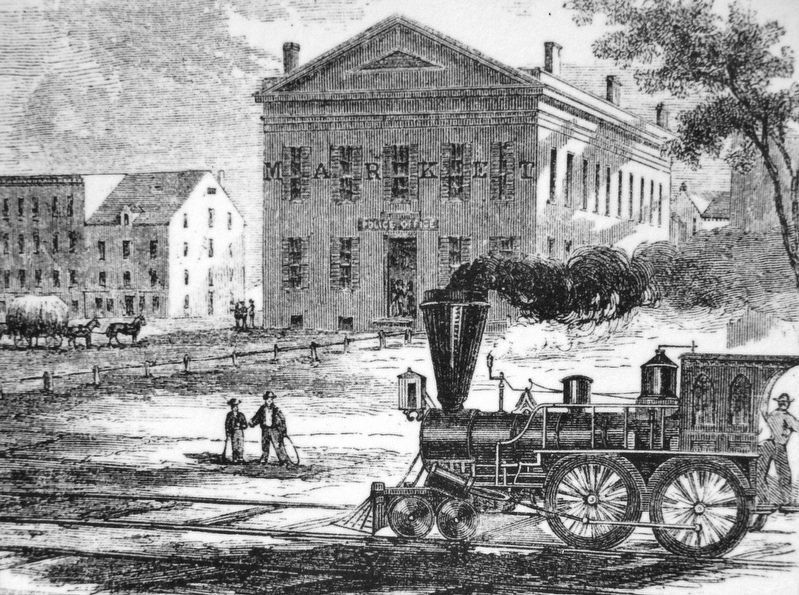
3. Marker detail: City Hall
City Hall, built as a market hall in 1845, became Syracuse's first City Hall in 1848 and a gathering place for reformers. In May 1851, U.S. Secretary of State Daniel Webster, speaking from the Courier Building, accused the people of Syracuse, gathered in front of City Hall, of treason if they refused to obey the Fugitive Slave Law. In 1892, this building was replaced by the current City Hall, designed by architect Charles E. Colton.
Courtesy of Onondaga Historical Association
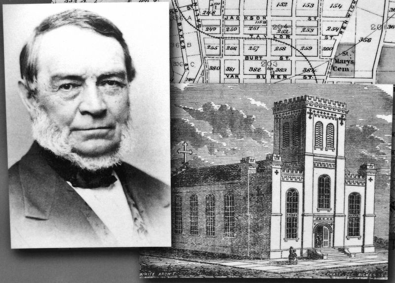
4. Marker detail: Samuel J. May (1797-1871)
and Unitarian Church (Church of Messiah)
and Unitarian Church (Church of Messiah)
The church, built in 1843 at the southeast corner of Burnet Avenue and State Street, became a major center of Underground Railroad activity in Syracuse under the leadership of Rev. Samuel J. May (who served this church-from 1845-1868). Associated with William Lloyd Garrison and the American Anti-Slavery Society, May championed nonviolence and women's rights as well as abolitionism.
Courtesy Wisconsin Historical Society
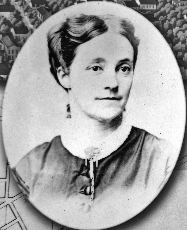
5. Marker detail: Chloe Merrick Reed (1832-1897)
Chloe Merrick Reed, member of the Wesleyan Methodist Church and teacher, supported the Underground Railroad in Syracuse. After the Civil War, she taught school for freed people of color in Fernandina, Florida, where she created an orphanage in a former plantation home. In 1869, she married Florida's governor, Harrison M. Reed, and promoted legislation for education and poor relief.
Courtesy of Onondaga Historical Association
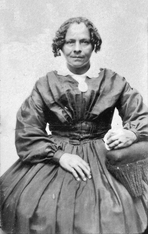
6. Marker detail: 19th Century African American Resident
Mary Robinson (1816-1868) was probably born in slavery and, like the many African Americans in Syracuse, became free when slavery officially ended in New York State in 1827, bought property, and formed a supportive community for freedom seekers. She was a laundress and landlady, and owned two houses and a lot on the corner of Burnet Avenue and Catherine Street. Her descendants lived there until the 1960s. This photograph of a Robinson family member was found in the Robinson home.
Courtesy of Onondaga Historical Association
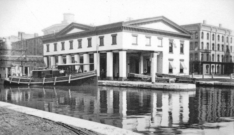
7. Marker detail: Weighlock Building
Built in 1849-1850, it is a surviving local presence of the Erie and Oswego canals, on which some African Americans worked, and others used as an escape route. After passage of the Fugitive Slave Act on September 18, 1850, among the first freedom seekers to come through Syracuse were William Harris, from South Carolina, and his wife and baby, who came on a canal boat. When the captain and others threatened to return the Harris family to slavery, William tried to commit suicide, and his wife jumped into the canal. Although both parents survived, their baby drowned.
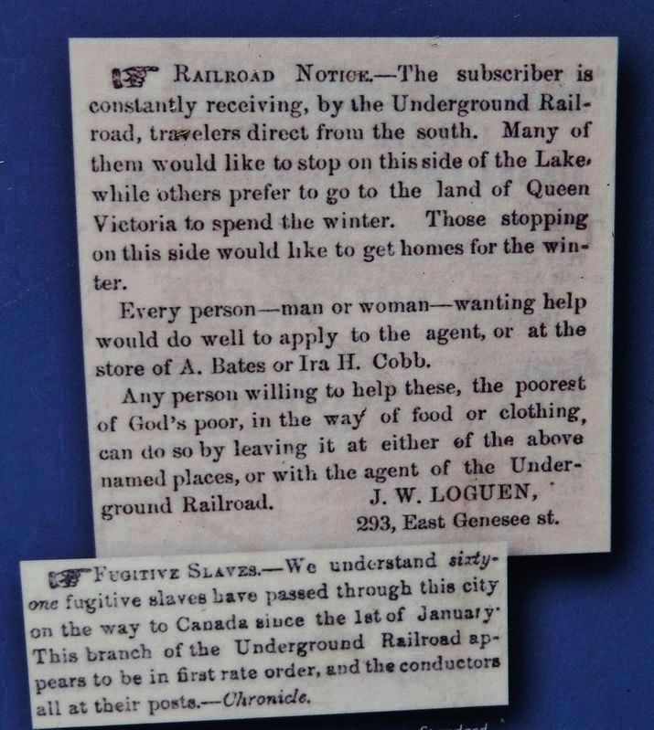
8. Marker detail: Railroad Notices
From the Syracuse Standard, October 2, 1854 (top) and November 25, 1854 (bottom).
The subscriber is constantly receiving, by the Underground Railroad, travelers direct from the south. Many of them would like to stop on this side of the Lake while others prefer to go to the land of Queen Victoria to spend the winter. Those stopping on this side would like to get homes for the winter.
Every person — man or woman — wanting help would do well to apply to the agent, or at the store of A. Bates or Ira H. Cobb.
Any person willing to help these, the poorest of God's poor, in the way of food or clothing, can do so by leaving it at either of the above named places, or with the agent of the Underground Railroad.
J. W. LOGUEN
293, East Genesee St.
Fugitive Slaves. — We understand sixty-one fugitive slaves have passed through this city on the way to Canada since the 1st of January. This branch of the Underground Railroad appears to be in first rate order, and the conductors all at their posts. — Chronicle.
Credits. This page was last revised on February 16, 2023. It was originally submitted on September 3, 2019, by Cosmos Mariner of Cape Canaveral, Florida. This page has been viewed 653 times since then and 83 times this year. Photos: 1, 2, 3, 4, 5, 6, 7, 8, 9. submitted on September 4, 2019, by Cosmos Mariner of Cape Canaveral, Florida.
