St. Mary's City in St. Mary's County, Maryland — The American Northeast (Mid-Atlantic)
"a lande, even as God made it"
Settling
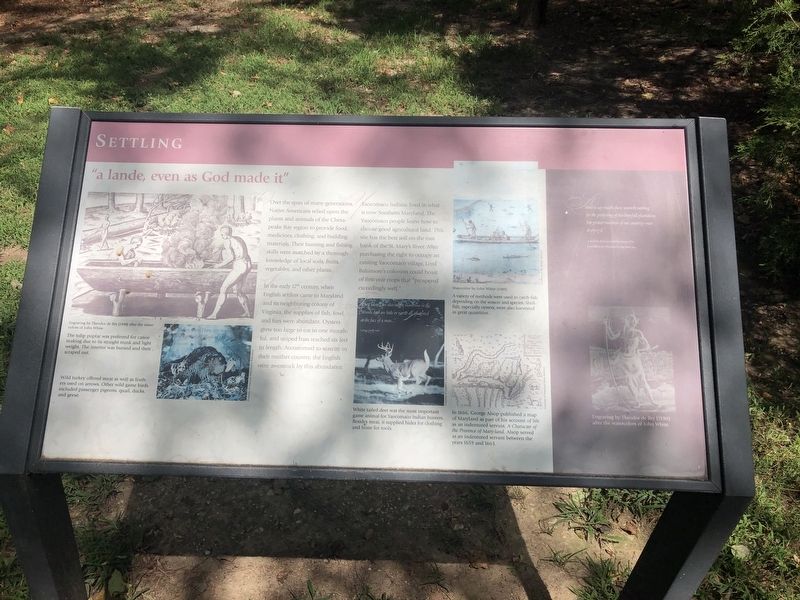
Over the span of many generations, Native Americans relied upon the plants and animals of the Chesapeake Bay region to provide food, medicines, clothing, and building materials. Their hunting and fishing skills were matched by a thorough knowledge of local soils, fruits, vegetables, and other plants.
In the early 17th century, when English settlers came to Maryland and its neighboring colony of Virginia, the supplies of fish, fowl, and furs were abundant. Oysters grew too large to eat in one mouthful, and striped bass reached six feet in length. Accustomed to scarcity in their mother country, the English were awestruck by this abundance.
Yaocomaco Indians lived in what is now Southern Maryland. The Yaocomaco people knew how to choose good agricultural land. This site has the best soil on the east bank of the St. Mary's River. After purchasing the right to occupy an existing Yaocomaco village, Lord Baltimore's colonists could boast of first-year crops that "prospered exceedingly well."
The tulip poplar was preferred for canoe making due to its straight trunk and light weight. The interior was burned and then scraped
this page online
Wild turkey offered meat as well as feathers used on arrows. Other wild game birds included passenger pigeons, quail, ducks, and geese.
A variety of methods were used to catch fish depending on the season and species. Shell fish, especially oysters, were harvested in great quantities.
White tailed deer was the most important game animal for Yaocomaco Indian hunters. Besides meat, it supplied hides for clothing and bone for tools.
In 1666, George Alsop published a map of Maryland as part of his account of life as an indentured servant, A Character of the Province of Mary-land. Alsop served as an indentured servant between the years 1659 and 1663.
[Aside:]
"And to say trueth, there wanteth nothing for the perfecting of this hopefull plantation; but greater numbers of our country-men to enjoy it."
A Relation of the Successful Beginning of the Lord Baltimore's Plantation in Maryland, 1634
Engraving by Theodore de Bry (1590) after the water colors of John White
Erected by Historic St. Mary's City.
Topics. This historical marker is listed in these topic lists: Colonial Era • Indigenous Peoples and Communities
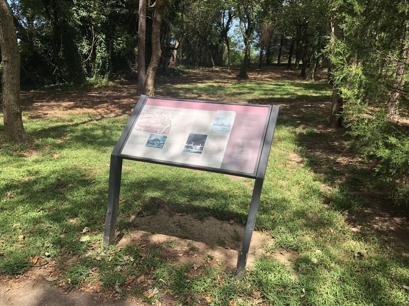
Location. This marker has been replaced by another marker nearby. It was located near 38° 10.933′ N, 76° 25.848′ W. Marker was in St. Mary's City, Maryland, in St. Mary's County. It could be reached from Point Lookout Road (Maryland Route 5) 0.6 miles west of Rosecroft Road, on the left when traveling west. Touch for map. Marker was at or near this postal address: 16721 Point Lookout Road, Saint Marys City MD 20686, United States of America. Touch for directions.

Regionally, this marker was in Southern Maryland. It was also in the American South, specifically in the Upper South, in the Mid-Atlantic, in the Tidewater, in the Chesapeake Bay Region, and on the Eastern Seaboard. Globally, it was in the North Atlantic Region, North America, the Western Hemisphere, the Western World, and the Anglosphere. Historically, it found itself in what was once one of the original Thirteen Colonies and also the Antebellum South.
Other nearby markers. At least 8 other markers are within walking distance of this location: A different marker also named "a lande, even as God made it" (here, next to this marker); An Opportunity Awaits… (within shouting distance of this marker); Encountering the Other (within shouting distance of this marker); Where is the City? (about 300 feet away, measured in a direct line); The Calvert Family and the Founding of Maryland (about 400 feet away); Historic St. Mary's City (about 400 feet away); "Dwell here, live plentifully, and be rich" (about 500 feet away); Welcome to the Chapel Field (about 500 feet away). Touch for a list and map of all markers in St. Mary's City.
Another marker is no longer nearby. An Opportunity Awaits… (was within shouting distance of this marker but has been replaced with another marker now near it).
Credits. This page was last revised on April 16, 2026. It was originally submitted on September 3, 2019, by Devry Becker Jones of Washington, District of Columbia. This page has been viewed 274 times since then and 11 times this year. Photos: 1, 2. submitted on September 3, 2019, by Devry Becker Jones of Washington, District of Columbia.
