Wilson in Niagara County, New York — The American Northeast (Mid-Atlantic)
The Government Piers at Twelve Mile Creek, Wilson, New York
Inscription.
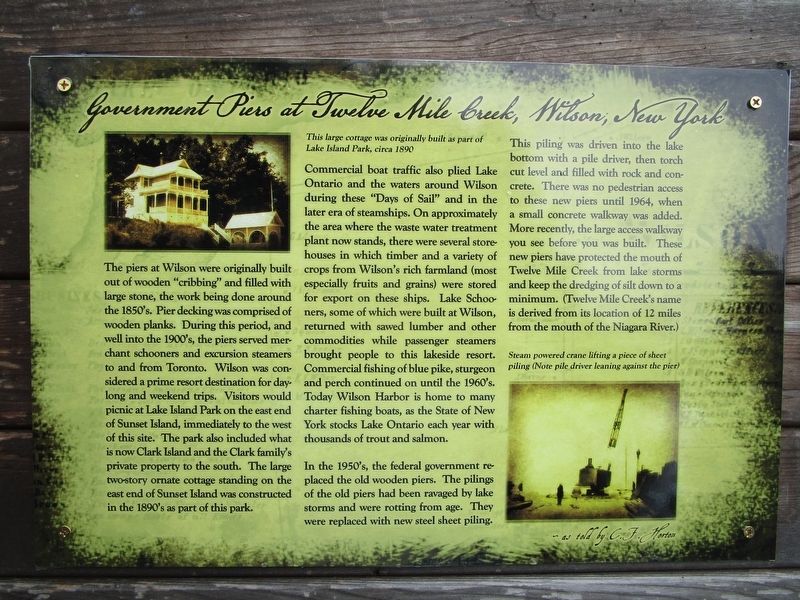
The piers at Wilson were originally built out of wooden “cribbing” and filled with large stone, the work being done around the 1850’s. Pier decking was comprised of wooden planks. During this period, and well into the 1990’s, the piers served merchant schooners and excursion steamers to and from Toronto. Wilson was considered a prime resort destination for day-long and weekend trips. Visitors would picnic at Lake Island Park on the east end of Sunset Island, immediately to the west of this site. The park also included what is now Clark Island and the Clark family’s private property to the south. The larger two-story ornate cottage standing on the east end of Sunset Island was constructed in the 1890’s as part of the park.
This large cottage was originally built as part of Lake Island Park, circa 1890.
Commercial boat traffic also plied Lake Ontario and the waters around Wilson during these “Days of Sail” and in the later era of steamships. On approximately the area where the waste water treatment plant now stands, there were several store-houses in which timber and a variety of crops from Wilson’s rich farmland (most especially fruits and grains) were stored for export on these ships. Lake Schooners, some of which were built at Wilson, returned with sawed lumber and other commodities while passenger, steamers brought people to this lakeside resort. Commercial fishing of blue pike, sturgeon and perch continued on until the 1960’s. Today Wilson Harbor is home to many charter fishing boats, as the State of New York stocks Lake Ontario each year with thousands of trout and salmon.
In the 1950’s, the federal government replaced the old wooden piers. The pilings of the old piers had been ravaged by lake storms and were rotting from age. They were replaced with new steel sheet piling. This piling was driven into the lake bottom with a pile driver, then torch cut level and filled with rock and concrete. There was no pedestrian access to these piers until 1964, when a small concrete walkway was added. More recently, the large access walkway you see before you was built. These new piers have protected the mouth of Twelve Mile Creek from lake storms and keep the dredging of silt down to a minimum. (Twelve Mile Creek’s name is derived from its location of 12 miles from the mouth of the Niagara River.)
Steam powered crane lifting a piece of sheer piling (Note pile driver leaning against the pier)
Erected 2019 by Wilson Historical Society.
Topics. This historical marker is listed in these topic lists: Agriculture • Parks & Recreational Areas • Waterways & Vessels. A significant historical year for this entry is 1890.
Location.
43° 19.05′ N, 78° 50.129′ W. Marker is in Wilson, New York, in Niagara County. Marker can be reached from Ontario Street, 0.1 miles west of Harbor Street. Touch for map. Marker is in this post office area: Wilson NY 14172, United States of America. Touch for directions.
Other nearby markers. At least 8 other markers are within walking distance of this marker. Wilson Harbor (about 400 feet away, measured in a direct line); Port of Entry Marker and Wilson Boat House (about 700 feet away); Lake Island Park, Wintergreen Island, Tugwell Island & Clark Island (approx. ¼ mile away); a different marker also named Lake Island Park (approx. ¼ mile away); Greenwood Veterans' Memorial Park (approx. 0.4 miles away); O'Connell Island (approx. 0.4 miles away); Vietnam Memorial in Memory of 1st Lt. Michael E. Witkop (approx. 0.4 miles away); A Solemn Tribute to the Men and Women of Wilson who Served (approx. 0.4 miles away). Touch for a list and map of all markers in Wilson.
Photographed By Anton Schwarzmueller, September 2, 2019
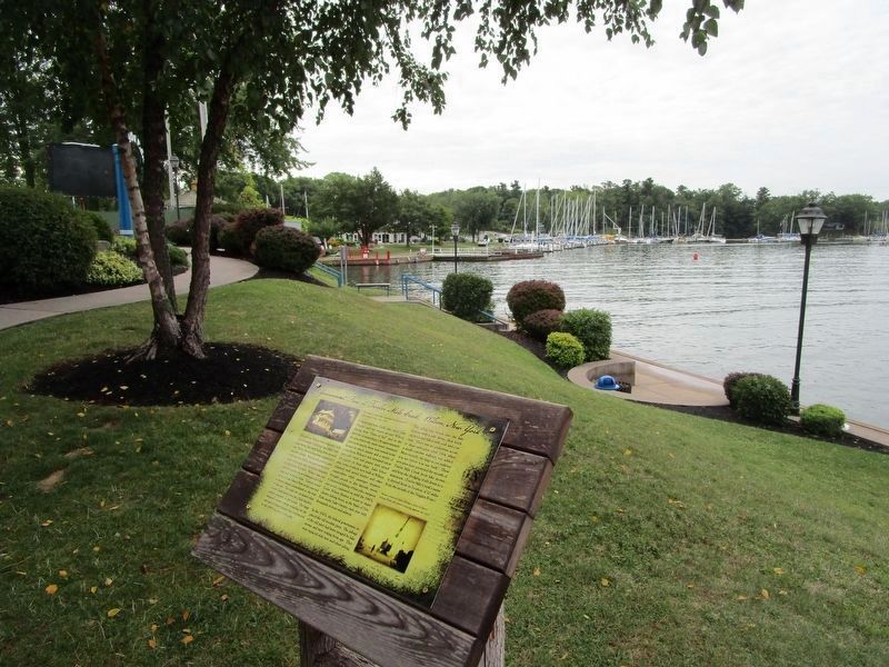
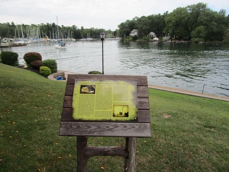
3. The Marker, Cottage and Sunset Island
The 1890 cottage pictured on the marker is across the harbor in this view. It is on Sunset Island, which is actually barely tethered to the mainland at Wilson-Tuscarora State Park. The fishing area just below the marker was flooded in the spring and early summer of 2019 due to high lake levels.
Photographed By Anton Schwarzmueller, September 2, 2019
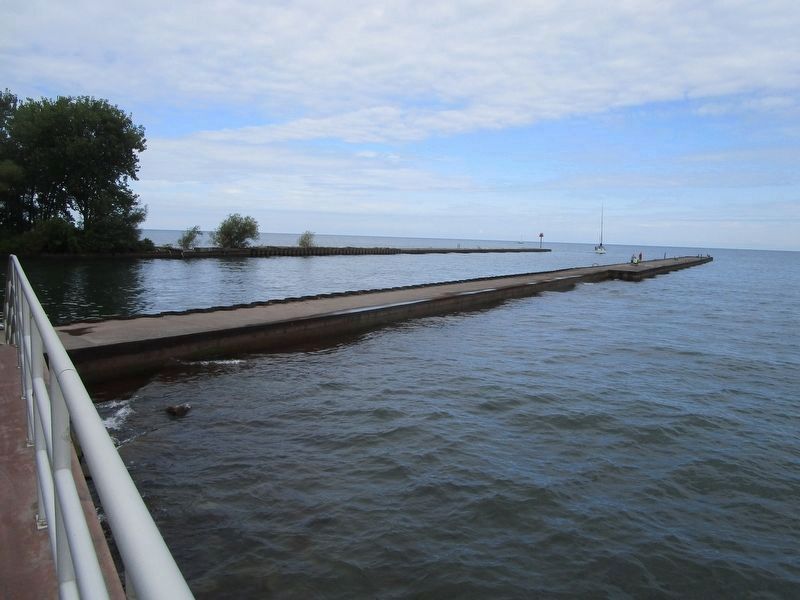
4. The Government Piers at Twelve Mile Creek
Picture taken from along the back of the water treatment facility, which is mentioned in the marker text. Note the beacon at the end of the west pier. The west pier extends from Sunset Island and is commonly covered with seagulls in season. There is no walkway to the west pier.
Photographed By Anton Schwarzmueller, September 2, 2019
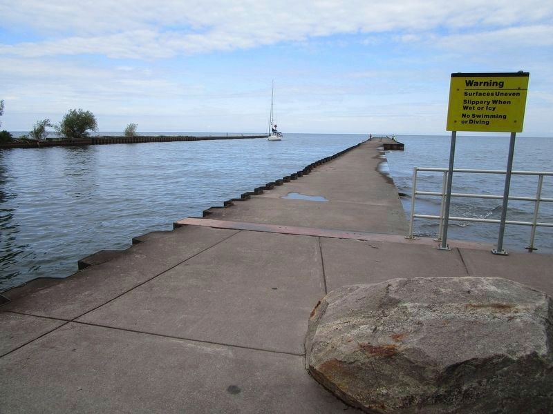
5. The Government Piers at Twelve Mile Creek, Wilson
The walkway is for the east pier only. Three survey badges are embedded in the cement walkway: two dated 1972 by the Interior Department, one dated 1978 by the US Army Corp of Engineers. Two are a couple feet from the end of the pier. The other is a few yards from the end.
Credits. This page was last revised on September 11, 2019. It was originally submitted on September 3, 2019, by Anton Schwarzmueller of Wilson, New York. This page has been viewed 202 times since then and 18 times this year. Photos: 1, 2, 3, 4, 5. submitted on September 3, 2019, by Anton Schwarzmueller of Wilson, New York.
