
Resaca in Gordon County, Georgia — The American South (South Atlantic)
Confederate Cemetery Resaca
Photographed by David Seibert, November 14, 2008
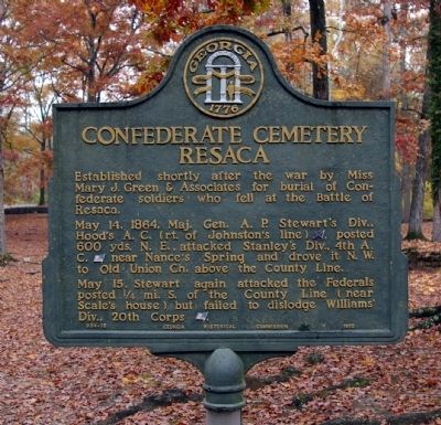
1. Confederate Cemetery Resaca Marker
Established shortly after the war by Miss Mary J. Green & Associates for burial of Confederate soldiers who fell at the battle of Resaca.
May 14, 1864, Maj. Gen. A. P. Stewart's Div., Hood's A. C. (rt. of Johnston's line) [CS], posted 600 yds. N. E., attacked Stanley's Div., 4th A. C. [US] near Nance's Spring and drove it N. W. to old Union Ch. above the County Line.
May 15. Stewart again attacked the Federals posted ¼ mi. S. of the County Line (near Scale's house) but failed to dislodge Williams' Div., 20th Corps [US].
Erected 1953 by Georgia Historical Commission. (Marker Number 064-15.)
Topics and series. This historical marker is listed in these topic lists: Cemeteries & Burial Sites • War, US Civil. In addition, it is included in the Georgia Historical Society series list. A significant historical date for this entry is May 14, 1864.
Location. 34° 36.335′ N, 84° 56.649′ W. Marker is in Resaca, Georgia, in Gordon County. It is on Confederate Cemetery Road 0.4 miles east of U.S. 41, on the right when traveling east. The marker is located just inside the Confederate Cemetery at the end of the road. Touch for map. Marker
this page online

Regionally, this marker is in Georgia’s Mountains. It is also in the American South, specifically in the Deep South, in Appalachia, and specifically in Southern Appalachia. Globally, it is in the North Atlantic Region, North America, the Western Hemisphere, the Western World, and the Anglosphere. Historically, it finds itself in what was once the original Cherokee Nation, the territory of the Mississippian Culture, one of the original Thirteen Colonies, one of the Confederate States of America, and the Antebellum South.
Other nearby markers. At least 8 other markers are within walking distance of this marker: Mary J. Green (a few steps from this marker); Mary Jane Green (a few steps from this marker); Miss Mary Green (within shouting distance of this marker); Atlanta Campaign (approx. 0.3 miles away); Battle of Resaca (approx. 0.3 miles away); The Resaca Confederate Cemetery (approx. 0.3 miles away); 123rd New York Infantry (approx. half a mile away); a different marker also named Battle of Resaca (approx. half a mile away).
Photographed by David Seibert, November 14, 2008
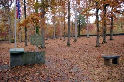
2. Confederate Cemetery Resaca Marker
Photographed by David Seibert, November 14, 2008
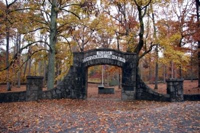
3. Resaca Confederate Cemetery
The Marker can be seen through the arch.
Photographed by David Seibert, November 14, 2008
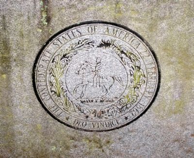
4. The Seal of the Confederate States of America
The Seal is just inside the Cemetery entrance, in front of the Marker.
Credits. This page was last revised on November 27, 2020. It was originally submitted on November 28, 2008, by David Seibert of Sandy Springs, Georgia. This page has been viewed 2,142 times since then and 26 times this year. Photos: 1, 2, 3, 4. submitted on November 28, 2008, by David Seibert of Sandy Springs, Georgia. • Craig Swain was the editor who published this page.
