Sylmar in Los Angeles in Los Angeles County, California — The American West (Pacific Coastal)
Rim of the Valley Trail
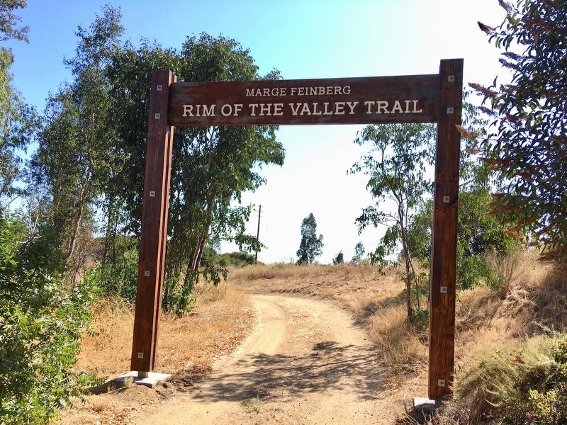
Marge Feinberg
| — | Saddletree Ranch Trailhead | — |
Photographed by Craig Baker, August 27, 2019
1. Rim of the Valley Trail Marker
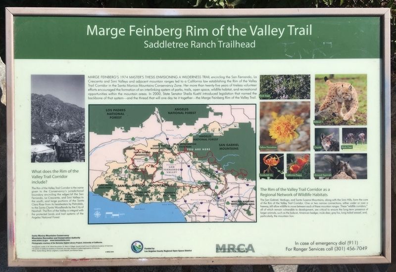
Marge Feinberg’s 1974 Master’s Thesis envisioning a wilderness trail encircling the San Fernando, La Crescenta and Simi Valleys and adjacent mountain ranges led to a California law establishing the Rim of the Valley Trail Corridor in the Santa Monica Mountains Conservancy Zone. Her more than twenty-five years of tireless volunteer efforts encouraged the formation of an interlinking system of parks, trails, open space, wildlife habitat, and recreational opportunities within the mountain areas. In 2000, State Senator Sheila Kuehl introduced legislation that named the backbone of that system and the thread that will one day tie it together the Marge Feinberg Rim of the Valley Trail.
What does the Rim of the Valley Trail Corridor include?
The Rim of the Valley Trail Corridor is the name given to the Conservancy's jurisdictional boundary encircling the edges of the San Fernando, La Crescenta, and Simi Valleys to the south, and large portions of the Santa Clara River from its headwaters by Palmdale, to the Santa Clarita Woodlands by the City of Newhall. The Rim of the Valley is integral with the protected lands
this page online
The Rim of the Valley Trail Corridor is a Regional Network of Wildlife Habitats
The San Gabriel, Verdugo, and Santa Susana Mountains, along with the Simi Hills, form the core of the Rim of the Valley Trail Corridor. One or two narrow connections, either under or over a freeway, still allow wildlife to move between each of these mountain ranges. These "wildlife corridors," all of which remain vulnerable to development, are critical to ensure the long-term presence of larger animals, such as the bobcat, American badger, mule deer, grey fox, long-tailed weasel, and, particularly, the mountain lion.
Erected 2003 by Santa Monica Mountains Conservancy; and Mountains Recreation and Conservation Authority.
Topics. This historical marker is listed in these topic lists: Animals • Environment • Parks & Recreational Areas • Women. A significant historical year for this entry is 1974.
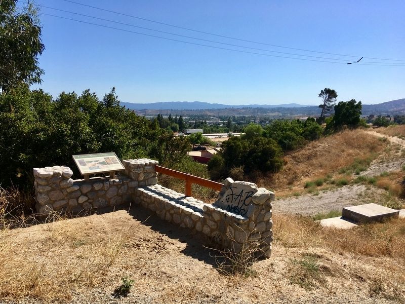
Location. 34° 19.504′ N, 118° 28.55′ W. Marker is in Los Angeles, California, in Los Angeles County. It is in Sylmar. It can be reached from Glenoaks Boulevard north of Foothill Boulevard,
Photographed by Craig Baker, August 27, 2019
2. Rim of the Valley Trail Marker

Regionally, this marker is in The Valley (the San Fernando Valley) and in the Transverse Ranges. It is also on the American Pacific Coast. Globally, it is in North America, on the Ring of Fire, on the Pacific Rim, in the Western Hemisphere, in the Western World, and in the Anglosphere. Historically, it finds itself in what was once New Spain and also Mexico’s Alta California.
Other nearby markers. At least 8 other markers are within 3 miles of this marker, measured as the crow flies: Sayre Fire (approx. half a mile away); The Cascades (approx. 1.2 miles away); "The Cascades" (approx. 1.2 miles away); Los Angeles Aqueduct Filtration Plant (approx. 1½ miles away); The San Fernando Pioneer Memorial Cemetery (approx. 1.6 miles away); Kramer House (approx. 2 miles away); Edminster House (approx. 2.2 miles away); O’Melveny Park (approx. 2.4 miles away).
Photographed by Craig Baker, August 27, 2019
3. Rim of the Valley Trail Marker
Another marker is no longer nearby. Beale's Cut (was approx. 2.3 miles away but has been confirmed missing).
Photographed by Craig Baker, August 27, 2019
4. Rim of the Valley Trail
Credits. This page was last revised on November 19, 2024. It was originally submitted on August 29, 2019, by Craig Baker of Sylmar, California. This page has been viewed 1,479 times since then and 78 times this year. Last updated on September 7, 2019, by Craig Baker of Sylmar, California. Photos: 1, 2, 3, 4. submitted on August 29, 2019, by Craig Baker of Sylmar, California. • Andrew Ruppenstein was the editor who published this page.
