Port Hastings in Inverness County, Nova Scotia — The Atlantic Provinces (North America)
History of the Canso Canal / Historique du Canal de Canso
Inscription.
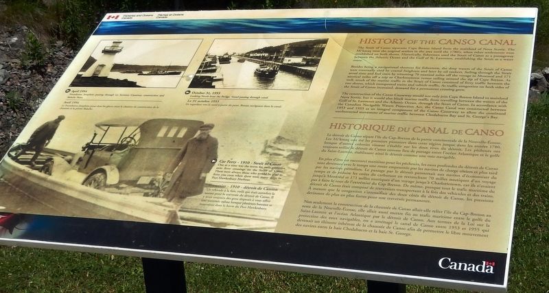
The Strait of Canso separates Cape Breton Island from the mainland of Nova Scotia. The Mi'kmaq were the original settlers in the area until the 1780's, when other settlements were established on both shores. Historically, fishermen used the Strait of Canso as a passageway between the Atlantic Ocean and the Gulf of St. Lawrence, establishing the Strait as a water route.
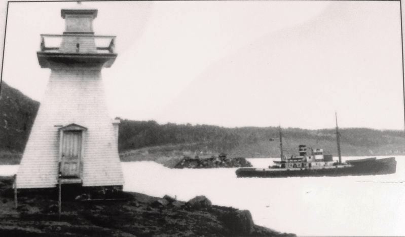
Besides being a navigational shortcut for fishermen, the deep waters of the Strait of Canso were eventually used by coastal freighters and later by oil tankers. Sailing through the Strait saved time and fuel costs by trimming 70 nautical miles off the voyage to Montreal and 171 nautical miles off a trip to Charlottetown versus sailing around the tip of Cape Breton. As well, much of the marine traffic in the Strait of Canso consisted of ferry traffic between the two shores, which transported trains and vehicle traffic. As traffic congestion on both sides of the Strait of Canso increased, demand for a permanent crossing grew.
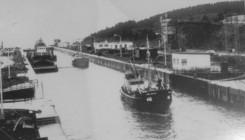
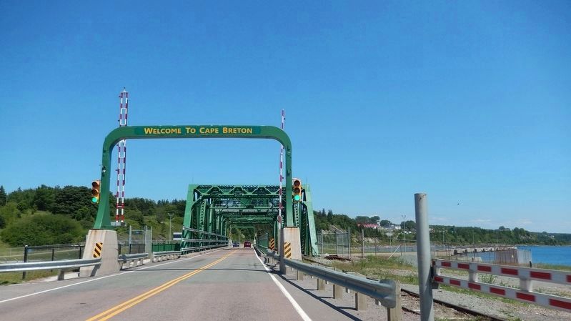
The construction of the Canso Causeway would not only join Cape Breton Island to mainland Nova Scotia, but it would also block marine traffic from travelling between the waters of the Gulf of St. Lawrence and the Atlantic Ocean, through the Strait of Canso. In accordance with the Canadian Navigable Waters Protection Act, the Canso Canal was constructed between 1953 and 1955 as an integral component of the Canso Causeway to allow the continued unobstructed movement of marine traffic between Chedabucto Bay and St. George's Bay.
Le détroit de Canso sépare l'île du Cap-Breton de la partie continentale de la Nouvelle-Écosse. Les Mi'kmaq ont été les premiers pionniers dans cette région jusque dans les années 1780, lorsque d'autres colonies vinrent s'établir sur les deux rives du détroit. Les pêcheurs ont toujours utilisé le détroit de Canso comme lieu de passage entre l'océan Atlantique et le golfe du Saint-Laurent, établissant ainsi le détroit comme une voie navigable.
En plus d'être un raccourci maritime pour les pêcheurs, les eaux profondes du détroit de Canso sont devenues avec le temps une route empruntée par les navires de charge côtiers et phis tard par les navires pétroliers. Le passage par le détroit permettait aux navires d’économiser du temps et de réduire les coûts du carburant en retranchant 70 milles nautiques d’un voyage jusqu'à Montréal et 171 milles nautiques d'un voyage jusqu'à Charlottetown, car ils n’avaient pas à faire
le tour de l'extrémité du Cap Breton. De même, presque tout le trafic maritime du détroit de Canso était composé de traversiers transportant à la fois des véhicules et des trains. À mesure que la congestion s'intensifiait des deux côtés du détroit de Canso, les pressions devinrent de plus en plus fortes pour une traversée permanente.
Non seulement la construction de la chaussée de Canso allait-elle relier l'île du Cap-Breton au reste de la Nouvelle-Écosse, elle allait aussi mettre fin au trafic maritime entre le golfe du Saint-Laurent et l'océan Atlantique par le détroit de Canso. Aux termes de la Loi sur la protection des eaux navigables, on a aménagé le canal de Canso entre 1953 et 1955 qui devenait un élément inhérent de la chaussée de Canso afin de permettre le libre mouvement des navires entre la baie Chedabucto et la baie St. George.
Erected by Fisheries and Oceans Canada/Pêches et Océans Canada.
Topics. This historical marker is listed in these topic lists: Bridges & Viaducts • Industry & Commerce • Roads & Vehicles • Waterways & Vessels.
Location. 45° 38.882′ N, 61° 24.744′ W. Marker is in Port Hastings, Nova Scotia, in Inverness County. Marker can be reached from Trans Canada Highway (National Route 104
) half a kilometer west of Ceilidh Trail (Route 19), on the right when traveling west. Marker is located in the Celtic Shores Coastal Trail interpretive plaza and trailhead, on the east side of the Canso Causeway. Touch for map. Marker is in this post office area: Port Hastings NS B9A 1J8, Canada. Touch for directions.
Other nearby markers. At least 4 other markers are within walking distance of this marker. Construction of the Canso Canal / Construction du Canal de Canso (here, next to this marker); The Building of the Canso Causeway / La Construction de la Levée de Canso (here, next to this marker); Operation of the Canso Canal / Exploitation du Canal (here, next to this marker); Canso Causeway (a few steps from this marker).
Related markers. Click here for a list of markers that are related to this marker. Canso Canal & Causeway
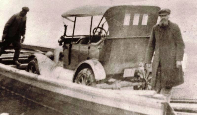
4. Marker detail: Car Ferry • 1910 • Strait of Canso
One at a time was the norm for early primitive auto ferry crossings on the Strait of Canso. There were always those who would be glad to ferry you even when there were many ships in Port Hawkesbury Harbour.
Traversier • 1910 • détroit de Canso
Un véhicule à la fois, voilà qui était autrefois la norme pour la traversée du détroit de Canso. Il y avait toujours des gens disposés à vous offrir une traversée même lorsque plusieurs bateaux se trouvaient dans le havre du Port Hawkesbury.
Traversier • 1910 • détroit de Canso
Un véhicule à la fois, voilà qui était autrefois la norme pour la traversée du détroit de Canso. Il y avait toujours des gens disposés à vous offrir une traversée même lorsque plusieurs bateaux se trouvaient dans le havre du Port Hawkesbury.
Credits. This page was last revised on November 22, 2021. It was originally submitted on September 9, 2019, by Cosmos Mariner of Cape Canaveral, Florida. This page has been viewed 256 times since then and 35 times this year. Photos: 1. submitted on September 11, 2019, by Cosmos Mariner of Cape Canaveral, Florida. 2, 3, 4, 5, 6. submitted on September 13, 2019, by Cosmos Mariner of Cape Canaveral, Florida.
