Winchester in Frederick County, Virginia — The American South (Mid-Atlantic)
Battle of Rutherford's Farm
Union Victory
November 28, 2008
1. Battle of Rutherford's Farm Marker
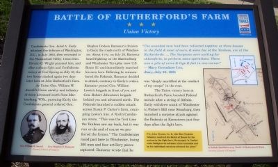
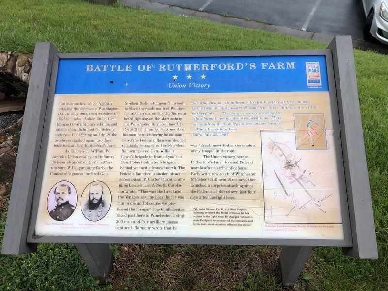
As Union Gen. William W. Averell’s Union cavalry and infantry division advanced south from Martinsburg, W.Va., pursuing Early, the Confederate general ordered Gen. Stephen Dodson Ramseur’s division to block the roads north of Winchester. About 4 P.M. on July 20, Ramseur heard fighting on the Martinsburg and Winchester Turnpike (now U.S. Route 11) and immediately marched his men here. Believing he outnumbered the Federals, Ramseur decided to attack, contrary to Early’s orders. Ramseur posted Gen. William Lewis’s brigade in front of you and Gen. Robert Johnston’s brigade behind you and advanced north. The Federals launched a sudden attack across Susan P. Carter’s farm, crumpling Lewis’s line. A North Carolinian wrote, “This was the first time the Yankees saw my back, but it was run or die and of course we
this page online
The Union victory here at Rutherford’s Farm boosted Federal morale after a string of defeats. Early withdrew south of Winchester to Fisher’s Hill near Strasburg, then launched a surprise attack against the Federals at Kernstown just four days after the fight here.
“The wounded men had been collected together at three houses in the field & most of ours, & some few of the Yankees, are at the Rutherfords. … The Surgeons were waiting for chloroform, to perform operations. There was a pile of arms & legs & feet in one corner.”
– Mary Greenhow Lee, diary, July 23, 1864
(Sidebar): Pvt. John Shanes, Co. K, 14th West Virginia Infantry, received the Medal of Honor for his actions in the fight here. He charged “a Confederate fieldpiece in advance of his comrades and by his individual exertions silenced the piece.”
Erected by Virginia Civil War Trails.
Topics and series. This historical marker is listed in this topic list: War, US Civil.
November 28, 2008
2. Battle of Rutherford's Farm Marker
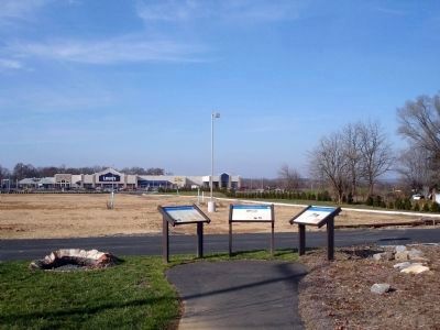
Location. This marker has been replaced by another marker nearby. It was located near 39° 13.241′ N, 78° 7.854′ W. Marker was in Winchester, Virginia, in Frederick County. It was on Martinsburg Pike (U.S. 11), on the right when traveling south. Touch for map. Marker was in this post office area: Winchester VA 22603, United States of America. Touch for directions.

Regionally, this marker was in Virginia’s Shenandoah Valley. It was also in the American South, specifically in the Upper South, and in the Mid-Atlantic. Globally, it was in North America, the Western Hemisphere, the Western World, and the Anglosphere. Historically, it found itself in what was once the territory of the Mississippian Culture, one of the original Thirteen Colonies, one of the Confederate States of America, and the Antebellum South.
Other nearby markers. At least 8 other markers are within walking distance of this location: Interrupted by War (within shouting distance of this marker); "Run or Die" (within shouting distance
November 28, 2008
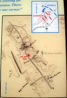
3. Close-up of Map(s) on Marker
Other markers no longer nearby. Rutherford's Farm (was here, next to this marker but has been replaced with another marker now near it); John Rutherford's Farm (was here, next to this marker but has been replaced with another marker now near it); Three Battlefields (was approx. 0.7 miles away but has been replaced with another marker now near it).
More about this marker. On the lower left of the marker are portraits of Gen. William W. Averell and Gen. Stephen D. Ramseur. On the right side of the marker are two maps captioned, Jedediah Hotchkiss map, Battle of Rutherford's Farm.
Related marker. Click here for another marker that is related to this marker.
Photographed by Craig Swain, October 5, 2008
4. Earth Movers on the Battlefield
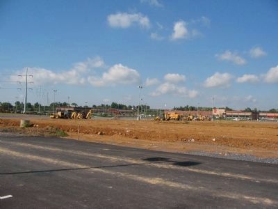
Looking northwest from the marker location. I-81 runs across the background. Ramseur's lines extended across this ground, and were flanked by Averell near where the highway runs today.
Also see . . .
1. Battle of Rutherford's Farm. Wikipedia entry (Submitted on February 25, 2026, by Larry Gertner of New York, New York.)
2. William W. Averell. Wikipedia Biography (Submitted on November 30, 2008.)
3. Stephen D. Ramseur. Wikipedia Biography (Submitted on November 30, 2008.)
Photographed by Devry Becker Jones (CC0), May 28, 2020
5. Battle of Rutherford's Farm Marker
The marker has experienced weather damage.
Credits. This page was last revised on February 26, 2026. It was originally submitted on November 30, 2008. This page has been viewed 3,351 times since then and 204 times this year. Photos: 1, 2, 3. submitted on November 30, 2008. 4. submitted on December 1, 2008, by Craig Swain of Leesburg, Virginia. 5. submitted on May 28, 2020, by Devry Becker Jones of Washington, District of Columbia. • Craig Swain was the editor who published this page.
