Lakes to Locks Passage
The Great Northeast Journey
— Champlain Canal Region —
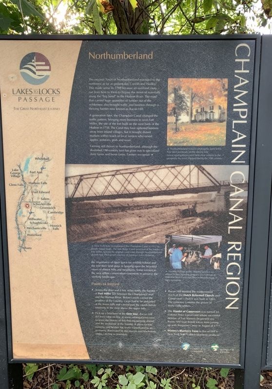
The original Town of Northumberland extended to the
northwest as far as present-day Corinth and Hadley
This made sense in 1798 because an overland route
ran from here to there to bypass the series of waterfalls
along the "big bend” in the Hudson River. The road
that carried huge quantities of lumber out of the
wilderness also brought traffic and business through a.
thriving hamlet now known as Bacon Hill.
A generation later, the Champlain Canal changed the
traffic pattern, bringing more business to west Fort
Miller, the site of the fort built on the west bank of the
Hudson in 1758. The Canal may have siphoned business
away from inland villages, but it brought distant
markets within reach of local farmers who raised
apples, potatoes, pork and wool.
Farming still thrives in Northumberland, although the
diversified 19th-century farm has given way to specialized
dairy farms and horse farms. Farmers recognize the importance
of open space for wildlife habitat and the role their land plays in keeping open the beautifu)
views of distant hills and mOuntains. Some farmers in
the area utilize conservation easements to preserve the
working landscape.
New. York State re-engineered the Champlain Canal in 1912 to handle
bigger boats. The new Barge Canal went east
Assuring that top quality Holstein genetics are utilized in their breeding programs is a hallmark of Welcome Stock Farm and other Northumberland fairy operations.
Points of Interest Across the river and a few miles north, the hamlet of Fort Miller lies between the Champlain Canal and the Hudson River. Before canals carried the produce of the country, cargo had to be unloaded at the lower falls and carried past the rapids before resuming to the river above the upper falls.
Bacon Hill narked the northernmost reach of the Dutch Reformed Church until Gansevoort's church was built in 1883. The cemetery contains the graves of many early settlers.
The Hamlet of Gansevoort was named for Colonel Peter Gansevoort whose successful defense of Fort Stanwix (in present day Rome,NY) kept British forces from joining up with Burgoyne's army in August of 1777.
Pick up a brohure of the farm tour, Bacon Hill Beckons Beckons (also online at www.saratogafarms.com) to learn the history of this thriving farming district and the evolution of the hamlet. A glove factory, tannery and beaver hat works contributed to an economy dominated by the taverns and blacksmih shops catering to teamsters.
Winney's Blueberry Farm in Bacon Hill is New York State’s oldest blueberry producer.
Northumberland features photogenic farm fields. Fine old farmsteads on the driving tour bear clear witness to the prosperity the town enjoyed during the 19th century.
Topics. This historical marker is listed in these topic lists: Agriculture • Industry & Commerce • Settlements & Settlers • Waterways & Vessels. A significant historical month for this entry is August 1777.
Location. 43° 7.114′ N, 73° 35.127′ W. Marker is in Schuylerville, New York, in Saratoga County. Marker is at the intersection of Broad Street (U.S. 4) and Stark’s Knob Road, on the right when traveling north on Broad Street. Touch for map. Marker is in this post office area: Schuylerville NY 12871, United States of America. Touch for directions.
Other nearby markers. At least 8 other markers are within walking distance of this marker. Train of Artillery (2007) (a few steps from this marker); Stark’s Knob (a few steps from this marker); Gen. Henry Knox Trail (within shouting distance of this marker); General Stark (approx. 0.2 miles away); Northumberland: A Thriving Canal Community (approx. 0.3 miles away); World War I and II and Korean Conflict Memorial (approx. 0.4 miles away); Position of Burgoyne's Bridge (approx. half a mile away); The Marshall House (approx. half a mile away). Touch for a list and map of all markers in Schuylerville.
Credits. This page was last revised on September 26, 2019. It was originally submitted on September 24, 2019, by Steve Stoessel of Niskayuna, New York. This page has been viewed 169 times since then and 16 times this year. Photo 1. submitted on September 24, 2019, by Steve Stoessel of Niskayuna, New York. • Andrew Ruppenstein was the editor who published this page.
