Antiaircraft Training at Camp Hero
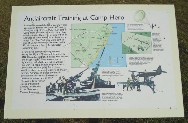
Battery 216 served the New York City area as a coastal defense site from 1943 until its deactivation in 1947. In 1951, when part of Camp Hero became an antiaircraft artillery training station, Battery 216's empty bunker was used to store ammunition. Antiaircraft units in the New York area were sent to train at Camp Hero for a few weeks with 90 millimeter and later 120 millimeter antiaircraft guns.
From three permanent firing stations facing the Atlantic Ocean, soldiers fired on OQ-19b radio-controlled planes, tow targets, and barge targets. They also conducted light antiaircraft artillery practice against the OQ-19b radio-controlled planes with .50 caliber machine guns. Both planes could simulate the attack patterns of enemy aircraft. Advances in planes and missile detection made manual antiaircraft defenses obsolete, and in 1957, Operation Changeover closed antiaircraft artillery installations in the New York Metropolitan area.
[Illustration captions, clockwise from top right]
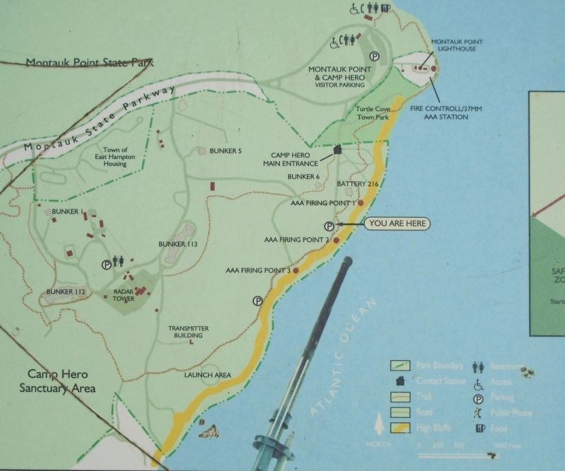
• This map shows the target launch area and firing stations. The target launch area is located beyond the third station and was used
for both catapult and rotary launches.• A launcher chief made sure that the target plane connected to the launching car was secure before starting the plane's engine. Then he plugged in the detonator box, and when he received the proper signal, launched the target.
• The OQ-19 target plane had greater maneuverability than towed targets, but lacked the size and speed of actual airplanes. Flight controllers created flight patterns for the target plane. The OQ-19b, which included an autopilot system, could simulate high-altitude flight patterns for 90mm and 120mm artillery practice.
• Soldiers perform maintenance work on a 120mm gun. This gun, installed after the 90mm model, had a maximum firing range of 20,000 yards.
• Soldiers take target practice with the M1 90mm gun. The M1 could be mobile or mounted in place, but was replaced by the more accurate M2. The M1 had a maximum firing range of 19,560 yards.
Erected by New York State Parks.
Topics. This historical marker is listed in these topic lists: Air & Space • Man-Made Features • Patriots & Patriotism • War, Cold. A significant historical year for this entry is 1943.
Location. 41° 3.886′ N, 71° 51.736′ W. Marker is in Montauk Point, New York, in Suffolk County. Marker can be reached from Old Montauk Highway
Other nearby markers. At least 8 other markers are within walking distance of this marker. Nature's Sculptures (within shouting distance of this marker); Battery Dunn (Battery 113) (approx. half a mile away); Montauk Point Lighthouse (approx. half a mile away); USS Montauk (approx. half a mile away); a different marker also named Montauk Point Lighthouse (approx. half a mile away); Montauk Lighthouse (approx. half a mile away); Amistad Memorial (approx. half a mile away); Commonly Seen Vessels (approx. half a mile away). Touch for a list and map of all markers in Montauk Point.
Also see . . .
1. Camp Hero State Park. (Submitted on September 29, 2019, by William Fischer, Jr. of Scranton, Pennsylvania.)
2. Camp Hero State Park at Wikipedia. (Submitted on September 29, 2019, by William Fischer, Jr. of Scranton, Pennsylvania.)
Credits. This page was last revised on November 18, 2020. It was originally submitted on September 29, 2019, by William Fischer, Jr. of Scranton, Pennsylvania. This page has been viewed 284 times since then and 17 times this year. Photos: 1, 2, 3. submitted on September 29, 2019, by William Fischer, Jr. of Scranton, Pennsylvania.


